 Old Cumbria Gazetteer
 |
 |
|
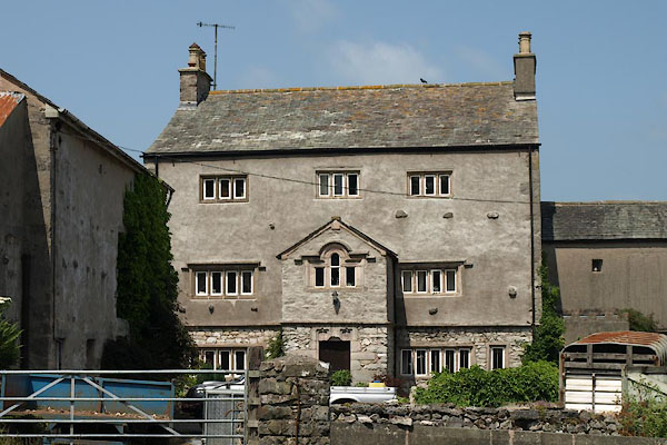
| Saltcotes Hall, Arnside | ||
| Saltcotes Hall | ||
| Street:- | Station Road | |
| civil parish:- | Arnside (formerly Westmorland) | |
| county:- | Cumbria | |
| locality type:- | buildings | |
| coordinates:- | SD46057874 | |
| 1Km square:- | SD4678 | |
| 10Km square:- | SD47 | |
| references:- | Listed Buildings 2010 |
|
|
|
||
 BYU32.jpg (taken 11.7.2013) 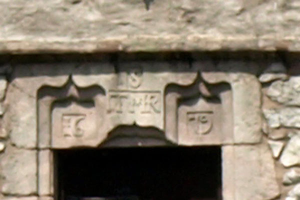 BYU33.jpg Date stone:- "S / T MR / 16 79" (taken 11.7.2013) |
||
|
|
||
| evidence:- | old map:- OS County Series (Wmd 46 6) placename:- Saltcote |
|
| source data:- | Maps, County Series maps of Great Britain, scales 6 and 25
inches to 1 mile, published by the Ordnance Survey, Southampton,
Hampshire, from about 1863 to 1948. |
|
|
|
||
| evidence:- | database:- Listed Buildings 2010 placename:- Saltcotes Farm item:- date stone (1679) |
|
| source data:- | courtesy of English Heritage "SALTCOTES FARM / / STATION ROAD / ARNSIDE / SOUTH LAKELAND / CUMBRIA / II / 76545 / SD4605078748" |
|
|
|
||
 Lakes Guides menu.