 Old Cumbria Gazetteer
 |
 |
|
| included in:- |
 St Anthony, Cartmel Fell St Anthony, Cartmel Fell |
|
| sundial, Cartmel Fell | ||
| site name:- | St Anthony's Church | |
| locality:- | Cartmel Fell | |
| civil parish:- | Cartmel Fell (formerly Lancashire) | |
| county:- | Cumbria | |
| locality type:- | sundial | |
| coordinates:- | SD41658805 | |
| 1Km square:- | SD4188 | |
| 10Km square:- | SD48 | |
|
|
||
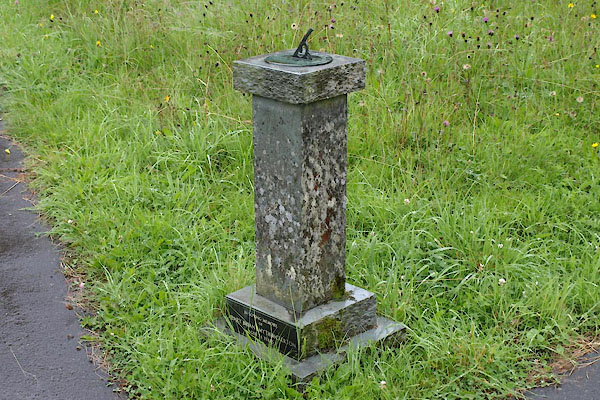 BTH01.jpg (taken 30.7.2010) 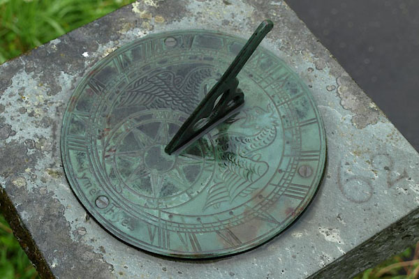 BTH02.jpg (taken 30.7.2010) |
||
| Made 1962. |
||
|
|
||
| evidence:- | database:- Listed Buildings 2010 |
|
| source data:- | courtesy of English Heritage "BASE OF SUNDIAL APPROXIMATELY 15 METRES TO SOUTH EAST OF ST ANTHONY'S CHURCH / / / CARTMEL FELL / SOUTH LAKELAND / CUMBRIA / II / 421165 / SD4165988049" |
|
| source data:- | courtesy of English Heritage "Base of sundial, sometimes refered to as mounting block. Late C17 or early C18. Stone rubble. Rectangular block with rounded end and 3 steps. Timber post in place of sundial." |
|
|
|
||
Lakes Guides menu.