 Old Cumbria Gazetteer
 |
 |
|
| Tearnside Cottage, Tearnside | ||
| Tearnside Cottage | ||
| Street:- | Kendal Road | |
| locality:- | Tearnside | |
| civil parish:- | Kirkby Lonsdale (formerly Westmorland) | |
| county:- | Cumbria | |
| locality type:- | buildings | |
| coordinates:- | SD58797943 | |
| 1Km square:- | SD5879 | |
| 10Km square:- | SD57 | |
| references:- | Listed Buildings 2010 |
|
|
|
||
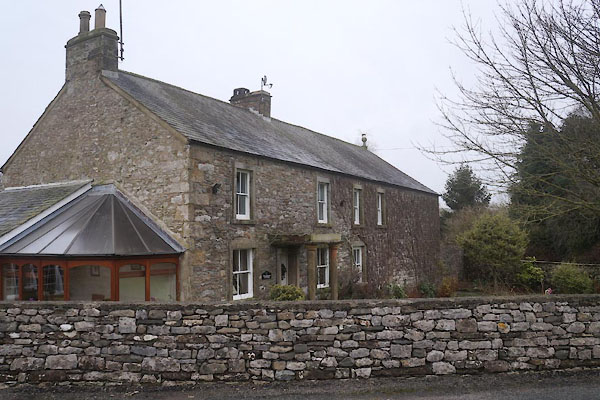 CEM11.jpg (taken 1.1.2016) 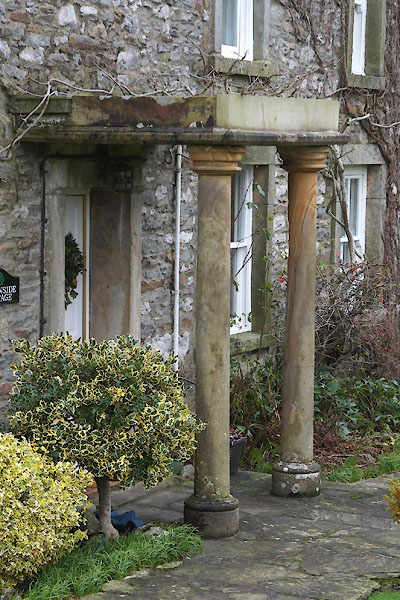 CEM12.jpg Porch. (taken 1.1.2016) |
||
|
|
||
| evidence:- | probably old map:- Jefferys 1770 (Wmd) placename:- Fell Yate |
|
| source data:- | Map, 4 sheets, The County of Westmoreland, scale 1 inch to 1
mile, surveyed 1768, and engraved and published by Thomas
Jefferys, London, 1770.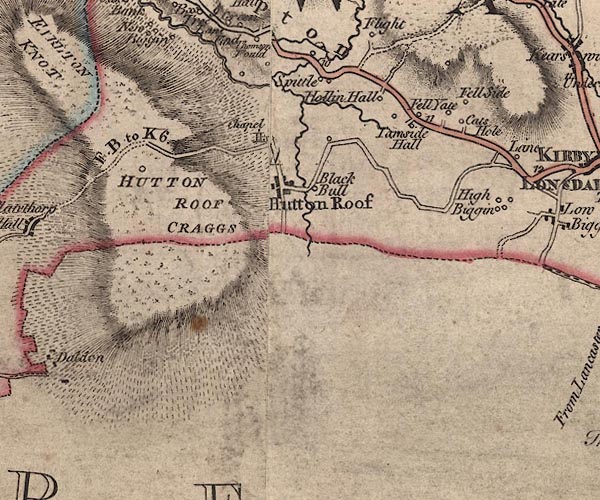 J5SD57NE.jpg "Fell Yate" circle, labelled in italic lowercase text; settlement, farm, house, or hamlet? item:- National Library of Scotland : EME.s.47 Image © National Library of Scotland |
|
|
|
||
| evidence:- | database:- Listed Buildings 2010 placename:- Tearnside Cottage |
|
| source data:- | courtesy of English Heritage "TEARNSIDE COTTAGE AND ATTACHED BARN / / KENDAL ROAD / KIRKBY LONSDALE / SOUTH LAKELAND / CUMBRIA / II / 75163 / SD5879679430" |
|
|
|
||
 Lakes Guides menu.