 Old Cumbria Gazetteer
 |
 |
|
|
| track, Penrith to Cockermouth | |||
| possible | |||
| Penrith to Cockermouth | |||
| Cockermouth to Penrith | |||
| civil parish:- | Penrith (formerly Cumberland) | ||
| civil parish:- | Dacre (formerly Cumberland) | ||
| civil parish:- | Hutton (formerly Cumberland) | ||
| civil parish:- | Mungrisdale (formerly Cumberland) | ||
| civil parish:- | Caldbeck (formerly Cumberland) | ||
| civil parish:- | Underskiddaw (formerly Cumberland) | ||
| civil parish:- | Bassenthwaite (formerly Cumberland) | ||
| civil parish:- | Blindcrake (formerly Cumberland) | ||
| civil parish:- | Setmurthy (formerly Cumberland) | ||
| civil parish:- | Cockermouth (formerly Cumberland) | ||
| county:- | Cumbria | ||
| locality type:- | track route (?) | ||
| 10Km square:- | NY52 | ||
| 10Km square:- | NY42 | ||
| 10Km square:- | NY33 | ||
| 10Km square:- | NY23 | ||
| 10Km square:- | NY22 | ||
| 10Km square:- | NY23 | ||
| 10Km square:- | NY13 | ||
| SummaryText:- | This route is proposed as a possible interpretation of a road shown on the map by Bowen and Kitchin 1760. The map is not very trustworthy. | ||
| references:- | Bowen and Kitchin 1760 |
||
|
|
|||
| evidence:- | old map:- Bowen and Kitchin 1760 |
||
| source data:- | Map, hand coloured engraving, A New Map of the Counties of
Cumberland and Westmoreland Divided into their Respective Wards,
scale about 4 miles to 1 inch, by Emanuel Bowen and Thomas
Kitchin et al, published by T Bowles, Robert Sayer, and John
Bowles, London, 1760.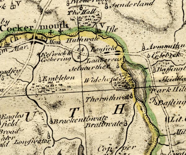 BO18NY12.jpg double line, dotted 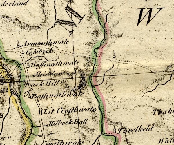 BO18NY22.jpg double line, dotted 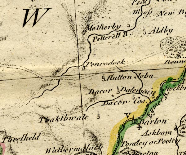 BO18NY32.jpg double line, dotted 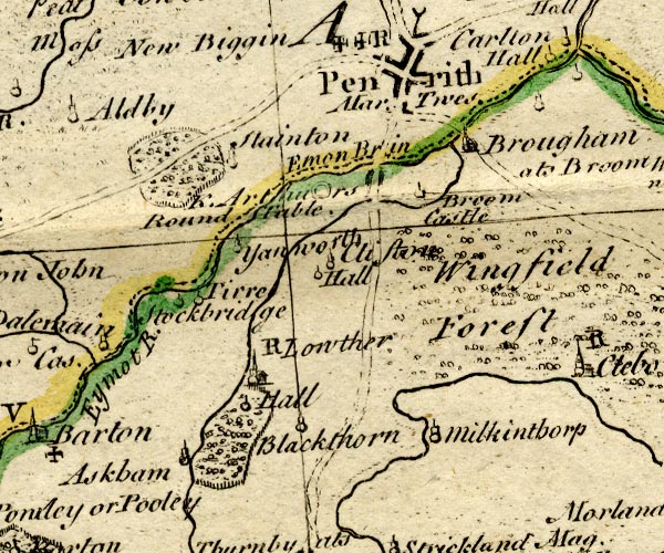 BO18NY42.jpg double line, dotted item:- Armitt Library : 2008.14.10 Image © see bottom of page |
||
|
|
|||
| place:- |  Penrith Penrith[Penruddock, Hutton] Mungrisdale ford, Mungrisdale Skiddaw House, Underskiddaw Whitewater Dash, Bassenthwaite Bassenthwaite Ouse Bridge, Blindcrake Cockermouth |
||
|
|
|||
Lakes Guides menu.