 Old Cumbria Gazetteer
 |
 |
|
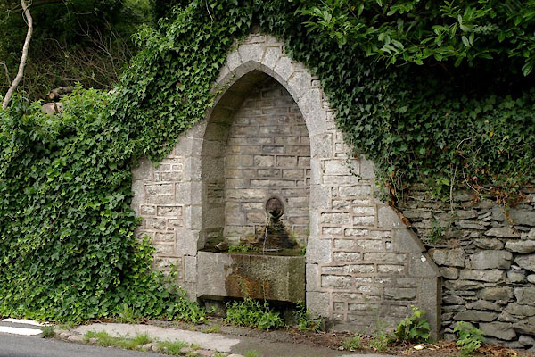
| water trough, Holker | ||
| locality:- | Holker | |
| civil parish:- | Lower Holker (formerly Lancashire) | |
| county:- | Cumbria | |
| locality type:- | water trough | |
| coordinates:- | SD36107720 | |
| 1Km square:- | SD3677 | |
| 10Km square:- | SD37 | |
| references:- | Listed Buildings 2010 |
|
|
|
||
 BZB03.jpg (taken 9.8.2013) 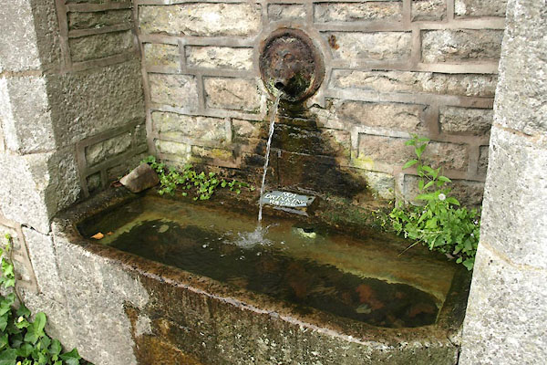 BZB04.jpg (taken 9.8.2013) |
||
|
|
||
| evidence:- | drawing:- Butler 1982-92 |
|
| source data:- | water trough, Holker drawn by David Butler courtesy of David Butler 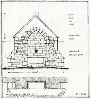 click to enlarge click to enlargePR1434.jpg item:- private collection : 377 Image © see bottom of page |
|
|
|
||
| evidence:- | database:- Listed Buildings 2010 |
|
| source data:- | courtesy of English Heritage "TROUGH APPROXIMATELY 35 METRES TO SOUTH OF PEAR TREE COTTAGE / / B5278 / LOWER HOLKER / SOUTH LAKELAND / CUMBRIA / II / 77034 / SD3610677208" |
|
| source data:- | courtesy of English Heritage "Trough. Probably mid to late Cl9. Dressed limestone. Gabled structure with lateral lean-to buttresses has chamfered arched recess. Trough in recess and iron lion's mask water spout to wall above. Included for group value." |
|
|
|
||
 Lakes Guides menu.