 Old Cumbria Gazetteer
 |
 |
|
| Packhorse Cottage, Low Lorton | ||
| Packhorse Cottage | ||
| locality:- | Low Lorton | |
| civil parish:- | Lorton (formerly Cumberland) | |
| county:- | Cumbria | |
| locality type:- | buildings | |
| locality type:- | inn (ex) | |
| coordinates:- | NY15272591 | |
| 1Km square:- | NY1525 | |
| 10Km square:- | NY12 | |
|
|
||
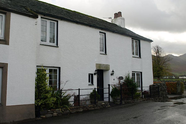 BVO88.jpg (taken 1.11.2011) 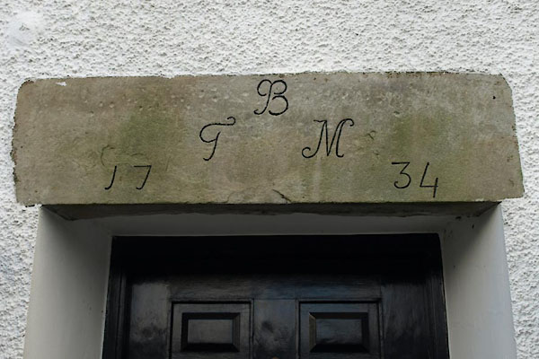 BVO89.jpg Date stone:- "B / [G] M / 17 34" (taken 1.11.2011) |
||
|
|
||
| evidence:- | old map:- OS County Series (Cmd 55 13) placename:- Packhorse Inn |
|
| source data:- | Maps, County Series maps of Great Britain, scales 6 and 25
inches to 1 mile, published by the Ordnance Survey, Southampton,
Hampshire, from about 1863 to 1948. |
|
|
|
||
 Lakes Guides menu.