 Old Cumbria Gazetteer
 |
 |
|
|
| Ambleside: Rydal Road | |||
| Rydal Road | |||
| locality:- | Ambleside | ||
| civil parish:- | Lakes (formerly Westmorland) | ||
| county:- | Cumbria | ||
| locality type:- | street | ||
| coordinates:- | NY37410480 (etc) | ||
| 1Km square:- | NY3704 | ||
| 10Km square:- | NY30 | ||
|
|
|||
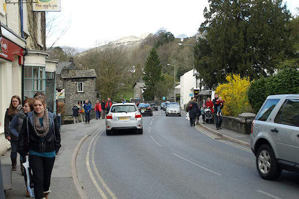 BWE60.jpg (taken 5.4.2012) |
|||
|
|
|||
| evidence:- | old photograph:- Bell 1880s-1940s |
||
| source data:- | Photograph, sepia, Rydal Road, Ambleside, Westmorland, by Herbert Bell, Ambleside,
Westmorland, 1890s.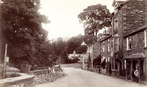 click to enlarge click to enlargeHB0538.jpg internegative at lower left:- "[H. Bell]" item:- Armitt Library : ALPS23 Image © see bottom of page |
||
|
|
|||
| mapping:- | [Ambleside: Greenbank Road] [Ambleside: Greenbank Road]  Ambleside: Smithy Brow Ambleside: Smithy Brow Ambleside: Bridge Street Ambleside: Bridge Street Ambleside: Market Place Ambleside: Compston Road Ambleside: Smithy Brow Ambleside: Smithy Brow Ambleside: Bridge Street Ambleside: Bridge Street Ambleside: Market Place Ambleside: Compston Road[Ambleside: Millans Park] Ambleside: Market Place Ambleside: Compston Road[Ambleside: Millans Park] |
||
|
|
|||
Lakes Guides menu.