 Old Cumbria Gazetteer
 |
 |
|
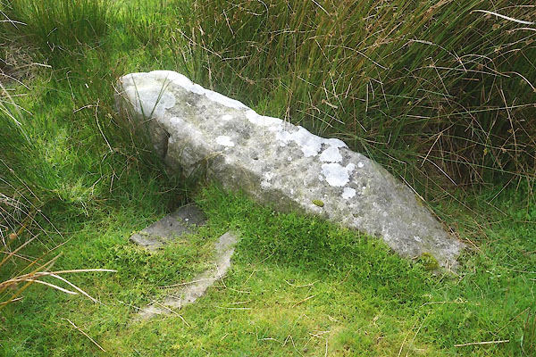
| boundary stone, Kaber (5) | ||
| locality:- | Pancake | |
| civil parish:- | Kaber (formerly Westmorland) | |
| county:- | Cumbria | |
| locality type:- | boundary stone | |
| locality type:- | county boundary mark | |
| coordinates:- | NY88840704 | |
| 1Km square:- | NY8907 | |
| 10Km square:- | NY80 | |
| county:- | North Yorkshire | |
|
|
||
 CFN23.jpg (taken 23.9.2016) 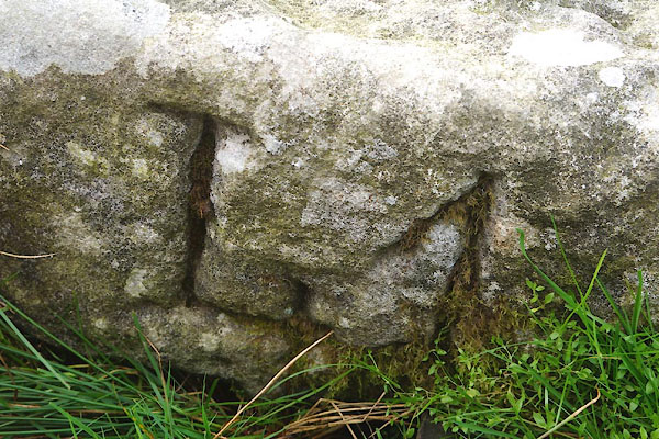 CFN24.jpg "L 4" (taken 23.9.2016) |
||
|
|
||
| evidence:- | old map:- OS County Series (Wmd 24) placename:- Tackan Tan |
|
| source data:- | Maps, County Series maps of Great Britain, scales 6 and 25
inches to 1 mile, published by the Ordnance Survey, Southampton,
Hampshire, from about 1863 to 1948. "Tackan Tan" |
|
|
|
||
 Lakes Guides menu.