 Old Cumbria Gazetteer
 |
 |
|
| High Brigflatts, Brigflatts | ||
| High Brigflatts | ||
| Street:- | Brigflatts Lane | |
| locality:- | Brigflatts | |
| civil parish:- | Sedbergh (formerly Yorkshire) | |
| county:- | Cumbria | |
| locality type:- | buildings | |
| coordinates:- | SD64069116 | |
| 1Km square:- | SD6491 | |
| 10Km square:- | SD69 | |
|
|
||
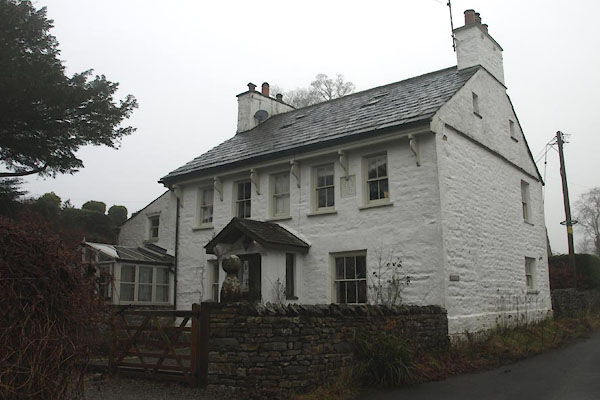 BXT89.jpg (taken 9.1.2013) 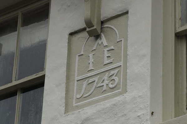 BXT90.jpg Date stone:- "A / I E / 1743" (taken 9.1.2013) |
||
|
|
||
| evidence:- | old map:- OS County Series (Yrk 63 3) placename:- High Brigg Flatts placename:- Brigg Flatts, High |
|
| source data:- | Maps, County Series maps of Great Britain, scales 6 and 25
inches to 1 mile, published by the Ordnance Survey, Southampton,
Hampshire, from about 1863 to 1948. |
|
|
|
||
 Lakes Guides menu.