 Old Cumbria Gazetteer
 |
 |
|
| Mill Bridge, Stainton | ||
| Mill Bridge | ||
| site name:- | St Sunday's Beck | |
| civil parish:- | Stainton (formerly Westmorland) | |
| county:- | Cumbria | |
| locality type:- | bridge | |
| coordinates:- | SD53158716 | |
| 1Km square:- | SD5387 | |
| 10Km square:- | SD58 | |
|
|
||
| evidence:- | perhaps old map:- Jefferys 1770 (Wmd) placename:- Mill Briggs |
|
| source data:- | Map, 4 sheets, The County of Westmoreland, scale 1 inch to 1
mile, surveyed 1768, and engraved and published by Thomas
Jefferys, London, 1770.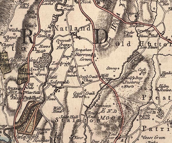 J5SD58NW.jpg "Mill Briggs" no symbol item:- National Library of Scotland : EME.s.47 Image © National Library of Scotland |
|
|
|
||
| evidence:- | old map:- Cary 1789 (edn 1805) |
|
| source data:- | Map, uncoloured engraving, Westmoreland, scale about 2.5 miles
to 1 inch, by John Cary, London, 1789; edition 1805.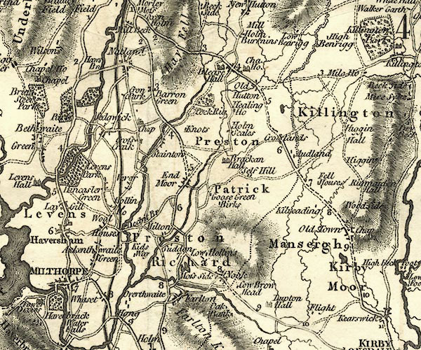 CY24SD58.jpg road across a stream; bridge over St Sunday's Beck item:- JandMN : 129 Image © see bottom of page |
|
|
|
||
 Lakes Guides menu.