 Old Cumbria Gazetteer
 |
 |
|
|
| included in:- |
 road, Penrith to Hesket Newmarket road, Penrith to Hesket Newmarket |
||
| road, through Hesket Newmarket | |||
| Hesket Newmarket road | |||
| civil parish:- | Castle Sowerby (formerly Cumberland) | ||
| civil parish:- | Caldbeck (formerly Cumberland) | ||
| county:- | Cumbria | ||
| locality type:- | route | ||
| 10Km square:- | NY33 | ||
|
|
|||
| evidence:- | old map:- Donald 1774 (Cmd) |
||
| source data:- | Map, hand coloured engraving, 3x2 sheets, The County of Cumberland, scale about 1
inch to 1 mile, by Thomas Donald, engraved and published by Joseph Hodskinson, 29
Arundel Street, Strand, London, 1774. double line, narrower, solid or dotted with a dot and number at 1 mile intervals; road distances from Carlisle? 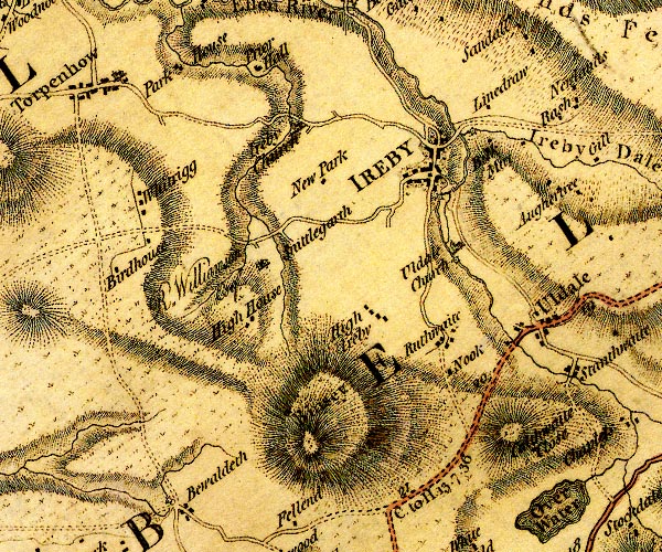 D4NY23NW.jpg "C. to H. 13:7:36" miles.furlongs.poles; Cockermouth to Hesket 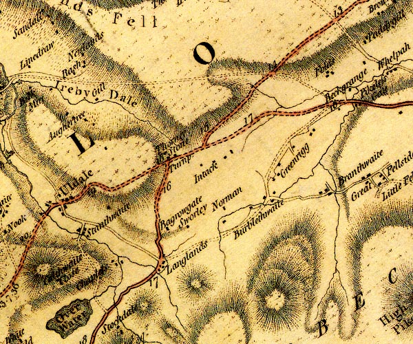 D4NY23NE.jpg 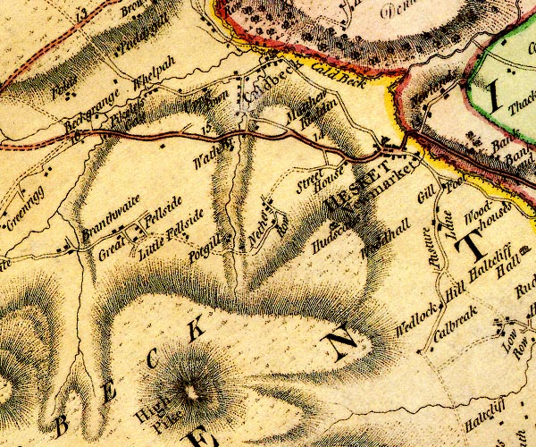 D4NY33NW.jpg item:- Carlisle Library : Map 2 Images © Carlisle Library |
||
|
|
|||
| evidence:- | old map:- Donald 1774 (Cmd) |
||
| source data:- | Map, hand coloured engraving, 3x2 sheets, The County of Cumberland, scale about 1
inch to 1 mile, by Thomas Donald, engraved and published by Joseph Hodskinson, 29
Arundel Street, Strand, London, 1774.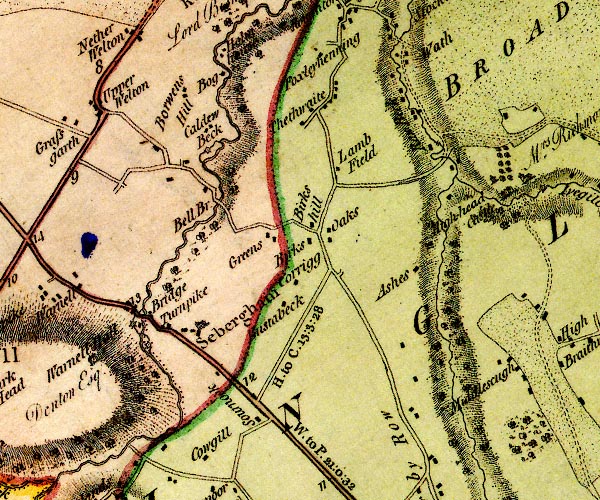 D4NY34SE.jpg "H. to C. 13:3:28" miles.furlongs.poles; Hesket to Carlisle item:- Carlisle Library : Map 2 Image © Carlisle Library |
||
|
|
|||
| evidence:- | old map:- Donald 1774 (Cmd) |
||
| source data:- | Map, hand coloured engraving, 3x2 sheets, The County of Cumberland, scale about 1
inch to 1 mile, by Thomas Donald, engraved and published by Joseph Hodskinson, 29
Arundel Street, Strand, London, 1774. double line, narrower, solid or dotted with a dot and number at 1 mile intervals; road distances from Carlisle? D4NY23NW.jpg "C. to H. 13:7:36" miles.furlongs.poles; Cockermouth to Hesket D4NY23NE.jpg D4NY33NW.jpg item:- Carlisle Library : Map 2 Images © Carlisle Library |
||
|
|
|||
| evidence:- | old map:- Donald 1774 (Cmd) |
||
| source data:- | Map, hand coloured engraving, 3x2 sheets, The County of Cumberland, scale about 1
inch to 1 mile, by Thomas Donald, engraved and published by Joseph Hodskinson, 29
Arundel Street, Strand, London, 1774. D4NY34SE.jpg "H. to C. 13:3:28" miles.furlongs.poles; Hesket to Carlisle item:- Carlisle Library : Map 2 Image © Carlisle Library |
||
|
|
|||
| evidence:- | road map:- Cary 1790 (Cmd/edn 1789) |
||
| source data:- | Road map, hand coloured engraving, Cumberland, scale about 15
miles to 1 inch, by John Cary, 181 Strand, London, 1790, edn
1789.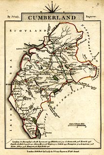 click to enlarge click to enlargeCY47.jpg double line item:- JandMN : 419 Image © see bottom of page |
||
|
|
|||
| evidence:- | old map:- Cooper 1808 |
||
| source data:- | Map, uncoloured engraving, Cumberland, scale about 10.5 miles to
1 inch, drawn and engraved by Cooper, published by R Phillips,
Bridge Street, Blackfriars, London, 1808. click to enlarge click to enlargeCOP3.jpg double line; road item:- JandMN : 86 Image © see bottom of page |
||
|
|
|||
| evidence:- | old map:- Hall 1820 (Cmd) |
||
| source data:- | Map, hand coloured engraving, Cumberland, scale about 21 miles
to 1 inch, engraved by Sidney Hall, published by S Leigh, 18
Strand, London, 1820-31. click to enlarge click to enlargeHA14.jpg single line, solid; minor road; ... Hesket ... item:- JandMN : 91 Image © see bottom of page |
||
|
|
|||
| places:- | [Newgate Inn, Castle Sowerby] Hesket Bridge, Hesket Newmarket Hesket Newmarket Caldbeck |
||
|
|
|||
| places:- | alternative route Hesket Newmarket to Caldbeck Hesket Newmarket Street Head, Caldbeck Upton, Caldbeck Toothill, Caldbeck Caldbeck |
||
|
|
|||
Lakes Guides menu.