Old Cumbria Gazetteer
 |
 |
|
||
| road, through Killington | ||||
| Killington road | ||||
| civil parish:- | Sedbergh (formerly Yorkshire) | |||
| civil parish:- | Killington (formerly Westmorland) | |||
| county:- | Cumbria | |||
| locality type:- | road route | |||
| locality type:- | track route | |||
| 10Km square:- | SD69 | |||
| 10Km square:- | SD68 | |||
| 10Km square:- | SD58 | |||
|
|
||||
| evidence:- | old map:- Jefferys 1770 (Wmd) |
|||
| source data:- | Map, 4 sheets, The County of Westmoreland, scale 1 inch to 1
mile, surveyed 1768, and engraved and published by Thomas
Jefferys, London, 1770.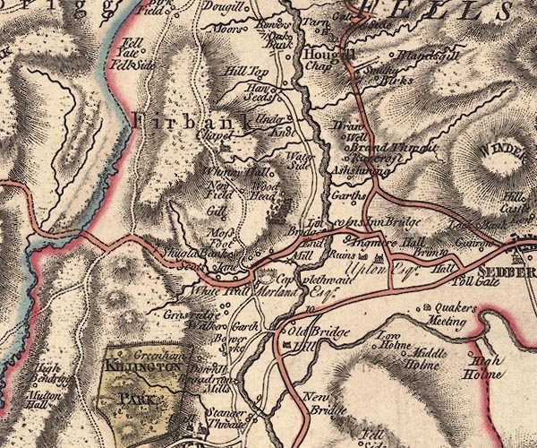 J5SD69SW.jpg 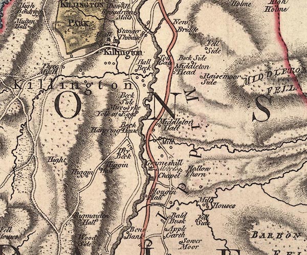 J5SD68NW.jpg 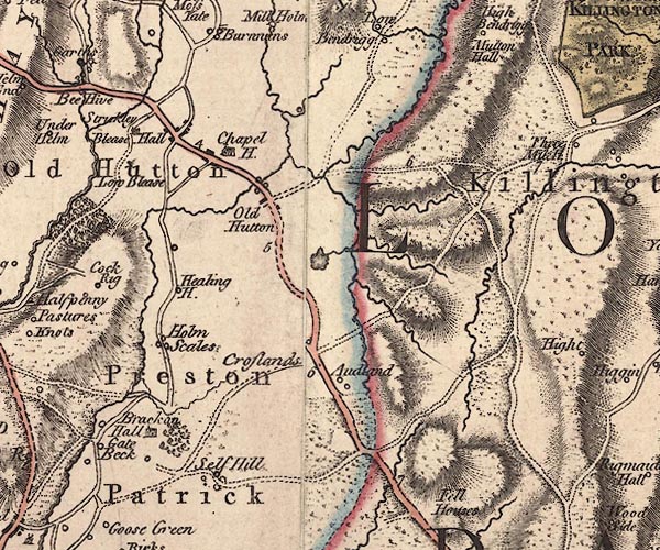 J5SD58NE.jpg double line; road, bold, main road, with mile numbers item:- National Library of Scotland : EME.s.47 Images © National Library of Scotland |
|||
|
|
||||
| place:- |  Four Lane Ends, Sedbergh (2) down the track SW ford, Killington Killington Three Mile House, Killington Four Lane Ends, Sedbergh (2) down the track SW ford, Killington Killington Three Mile House, Killington |
|||
|
|
||||
| places:- |
|
|||
Lakes Guides menu.