 Old Cumbria Gazetteer
 |
 |
|
| toll gate, Kirkby Lonsdale | ||
| suggested | ||
| gone | ||
| site name:- | road, Lancaster to Kirkby Lonsdale (old route?) | |
| locality:- | Kirkby Lonsdale | |
| civil parish:- | Kirkby Lonsdale (formerly Westmorland) | |
| county:- | Cumbria | |
| locality type:- | toll gate (site) | |
| coordinates:- | SD61267834 | |
| 1Km square:- | SD6178 | |
| 10Km square:- | SD67 | |
| references:- | Jefferys 1770 |
|
|
|
||
| evidence:- | old map:- Jefferys 1770 (Wmd) |
|
| source data:- | Map, 4 sheets, The County of Westmoreland, scale 1 inch to 1
mile, surveyed 1768, and engraved and published by Thomas
Jefferys, London, 1770.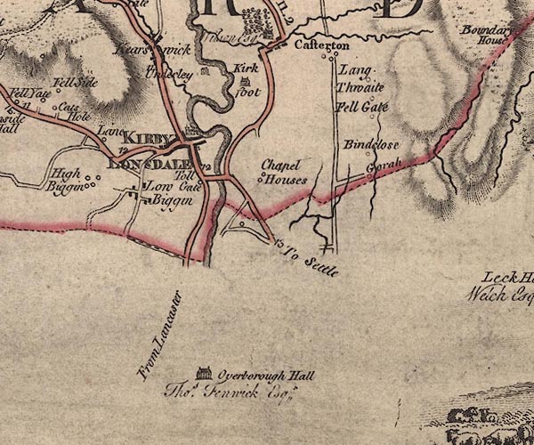 J5SD67NW.jpg "Toll Gate" circle; toll gate item:- National Library of Scotland : EME.s.47 Image © National Library of Scotland |
|
|
|
||
 Lakes Guides menu.