 Old Cumbria Gazetteer
 |
 |
|
| Ullthwaite Mill, Hugill | ||
| Ullthwaite Mill | ||
| site name:- | Kent, River | |
| locality:- | Ullthwaite | |
| civil parish:- | Hugill (formerly Westmorland) | |
| county:- | Cumbria | |
| locality type:- | water mill | |
| locality type:- | mill | |
| locality type:- | corn mill | |
| coordinates:- | NY45570121 | |
| 1Km square:- | NY4501 | |
| 10Km square:- | NY40 | |
|
|
||
| evidence:- | old map:- OS County Series (Wmd 27 13) placename:- Ullthwaite Mill |
|
| source data:- | Maps, County Series maps of Great Britain, scales 6 and 25
inches to 1 mile, published by the Ordnance Survey, Southampton,
Hampshire, from about 1863 to 1948. OS County Series (Wmd 33 1) "Ullthwaite Mill (Corn) / Sluice / Mill Race / Weir" |
|
|
|
||
| evidence:- | old map:- Jefferys 1770 (Wmd) |
|
| source data:- | Map, 4 sheets, The County of Westmoreland, scale 1 inch to 1
mile, surveyed 1768, and engraved and published by Thomas
Jefferys, London, 1770.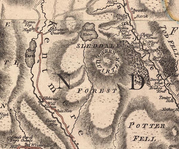 J5NY40SE.jpg circle with rays; water mill item:- National Library of Scotland : EME.s.47 Image © National Library of Scotland |
|
|
|
||
| notes:- |
Records from 1272 onwards. In 1930 there were remains of machinery as well as structure. |
|
| Somervell, John: 1930: Water Power Mills of South Westmorland |
||
|
|
||
 Lakes Guides menu.