 Old Cumbria Gazetteer
 |
 |
|
| Old Vicarage, Witherslack | ||
| locality:- | Witherslack | |
| civil parish:- | Witherslack (formerly Westmorland) | |
| county:- | Cumbria | |
| locality type:- | buildings | |
| coordinates:- | SD43208411 | |
| 1Km square:- | SD4384 | |
| 10Km square:- | SD48 | |
|
|
||
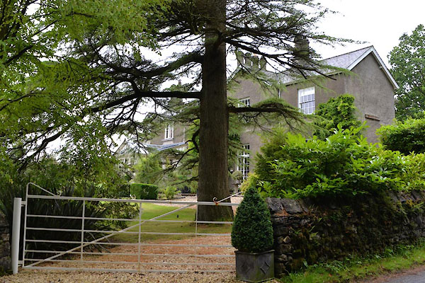 CGG25.jpg (taken 30.6.2017) 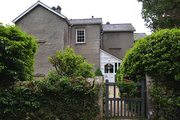 CGG24.jpg (taken 30.6.2017) |
||
|
|
||
| evidence:- | old map:- Jefferys 1770 (Wmd) placename:- Parsonage |
|
| source data:- | Map, 4 sheets, The County of Westmoreland, scale 1 inch to 1
mile, surveyed 1768, and engraved and published by Thomas
Jefferys, London, 1770.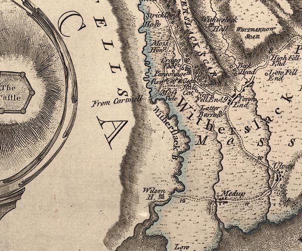 J5SD48SW.jpg "Parsonage / Revd. Mr. Wilson" house item:- National Library of Scotland : EME.s.47 Image © National Library of Scotland |
|
|
|
||
 Lakes Guides menu.