 Old Cumbria Gazetteer
 |
 |
|
| Brathay Rocks, Skelwith | ||
| Brathay Rocks | ||
| locality:- | Windermere lake | |
| civil parish:- | Skelwith (formerly Lancashire) | |
| county:- | Cumbria | |
| locality type:- | headland | |
| locality type:- | rocks | |
| coordinates:- | NY37090289 | |
| 1Km square:- | NY3702 | |
| 10Km square:- | NY30 | |
|
|
||
| evidence:- | old map:- OS County Series (Wmd 26 14) placename:- Hanikin |
|
| source data:- | Maps, County Series maps of Great Britain, scales 6 and 25
inches to 1 mile, published by the Ordnance Survey, Southampton,
Hampshire, from about 1863 to 1948. |
|
|
|
||
| evidence:- | old photograph:- Bell 1880s-1940s item:- clouds; sunset |
|
| source data:- | Photograph, black and white, sunset clouds, Brathay Rocks by Windermere lake, Skelwith,
Lancashire, by Herbert Bell, photographer, Ambleside, Westmorland, 1890s.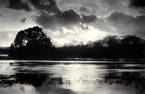 click to enlarge click to enlargeHB0894.jpg item:- Armitt Library : ALPS565 Image © see bottom of page |
|
|
|
||
| evidence:- | old photograph:- Bell 1880s-1940s item:- rowing boat; boat |
|
| source data:- | Photograph, sepia, Brathay Rocks on Windermere, Skelwith, Westmorland, by Herbert
Bell, Ambleside, Westmorland, 1890s?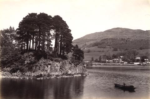 click to enlarge click to enlargeHB0264.jpg item:- Armitt Library : ALPS618 Image © see bottom of page |
|
|
|
||
 Lakes Guides menu.