 |
 |
|
|
|
|
Barngill |
| civil parish:- |
Distington (formerly Cumberland) |
| county:- |
Cumbria |
| locality type:- |
locality |
| locality type:- |
buildings |
| coordinates:- |
NX99672185 (etc) |
| 1Km square:- |
NX9921 |
| 10Km square:- |
NX92 |
|
|
| evidence:- |
old map:- OS County Series (Cmd 61 11)
placename:- Barngill
|
| source data:- |
Maps, County Series maps of Great Britain, scales 6 and 25
inches to 1 mile, published by the Ordnance Survey, Southampton,
Hampshire, from about 1863 to 1948.
|
|
|
| evidence:- |
old map:- Donald 1774 (Cmd)
placename:- Barngill
|
| source data:- |
Map, hand coloured engraving, 3x2 sheets, The County of Cumberland, scale about 1
inch to 1 mile, by Thomas Donald, engraved and published by Joseph Hodskinson, 29
Arundel Street, Strand, London, 1774.
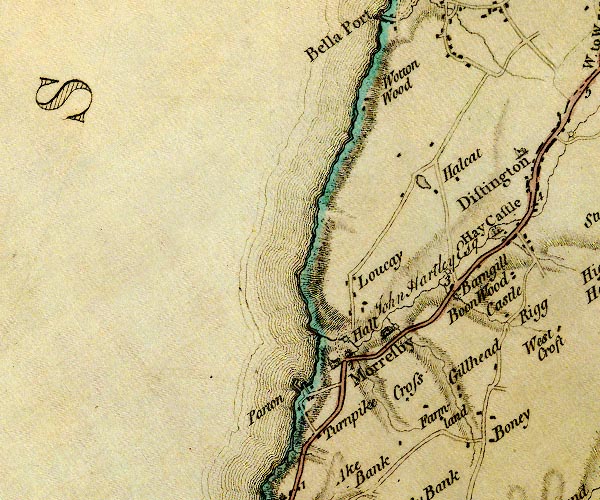
D4NX92SE.jpg
"Barngill"
block or blocks, labelled in lowercase; a hamlet or just a house
item:- Carlisle Library : Map 2
Image © Carlisle Library |
|
|
| places:- |
 |
NX99512193 Barngill Bridge (Distington / Lowca) |
|
|
|
NX99912210 Barngill House (Distington) |
|
|
|
NX99862190 Barngill Quarry (Distington) |
|
|
|
NX99852159 Middlegill Farm (Moresby) |
|
|
|
NX99512219 mill, Barngill (Lowca) gone |
|
|
|
NX99692180 mill, Barngill (2) (Distington) suggested |
|
|
|
NX99952215 Robin Hood (Distington) |
|
|
|
NX99552168 milestone, Moresby (Moresby) |
|
