 Old Cumbria Gazetteer
 |
 |
|
| chapel, Dufton | ||
| locality:- | Dufton | |
| civil parish:- | Dufton (formerly Westmorland) | |
| county:- | Cumbria | |
| locality type:- | barn | |
| locality type:- | chapel (ex) | |
| locality type:- | methodist chapel (ex) | |
| coordinates:- | NY69412478 | |
| 1Km square:- | NY6924 | |
| 10Km square:- | NY62 | |
|
|
||
| MN photo:- |
This is either the chapel converted to a barn, or a barn on the cite of the chapel. |
|
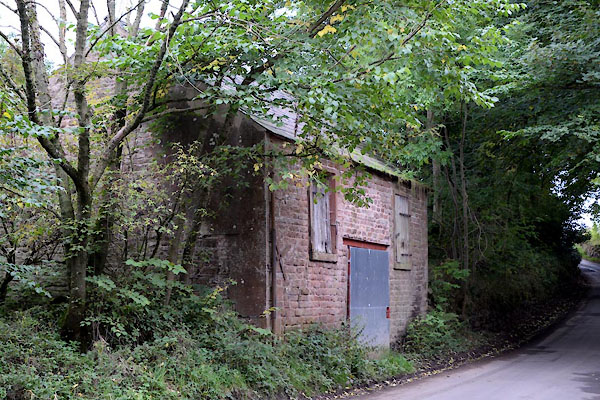 CGP85.jpg (taken 24.9.2017) |
||
|
|
||
| evidence:- | old map:- OS County Series (Wmd 9 7) |
|
| source data:- | Maps, County Series maps of Great Britain, scales 6 and 25
inches to 1 mile, published by the Ordnance Survey, Southampton,
Hampshire, from about 1863 to 1948. "Methodist Chapel (Primitive)" |
|
|
|
||
 Lakes Guides menu.