 Old Cumbria Gazetteer
 |
 |
|
| cross, Alston Moor | ||
| locality:- | ||
| civil parish:- | Alston Moor (formerly Cumberland) | |
| county:- | Cumbria | |
| locality type:- | cross (several?) | |
| coordinates:- | NY79574168 | |
| 1Km square:- | NY7941 | |
| 10Km square:- | NY74 | |
| SummaryText:- | 'Crosses' in English Black Letter on a 1960s map; not on the county boundary | |
|
|
||
| evidence:- | old map:- Donald 1774 (Cmd) placename:- Shorts Cross |
|
| source data:- | Map, hand coloured engraving, 3x2 sheets, The County of Cumberland, scale about 1
inch to 1 mile, by Thomas Donald, engraved and published by Joseph Hodskinson, 29
Arundel Street, Strand, London, 1774.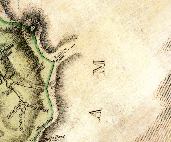 D4NY84SW.jpg "Shorts Cross" cross on county boundary item:- Carlisle Library : Map 2 Image © Carlisle Library |
|
|
|
||
 Lakes Guides menu.