 Old Cumbria Gazetteer
 |
 |
|
| engine house, Whitehaven | ||
| gone | ||
| Ginns Engine | ||
| locality:- | Arrowthwaite (?) | |
| locality:- | Whitehaven | |
| civil parish:- | Whitehaven (formerly Cumberland) | |
| county:- | Cumbria | |
| locality type:- | engine house | |
| coordinates:- | NX97231730 (guess) | |
| 1Km square:- | NX9717 | |
| 10Km square:- | NX91 | |
|
|
||
| evidence:- | old map:- Donald 1774 (Cmd) |
|
| source data:- | Map, hand coloured engraving, 3x2 sheets, The County of Cumberland, scale about 1
inch to 1 mile, by Thomas Donald, engraved and published by Joseph Hodskinson, 29
Arundel Street, Strand, London, 1774.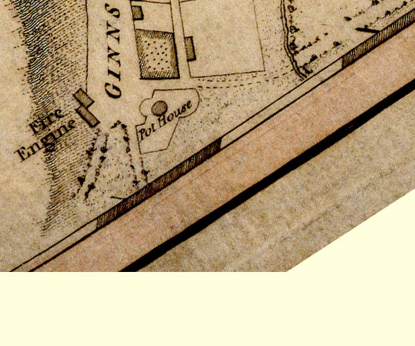 D49717G.jpg "Fire Engine" building item:- Carlisle Library : Map 2 Image © Carlisle Library |
|
|
|
||
|
|
||
| Finlay, Michael: 2006: Mining and Related Tokens of West Cumberland and their Issuers:
Plains Books |
||
|
|
||
 Lakes Guides menu.