 Old Cumbria Gazetteer
 |
 |
|
| house, Ellonby | ||
| Horse and Farrier Inn | ||
| locality:- | Ellonby | |
| civil parish:- | Skelton (formerly Cumberland) | |
| county:- | Cumbria | |
| locality type:- | buildings | |
| locality type:- | inn (ex) | |
| coordinates:- | NY42593517 | |
| 1Km square:- | NY4235 | |
| 10Km square:- | NY43 | |
|
|
||
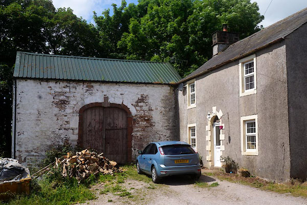 CDM56.jpg (taken 3.7.2015) 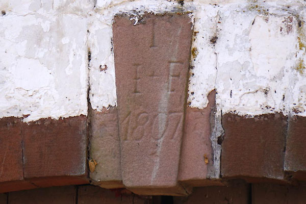 CDM57.jpg Date stone on barn:- "T / I + F / 1807" (taken 3.7.2015) |
||
|
|
||
| evidence:- | old map:- OS County Series (Cmd 49 5) placename:- Horse and Farrier Inn |
|
| source data:- | Maps, County Series maps of Great Britain, scales 6 and 25
inches to 1 mile, published by the Ordnance Survey, Southampton,
Hampshire, from about 1863 to 1948. |
|
|
|
||
 Lakes Guides menu.