 Old Cumbria Gazetteer
 |
 |
|
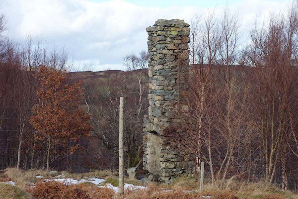
| house, Shap Rural (2) | ||
| locality:- | Naddle Forest (roughly) | |
| civil parish:- | Shap Rural (formerly Westmorland) | |
| county:- | Cumbria | |
| locality type:- | building/s (ruins) | |
| coordinates:- | NY50311395 | |
| 1Km square:- | NY5013 | |
| 10Km square:- | NY51 | |
|
|
||
 BZW86.jpg (taken 16.2.2014) |
||
|
|
||
| notes:- |
OS 25 inch map 1915 shows a building and an enclosure of 0.215 acres, parcel no.297. |
|
| A mid 20th century 6 inch map has 'Chy' |
||
|
|
||
 Lakes Guides menu.