 Old Cumbria Gazetteer
 |
 |
|
| Knowes Sike | ||
| runs into:- |  spring, Mallerstang spring, Mallerstang |
|
|
|
||
| locality:- | Knowes | |
| locality:- | Mallerstang | |
| civil parish:- | Mallerstang (formerly Westmorland) | |
| county:- | Cumbria | |
| locality type:- | river | |
| 1Km square:- | NY7800 (etc) | |
| 10Km square:- | NY70 | |
|
|
||
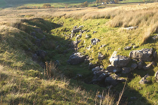 CEG80.jpg Dry gully; looking down. (taken 3.11.2015) |
||
| The water runs underground, audibly, perhaps appearing on the surface after rain.
It rises in a spring just above Thrang Force. |
||
|
|
||
| evidence:- | old map:- OS County Series (Wmd 36 3) placename:- Knowes Sike |
|
| source data:- | Maps, County Series maps of Great Britain, scales 6 and 25
inches to 1 mile, published by the Ordnance Survey, Southampton,
Hampshire, from about 1863 to 1948. |
|
|
|
||
Lakes Guides menu.