 Old Cumbria Gazetteer
 |
 |
|
| Low Pate Hole, Great Asby | ||
| Low Pate Hole | ||
| site name:- | Asby Gill | |
| locality:- | Great Asby | |
| civil parish:- | Asby (formerly Westmorland) | |
| county:- | Cumbria | |
| locality type:- | pothole | |
| coordinates:- | NY67801250 | |
| 1Km square:- | NY6712 | |
| 10Km square:- | NY61 | |
| SummaryText:- | Asby Beck re-emrges from underground | |
|
|
||
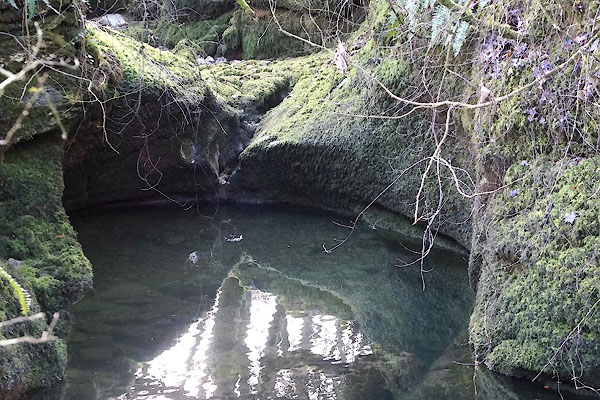 CFW49.jpg Low Pate Hole? water welling up? (taken 6.3.2017) |
||
|
|
||
| evidence:- | old map:- OS County Series (Wmd 22 3) placename:- Low Pate Hole placename:- Pate Hole, Low |
|
| source data:- | Maps, County Series maps of Great Britain, scales 6 and 25
inches to 1 mile, published by the Ordnance Survey, Southampton,
Hampshire, from about 1863 to 1948. |
|
|
|
||
| also see:- |  Pate Hole Mouth, Great Asby Pate Hole Mouth, Great Asby |
|
|
|
||
Lakes Guides menu.