 Old Cumbria Gazetteer
 |
 |
|
| Monkhill Lough, Monkhill | ||
| Monkhill Lough | ||
| site name:- | Greathill Beck | |
| locality:- | Monkhill | |
| civil parish:- | Beaumont (formerly Cumberland) | |
| county:- | Cumbria | |
| locality type:- | tarn (mill dam, drained?) | |
| locality type:- | area | |
| coordinates:- | NY33785835 (etc) | |
| 1Km square:- | NY3358 | |
| 10Km square:- | NY35 | |
|
|
||
| evidence:- | old map:- Donald 1774 (Cmd) |
|
| source data:- | Map, hand coloured engraving, 3x2 sheets, The County of Cumberland, scale about 1
inch to 1 mile, by Thomas Donald, engraved and published by Joseph Hodskinson, 29
Arundel Street, Strand, London, 1774.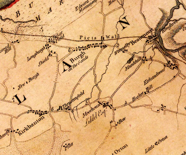 D4NY35NW.jpg lake by Munkhill item:- Carlisle Library : Map 2 Image © Carlisle Library |
|
|
|
||
| notes:- |
Before it was drained this was a place for ice skating and curling in winter. It was
also a water source for the fire brigade. It was used twice for fires at Monkhill
Hall; in the 1930s, in a bucket chain; in 1971, using suction hoses. |
|
|
|
||
 Lakes Guides menu.