 Old Cumbria Gazetteer
 |
 |
|
| Sea Dike, Skinburness | ||
| Sea Dike | ||
| locality:- | Skinburness Marsh | |
| locality:- | Moricambe | |
| civil parish:- | Holme Abbey (formerly Cumberland) | |
| civil parish:- | Holme St Cuthbert (formerly Cumberland) | |
| civil parish:- | Holme Low (formerly Cumberland) | |
| county:- | Cumbria | |
| locality type:- | sea dike | |
| coordinates:- | NY13065536 (etc) | |
| 1Km square:- | NY1355 | |
| 10Km square:- | NY15 | |
|
|
||
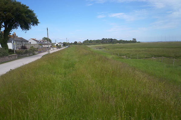 CDH69.jpg NW from Marsh House, Skinburness. (taken 12.6.2015) 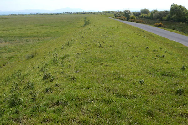 CDH70.jpg SE from Skinburness. (taken 12.6.2015) |
||
|
|
||
| evidence:- | old map:- OS County Series (Cmd 20 8) placename:- Sea Dike |
|
| source data:- | Maps, County Series maps of Great Britain, scales 6 and 25
inches to 1 mile, published by the Ordnance Survey, Southampton,
Hampshire, from about 1863 to 1948. "Sea Dike" labelled as an antiquity |
|
|
|
||
| evidence:- | old map:- Donald 1774 (Cmd) placename:- Sea Dike |
|
| source data:- | Map, hand coloured engraving, 3x2 sheets, The County of Cumberland, scale about 1
inch to 1 mile, by Thomas Donald, engraved and published by Joseph Hodskinson, 29
Arundel Street, Strand, London, 1774.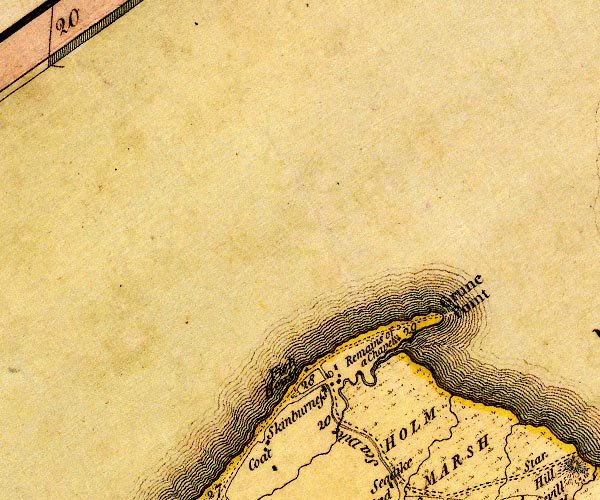 D4NY15NW.jpg "Sea Dike" double line, perhaps a sea wall on landward side of the road item:- Carlisle Library : Map 2 Image © Carlisle Library |
|
|
|
||
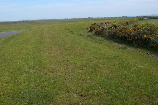 CDH72.jpg (taken 12.6.2015) |
||
|
|
||
| hearsay:- |
Built by the monks of Holme Coultram Abbey around the southern part of Moricambe Bay
to hold back the sea during the medieval warm period. From 1570-1880 it was maintained
by the Sixteen Men of Holme Cultram; from 1880 by the Sea Dike Charity. |
|
|
|
||
| Cracknell, Basil E: 2005: Outrageous Waves: Phillimore and Co:: ISBN 1 86077 344 0 |
||
|
|
||
 Lakes Guides menu.