 Old Cumbria Gazetteer
 |
 |
|
| cross, Rockcliffe | ||
| locality:- | St Mary's Church | |
| locality:- | Rockcliffe | |
| civil parish:- | Rockcliffe (formerly Cumberland) | |
| county:- | Cumbria | |
| locality type:- | cross | |
| coordinates:- | NY35906161 | |
| 1Km square:- | NY3561 | |
| 10Km square:- | NY36 | |
|
|
||
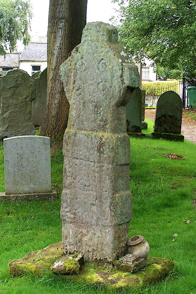 BOA71.jpg (taken 31.8.2007) |
||
| Norse. |
||
|
|
||
| evidence:- | old map:- OS County Series (Cmd 16 6) |
|
| source data:- | Maps, County Series maps of Great Britain, scales 6 and 25
inches to 1 mile, published by the Ordnance Survey, Southampton,
Hampshire, from about 1863 to 1948. "Cross" |
|
|
|
||
 Lakes Guides menu.