 Old Cumbria Gazetteer
 |
 |
|
||
| Eskmeals Pool | ||||
| civil parish:- | Waberthwaite (formerly Cumberland) | |||
| civil parish:- | Bootle (formerly Cumberland) | |||
| county:- | Cumbria | |||
| locality type:- | river | |||
| locality type:- | boundary | |||
| locality type:- | parish boundary | |||
| 1Km square:- | SD0992 (etc) | |||
| 10Km square:- | SD09 | |||
|
|
||||
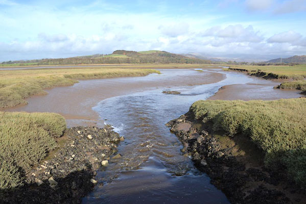 CGU33.jpg At Pool Bridge, (taken 25.10.2017) |
||||
|
|
||||
| evidence:- | old map:- OS County Series (Cmd 82 15) placename:- Eskmeals Pool |
|||
| source data:- | Maps, County Series maps of Great Britain, scales 6 and 25
inches to 1 mile, published by the Ordnance Survey, Southampton,
Hampshire, from about 1863 to 1948. "Eskmeals Pool" "Ordinary Spring Tides flow to this point" about SD09009388 |
|||
|
|
||||
| places:- |
|
|||
 Lakes Guides menu.