 Old Cumbria Gazetteer
 |
 |
|
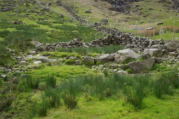
| Iron Gate Sheepfold, Dunnerdale-with-Seathwaite | ||
| Iron Gate Sheepfold | ||
| locality:- | Iron Gate | |
| locality:- | Wrynose Bottom | |
| civil parish:- | Dunnerdale-with-Seathwaite (formerly Lancashire) | |
| county:- | Cumbria | |
| locality type:- | sheepfold | |
| coordinates:- | NY25720197 | |
| 1Km square:- | NY2501 | |
| 10Km square:- | NY20 | |
|
|
||
 CDE39.jpg (taken 4.6.2015) |
||
|
|
||
| evidence:- | old map, old map:- OS County Series (Lan 1) placename:- Iron Gate Sheepfold |
|
| source data:- | Maps, County Series maps of Great Britain, scales 6 and 25
inches to 1 mile, published by the Ordnance Survey, Southampton,
Hampshire, from about 1863 to 1948. OS County Series (Cmd 80) "Iron Gate Sheepfold" |
|
|
|
||
 Lakes Guides menu.