 Old Cumbria Gazetteer
 |
 |
|
| boundary stone, Mungrisdale (6) | ||
| locality:- | Carrhead Foot Bridge | |
| civil parish:- | Mungrisdale (formerly Cumberland) | |
| county:- | Cumbria | |
| locality type:- | boundary stone | |
| locality type:- | township boundary mark | |
| coordinates:- | NY36323336 | |
| 1Km square:- | NY3633 | |
| 10Km square:- | NY33 | |
|
|
||
| notes:- |
Courtesy of Colin Smith, 1999 and 2005. |
|
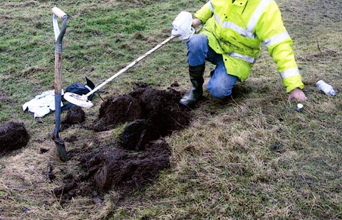
| Mungrisdale 00011 |
||
| OS County Series (Cmd 48 10) |
||
| Stone and plate found by metal detector, buried, 2005 |
||
 PH0118.jpg 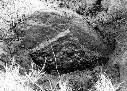 PH0119.jpg |
||
|
|
||
 Lakes Guides menu.