 Old Cumbria Gazetteer
 |
 |
|
| included in:- |
 Middle Swinklebank, Longsleddale Middle Swinklebank, Longsleddale |
|
| Middle Swinklebank, Longsleddale: Corn Rent Act 1836 | ||
| evidence:- | tithe schedule:- Kendal Corn Rent Act 1836 placename:- Middle Swindle Bank |
|
| source data:- | Tithe map, Plan of part of the Township of Longsleddale, Westmorland, made regarding
the Kendal Corn Rent Act, ie a tithe award map, scale about 20 inches to 1 mile, Kendal,
Westmorland, 1836. Schedule, each row gives:- Field no. / Tenant's name / Close ie Field name / Type of culture / Area, acres Owned by Edward Walker, tenanted by Henry Mattinson; Middle Swindle Bank. "/ / Walker Edward" "/ 498 / Henry Mattinson / High Field / Ar &Mea / 9 255" "/ 499 / Do / Plantation / / 8 805" "/ 501 / Do / High Wood / Pas / 4 935" "/ 502 / Do / Crow foot Field / Pas / 4 160" "/ 503 / Do / Broad Field Acre / Mea / 1 665" "/ 519 / Do / Stewards Ing / Mea / 3 255" "/ 528 / Do / Cragg / Pas / 24 515" "/ 529 / Do / Plantation / / 0 030" "/ 530 / Do / Plantation / / 0 300" "/ 531 / Do / Wood / Pas / 21 645" "/ 532 / Do / Calf Parrock / Pas / 0 615" "/ 533 / Do / New Close / Mea / 0 765" "/ 534 / Do / Homstd. &c at Midl. Sw. Bank / / 0 300" "/ 535 / Do / Orchard &Graden / / 0 135" "/ 536 / Do / Green / Mea. / 2 075" "/ 537 / Do / Low Field / Ar &Mea / 3 790" "/ 554 / ¼part Do / Grassing Heads / Pas / 26 075" "/ / / / / [total] 112 320" "" 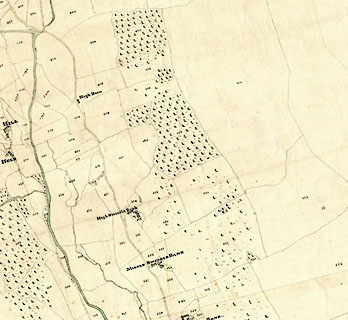 click to enlarge click to enlargeCRny4904.jpg map courtesy of Mark Cropper item:- private collection : 370 Image © see bottom of page |
|
|
|
||
| evidence:- | tithe awards:- Kendal Corn Rent Act 1836 placename:- Middle Swindle Bank |
|
| source data:- | Plan of the Township of Longsleddale, made for the Kendal Corn Rent Act, ie a tithe
award map, scale about 10 inches to 1 mile, Kendal, Westmorland, 1836. "Walker Edward / Henry Mattinson / Middle Swindle Bank / 112 320 112 1 11 / ..." |
|
|
|
||
Lakes Guides menu.