 Old Cumbria Gazetteer
 |
 |
|
| Angle Tarn, Borrowdale | ||
| runs into:- |  Angletarn Gill Angletarn Gill |
|
|
|
||
| Angle Tarn | ||
| civil parish:- | Borrowdale (formerly Cumberland) | |
| county:- | Cumbria | |
| locality type:- | tarn | |
| coordinates:- | NY24430765 | |
| 1Km square:- | NY2407 | |
| 10Km square:- | NY20 | |
| altitude:- | 1854 feet | |
| altitude:- | 565m | |
|
|
||
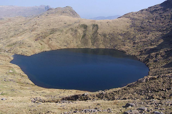 BQL58.jpg (taken 20.4.2009) 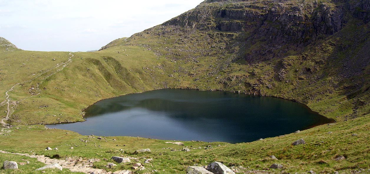 Click to enlarge BPF57.jpg (taken 20.5.2008) |
||
|
|
||
| evidence:- | old map:- Otley 1818 |
|
| source data:- | Map, uncoloured engraving, The District of the Lakes,
Cumberland, Westmorland, and Lancashire, scale about 4 miles to
1 inch, by Jonathan Otley, 1818, engraved by J and G Menzies,
Edinburgh, Scotland, published by Jonathan Otley, Keswick,
Cumberland, et al, 1833.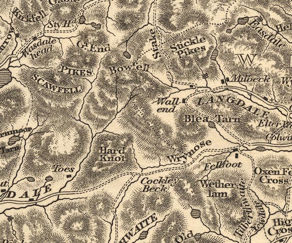 OT02NY20.jpg item:- JandMN : 48.1 Image © see bottom of page |
|
|
|
||
| evidence:- | descriptive text:- Otley 1823 (5th edn 1834) item:- fishing; perch |
|
| source data:- | Guide book, A Concise Description of the English Lakes, the
mountains in their vicinity, and the roads by which they may be
visited, with remarks on the mineralogy and geology of the
district, by Jonathan Otley, published by the author, Keswick,
Cumberland now Cumbria, by J Richardson, London, and by Arthur
Foster, Kirkby Lonsdale, Cumbria, 1823; published 1823-49,
latterly as the Descriptive Guide to the English Lakes. goto source Page 37:- "... Angle Tarn, stocked only with a few perch, is at the head of the stream belonging to the branch of Borrowdale called Langstreth. At the foot of Eagle Crag, this is joined by another stream from the branch of Greenup; and after passing Stonethwaite and Rosthwaite, joins the Seathwaite branch a little further down the vale. ..." |
|
|
|
||
| evidence:- | old map:- Garnett 1850s-60s H placename:- Angle Tarn |
|
| source data:- | Map of the English Lakes, in Cumberland, Westmorland and
Lancashire, scale about 3.5 miles to 1 inch, published by John
Garnett, Windermere, Westmorland, 1850s-60s.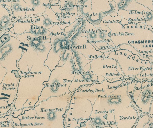 GAR2NY20.jpg "Angle T." outline with shore form lines, lake or tarn item:- JandMN : 82.1 Image © see bottom of page |
|
|
|
||
| evidence:- | old print:- Heaton Cooper 1905 (edn 1908) placename:- Angle Tarn |
|
| source data:- | Print, colour halftone, Angle Tarn, Borrowdale, Cumberland, from a watercolour painting
by Alfred Heaton Cooper, published by Adam and Charles Black, London, 2nd edn 1908.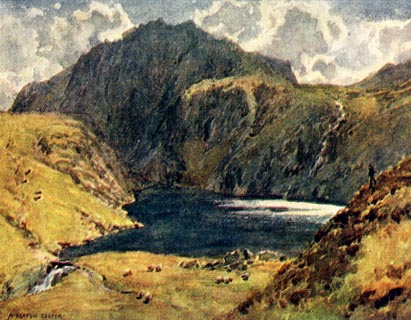 click to enlarge click to enlargeHC0167.jpg Opposite p.204 of The English Lakes, painted by Alfred Heaton Cooper, described by William T Palmer. printed at tissue opposite the print:- "ANGLE TARN, ESK HAUSE" printed at signed lower left:- "A HEATON COOPER" item:- JandMN : 468.67 Image © see bottom of page |
|
|
|
||
| evidence:- | old print:- MacBride 1922 placename:- Angle Tarn |
|
| source data:- | Print, colour, Angle Tarn, Esk Hause, by Alfred Heaton Cooper, published by Adam and
Charles Black, 4-6 Soho Square, London, 2nd edn 1928.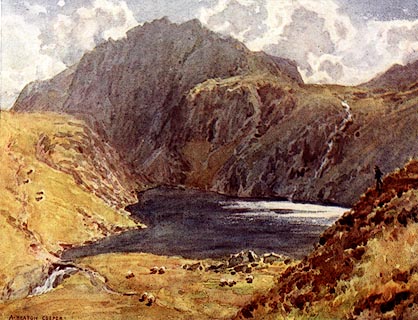 click to enlarge click to enlargeMB0108.jpg Tipped in opposite p.37 in Wild Lakeland by MacKenzie MacBride. printed at bottom:- "ANGLE TARN, ESK HAUSE" signed at lower left:- "A. HEATON COOPER" item:- JandMN : 195.10 Image © see bottom of page |
|
|
|
||
| evidence:- | old print:- Prior 1865 placename:- Angle Tarn |
|
| source data:- | Print, uncoloured engraving, Angle Tarn, Borrowdale, Cumberland, published by John
Garnett, Windermere, Westmorland, and by Simpkin, Marshall and Co, London, 1865.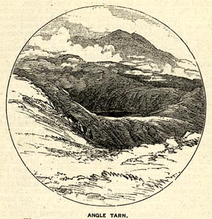 click to enlarge click to enlargePI0101.jpg Included on page 10 of the guide book, Ascents and Passes in the Lake District of England, by Herman Prior. printed at bottom:- "ANGLE TARN." item:- JandMN : 235.3 Image © see bottom of page |
|
|
|
||
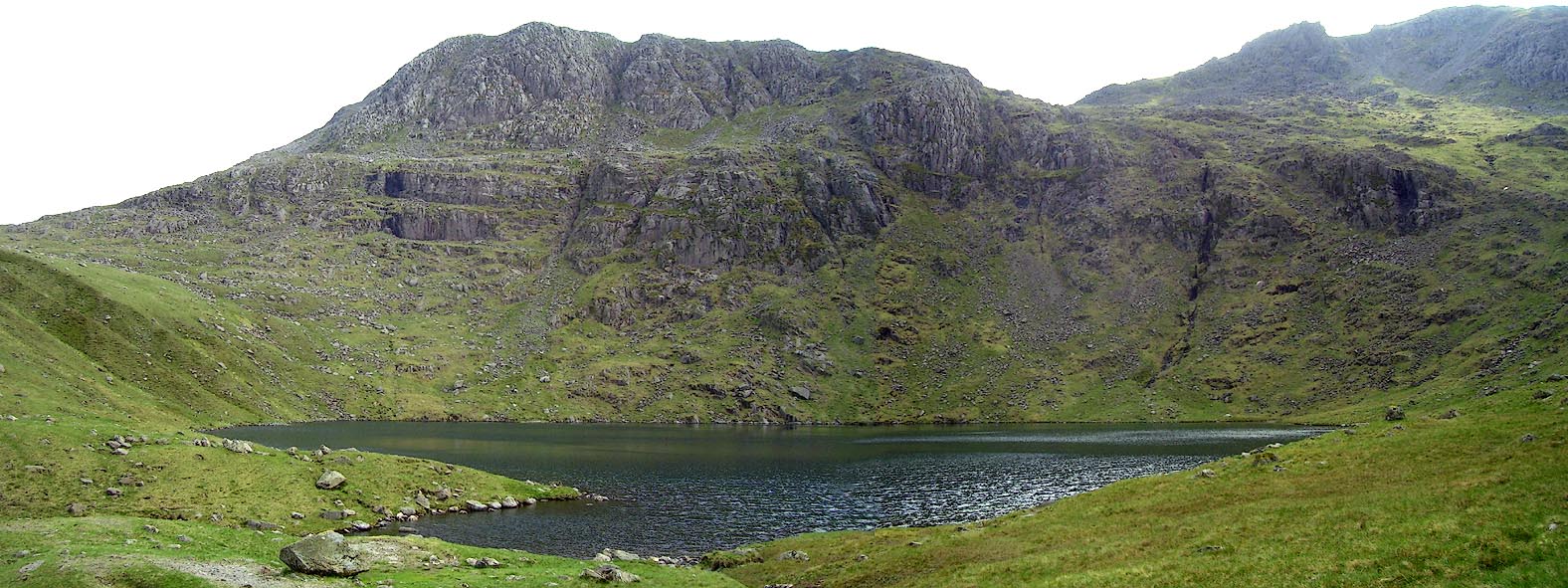 Click to enlarge BPF58.jpg and Hanging Knotts. (taken 20.5.2008) |
||
|
|
||
| hearsay:- |
Nancy Price says:- |
|
| "A sinister, laughterless tarn, it is like a dead jelly fish, flat and squishy, or
it might be a polluted spring from the Devil Kingdom. None but the damned could desire
such water. It was soft and warm, and had no freshness in it. Horrid shapes might
well wallow there with long black shining arms ready to drag any unwary wanderer to
their depths." |
||
| hmm. |
||
| Price, Nancy:: Vagabonds' Way Baron 1925 |
||
|
|
||
| hearsay:- |
It's about 40 feet, 15m deep. |
|
|
|
||
Lakes Guides menu.