 Old Cumbria Gazetteer
 |
 |
|
| beacon, Warton | ||
| site name:- | Warton Crag (?) | |
| county:- | Lancashire | |
| locality type:- | beacon (?) | |
| 1Km square:- | SD4872 | |
| 10Km square:- | SD47 | |
| references:- | West 1784 map |
|
|
|
||
| evidence:- | descriptive text:- West 1778 (11th edn 1821) |
|
| source data:- | Guide book, A Guide to the Lakes, by Thomas West, published by
William Pennington, Kendal, Cumbria once Westmorland, and in
London, 1778 to 1821. goto source goto sourcePage 14:- "... The station at Lancaster was connected with that at Watercrook, near Kendal, by the intervention of the beacon on Warton Crag, and the castellum on the summit of a hill that rises immediately above Watercrook, at present called Castle Steads." |
|
|
|
||
| evidence:- | old map:- West 1784 map |
|
| source data:- | Map, hand coloured engraving, A Map of the Lakes in Cumberland,
Westmorland and Lancashire, scale about 3.5 miles to 1 inch,
engraved by Paas, 53 Holborn, London, about 1784.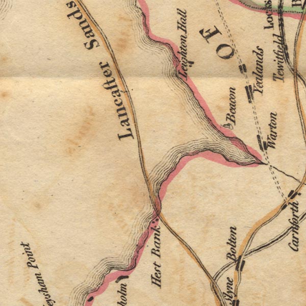 Ws02SD46.jpg "Beacon" Shown by a drawing of a tower. item:- Armitt Library : A1221.1 Image © see bottom of page |
|
|
|
||
Lakes Guides menu.