 Old Cumbria Gazetteer
 |
 |
|
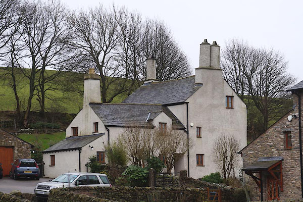
| Birk Hag, Kendal | ||
| Birk Hag | ||
| civil parish:- | Kendal (formerly Westmorland) | |
| county:- | Cumbria | |
| locality type:- | buildings | |
| coordinates:- | SD53109170 | |
| 1Km square:- | SD5391 | |
| 10Km square:- | SD59 | |
|
|
||
 CEO64.jpg (taken 19.2.2016) |
||
|
|
||
| evidence:- | old map:- OS County Series (Wmd 39 5) placename:- Birk Hag |
|
| source data:- | Maps, County Series maps of Great Britain, scales 6 and 25
inches to 1 mile, published by the Ordnance Survey, Southampton,
Hampshire, from about 1863 to 1948. |
|
|
|
||
| evidence:- | hearth tax returns:- Hearth Tax 1675 placename:- Birk Hagge |
|
| source data:- | Records, hearth tax survey returns, Westmorland, 1674/75. "Birk hagge" in "Kendall parke and oxen-holme" |
|
|
|
||
| evidence:- | database:- Listed Buildings 2010 placename:- Birk Hag Farm |
|
| source data:- | courtesy of English Heritage "BIRK HAG FARMHOUSE / / A686 / KENDAL / SOUTH LAKELAND / CUMBRIA / II / 75344 / SD5312291689" |
|
|
|
||
 Lakes Guides menu.