 Old Cumbria Gazetteer
 |
 |
|
| Bluecaster Side, Sedbergh | ||
| Bluecaster Side | ||
| Street:- | Cautley Road | |
| civil parish:- | Sedbergh (formerly Yorkshire) | |
| county:- | Cumbria | |
| locality type:- | buildings | |
| coordinates:- | SD70079631 | |
| 1Km square:- | SD7096 | |
| 10Km square:- | SD79 | |
|
|
||
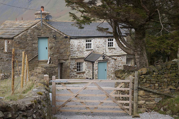 CEQ14.jpg (taken 26.2.2016) 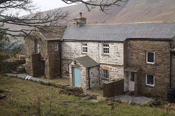 CEQ15.jpg (taken 26.2.2016) |
||
|
|
||
| evidence:- | old map:- OS County Series (Yrk 49 5) placename:- Bluecaster Side |
|
| source data:- | Maps, County Series maps of Great Britain, scales 6 and 25
inches to 1 mile, published by the Ordnance Survey, Southampton,
Hampshire, from about 1863 to 1948. |
|
|
|
||
| evidence:- | old map:- Jefferys 1770 (Wmd) placename:- Side |
|
| source data:- | Map, 4 sheets, The County of Westmoreland, scale 1 inch to 1
mile, surveyed 1768, and engraved and published by Thomas
Jefferys, London, 1770.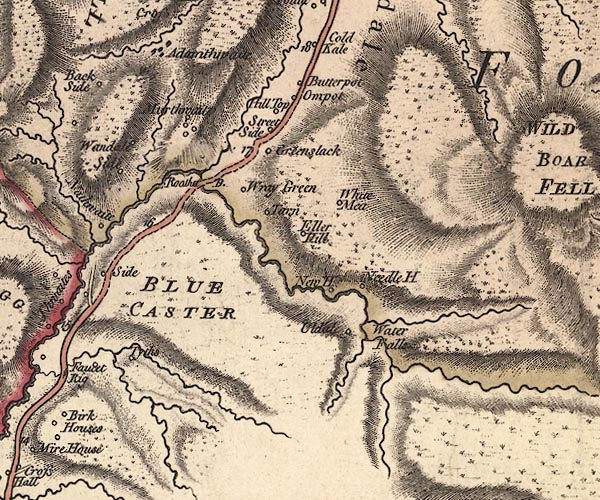 J5SD79NW.jpg "Side" circle, labelled in italic lowercase text; settlement, farm, house, or hamlet? item:- National Library of Scotland : EME.s.47 Image © National Library of Scotland |
|
|
|
||
| evidence:- | database:- Listed Buildings 2010 placename:- Bluecaster |
|
| source data:- | courtesy of English Heritage "BLUECASTER / / CAUTLEY ROAD / SEDBERGH / SOUTH LAKELAND / CUMBRIA / II / 484523 / SD7007296315" |
|
|
|
||
 Lakes Guides menu.