 Old Cumbria Gazetteer
 |
 |
|
||||||||||||||||||||||||
| Bow Fell, Eskdale | ||||||||||||||||||||||||||
| Bow Fell | ||||||||||||||||||||||||||
| civil parish:- | Eskdale (formerly Cumberland) | |||||||||||||||||||||||||
| civil parish:- | Lakes (formerly Westmorland) | |||||||||||||||||||||||||
| county:- | Cumbria | |||||||||||||||||||||||||
| locality type:- | hill | |||||||||||||||||||||||||
| locality type:- | fell | |||||||||||||||||||||||||
| locality type:- | boundary mark | |||||||||||||||||||||||||
| locality type:- | county boundary mark | |||||||||||||||||||||||||
| coordinates:- | NY24470647 (etc) | |||||||||||||||||||||||||
| 1Km square:- | NY2406 | |||||||||||||||||||||||||
| 10Km square:- | NY20 | |||||||||||||||||||||||||
| altitude:- | 2959 feet | |||||||||||||||||||||||||
| altitude:- | 902m | |||||||||||||||||||||||||
| SummaryText:- | on old county boundary | |||||||||||||||||||||||||
|
|
||||||||||||||||||||||||||
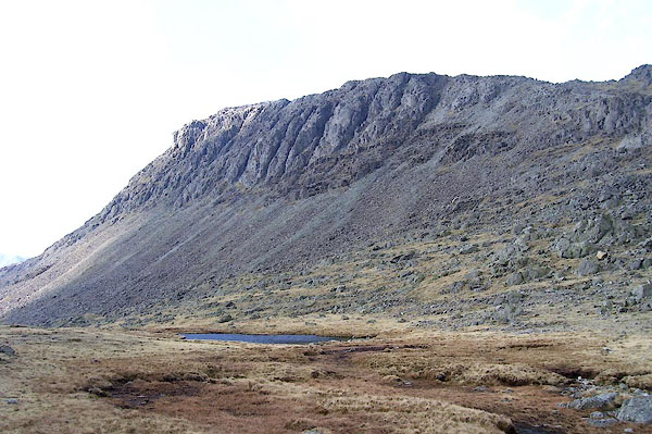
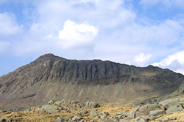 BNL42.jpg (taken 26.3.2007) 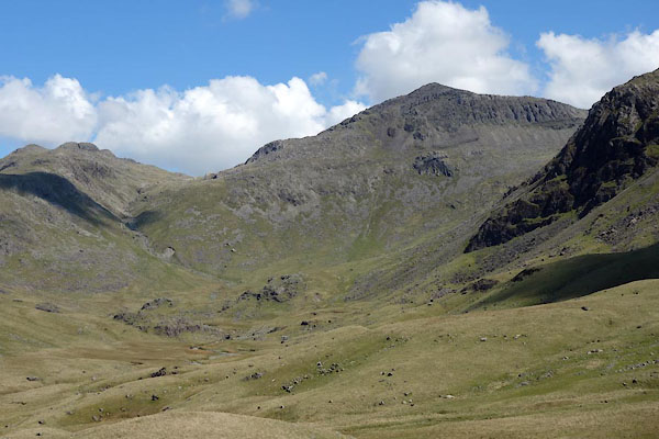 BYN03.jpg From Lincove Beck. (taken 4.6.2013) |
||||||||||||||||||||||||||
|
|
||||||||||||||||||||||||||
| evidence:- | old map:- OS County Series (Wmd 25 1) placename:- Bow Fell |
|||||||||||||||||||||||||
| source data:- | Maps, County Series maps of Great Britain, scales 6 and 25
inches to 1 mile, published by the Ordnance Survey, Southampton,
Hampshire, from about 1863 to 1948. |
|||||||||||||||||||||||||
|
|
||||||||||||||||||||||||||
| evidence:- | old map:- Jefferys 1770 (Wmd) placename:- Bow Fell |
|||||||||||||||||||||||||
| source data:- | Map, 4 sheets, The County of Westmoreland, scale 1 inch to 1
mile, surveyed 1768, and engraved and published by Thomas
Jefferys, London, 1770. J5NY20NE.jpg "BOW FELL" hill hachuring; hill or mountain, on county boundary item:- National Library of Scotland : EME.s.47 Image © National Library of Scotland |
|||||||||||||||||||||||||
|
|
||||||||||||||||||||||||||
| evidence:- | old map:- Donald 1774 (Cmd) placename:- Bow Fell |
|||||||||||||||||||||||||
| source data:- | Map, hand coloured engraving, 3x2 sheets, The County of Cumberland, scale about 1
inch to 1 mile, by Thomas Donald, engraved and published by Joseph Hodskinson, 29
Arundel Street, Strand, London, 1774. D4NY20NW.jpg "BOW FELL" hill hachuring; hill or mountain, on county boundary item:- Carlisle Library : Map 2 Image © Carlisle Library |
|||||||||||||||||||||||||
|
|
||||||||||||||||||||||||||
| evidence:- | descriptive text:- West 1778 (11th edn 1821) placename:- Bowfell |
|||||||||||||||||||||||||
| source data:- | Guide book, A Guide to the Lakes, by Thomas West, published by
William Pennington, Kendal, Cumbria once Westmorland, and in
London, 1778 to 1821. goto source goto sourcePage 190:- "A TABLE OF THE Height of Mountains and Lakes SEEN IN THIS TOUR, ... TAKEN FROM THE LEVEL OF THE SEA. ... by Mr. John Dalton." "Bowfell (Langdale) ... 1030 [yards]" |
|||||||||||||||||||||||||
|
|
||||||||||||||||||||||||||
| evidence:- | old map:- Cary 1789 (edn 1805) placename:- Bow Fell |
|||||||||||||||||||||||||
| source data:- | Map, uncoloured engraving, Westmoreland, scale about 2.5 miles
to 1 inch, by John Cary, London, 1789; edition 1805.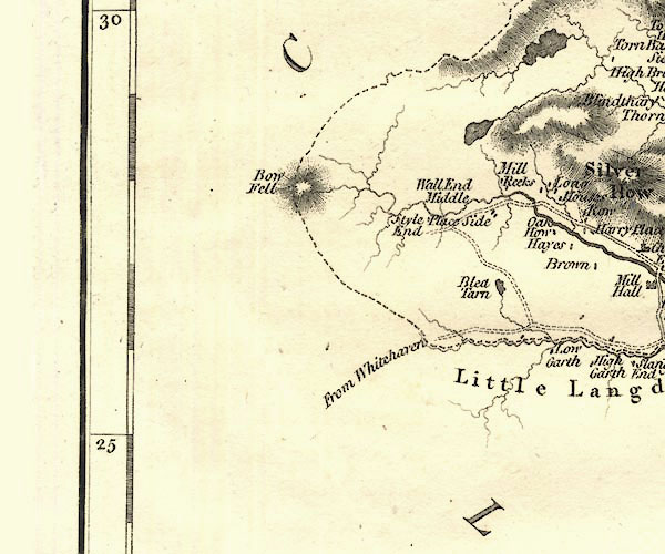 CY24NY20.jpg "Bow Fell" hill hachuring item:- JandMN : 129 Image © see bottom of page |
|||||||||||||||||||||||||
|
|
||||||||||||||||||||||||||
| evidence:- | old drawing:- Green 1790s-1820s (1808) placename:- Bow Fell |
|||||||||||||||||||||||||
| source data:- | Drawing, pencil, Bow Fell from Side House in Langdale, Great Langdale, Westmorland,
by William Green, Ambleside, Westmorland, 19 September 1808.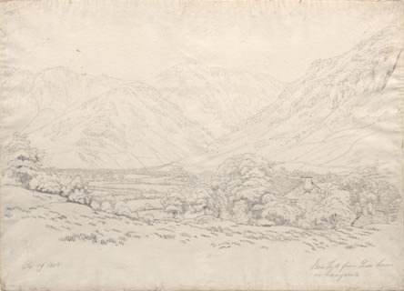 click to enlarge click to enlargePR1760.jpg ms, pencil at lower left, right:- "Sep 19 1808 / Bow Fell from Side House in Langdale" item:- Dove Cottage : B47 Image © see bottom of page |
|||||||||||||||||||||||||
|
|
||||||||||||||||||||||||||
| evidence:- | old map:- Cooper 1808 placename:- Bow Fell |
|||||||||||||||||||||||||
| source data:- | Map, uncoloured engraving, Cumberland, scale about 10.5 miles to
1 inch, drawn and engraved by Cooper, published by R Phillips,
Bridge Street, Blackfriars, London, 1808. click to enlarge click to enlargeCOP3.jpg "Bow Fell" hill hachuring; mountain or hill, on county boundary item:- JandMN : 86 Image © see bottom of page |
|||||||||||||||||||||||||
|
|
||||||||||||||||||||||||||
| evidence:- | old map:- Cooper 1808 placename:- Bow Fell |
|||||||||||||||||||||||||
| source data:- | Map, hand coloured engraving, Westmoreland ie Westmorland, scale
about 9 miles to 1 inch, by H Cooper, 1808, published by R
Phillips, Bridge Street, Blackfriars, London, 1808. click to enlarge click to enlargeCOP4.jpg "Bow Fell" hill hachuring; mountain or hill; on county boundary item:- Dove Cottage : 2007.38.53 Image © see bottom of page |
|||||||||||||||||||||||||
|
|
||||||||||||||||||||||||||
| evidence:- | old print:- Green 1810 (plate 53) |
|||||||||||||||||||||||||
| source data:- | Print, soft ground etching, Langdale Head, Great Langdale, Westmorland, by William
Green, Ambleside, Westmorland, 1809.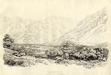 click to enlarge click to enlargeGN1253.jpg Probably Bow Fell centre background. Plate 53 in Sixty Studies from Nature, 1810. printed at top right:- "53" printed at bottom:- "LANGDALE HEAD. / Drawn &Engraved by William Green and Published at Ambleside, Augst. 1, 1809." watermark:- "J WHATMAN / 1813" item:- Armitt Library : A6641.53 Image © see bottom of page |
|||||||||||||||||||||||||
|
|
||||||||||||||||||||||||||
| evidence:- | old map:- Otley 1818 placename:- Bowfell |
|||||||||||||||||||||||||
| source data:- | Map, uncoloured engraving, The District of the Lakes,
Cumberland, Westmorland, and Lancashire, scale about 4 miles to
1 inch, by Jonathan Otley, 1818, engraved by J and G Menzies,
Edinburgh, Scotland, published by Jonathan Otley, Keswick,
Cumberland, et al, 1833.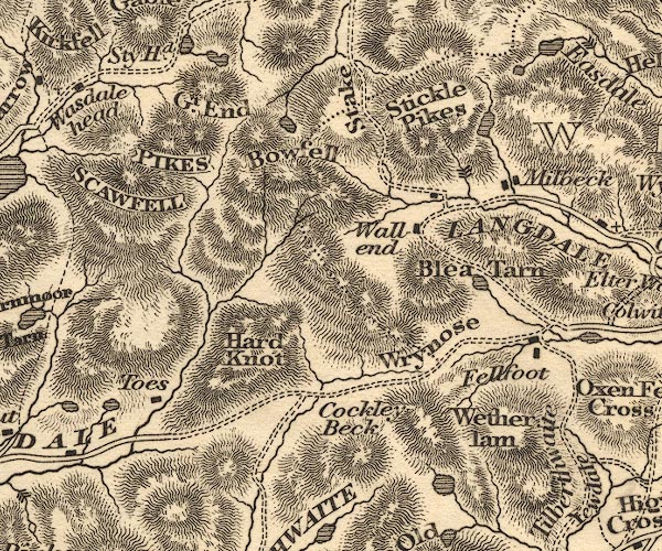 OT02NY20.jpg item:- JandMN : 48.1 Image © see bottom of page |
|||||||||||||||||||||||||
|
|
||||||||||||||||||||||||||
| evidence:- | outline view:- Otley 1823 (4th edn 1830) placename:- Bowfell |
|||||||||||||||||||||||||
| source data:- | Print, engraving, outline view, Some of the Western Mountains as seen from Helvellyn,
published by Jonathan Otley, Keswick, Cumberland et al, 1830.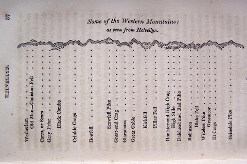 click to enlarge click to enlargeO75E02.jpg p.57 in A Concise Description of the English Lakes, by Jonathan Otley, 4th edition, 1830. "Some of the Western Mountains: / as seen from Helvellyn." "Wetherlam / Old Man - Coniston Fell / Carrs, or Scars / Gray Friar / Black Combe / Crinkle Crags / Bowfell / Scawfell Pike / Great-end Crag / Glaramara / Great Gable / Kirkfell / Pillar Fell / Honister and High Crag / High Stile / Dalehead and Red Pike / Robinson / Blake Fell / Witeless Pike / Grasmoor / Ill Crags / Grisedale Pike" item:- Armitt Library : A1175.3 Image © see bottom of page |
|||||||||||||||||||||||||
|
|
||||||||||||||||||||||||||
| evidence:- | outline view:- Otley 1823 (4th edn 1830) placename:- Bowfell |
|||||||||||||||||||||||||
| source data:- | Print, engraving, outline view, Mountains of Coniston, Langdale, &c. as they appear
from the road between Troutbeck Bridge and Bowness, published by Jonathan Otley, Keswick,
Cumberland et al, 1830.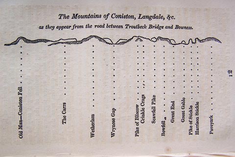 click to enlarge click to enlargeO75E04.jpg p.97 in A Concise Description of the English Lakes, by Jonathan Otley, 4th edition, 1830. "The Mountains of Coniston, Langdale, &c. / as they appear from the road between Troutbeck Bridge and Bowness." "Old Man - Coniston Fell / The Carrs / Wetherlam / Wrynose Gap / Pike of Bliscow / Crinkle Crags / Scawfell Pike / Bowfell / Great End / Great Gable / Pike of Stickle / Harrison Stickle / Paveyark" item:- Armitt Library : A1175.4 Image © see bottom of page |
|||||||||||||||||||||||||
|
|
||||||||||||||||||||||||||
| evidence:- | outline view:- Otley 1823 (8th edn 1849) placename:- Bowfell |
|||||||||||||||||||||||||
| source data:- | Engraving, outline view of mountains, Windermere looking towards the West from the
Road between Troutbeck and Bowness, drawn by T Binns, engraved by O Jewitt, opposite
p.4 of A Descriptive Guide of the English Lakes, by Jonathan Otley, 8th edition, 1849.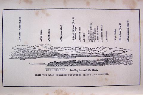 click to enlarge click to enlargeO80E03.jpg item:- Armitt Library : A1180.4 Image © see bottom of page |
|||||||||||||||||||||||||
|
|
||||||||||||||||||||||||||
| evidence:- | outline view:- Otley 1823 (8th edn 1849) placename:- Bowfell |
|||||||||||||||||||||||||
| source data:- | Engraving, outline view of mountains, A Group of Mountains seen from Helvellyn, looking
towards the South West, drawn by T Binns, engraved by O Jewitt, opposite p.50 of A
Descriptive Guide of the English Lakes, by Jonathan Otley, 8th edition, 1849.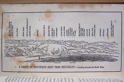 click to enlarge click to enlargeO80E17.jpg item:- Armitt Library : A1180.18 Image © see bottom of page |
|||||||||||||||||||||||||
|
|
||||||||||||||||||||||||||
| evidence:- | outline view:- Otley 1823 (5th edn 1834) |
|||||||||||||||||||||||||
| source data:- | Print, woodcut outline view, The Mountains of Coniston, Langdale, Etc, by Jonathan
Otley, Keswick, Cumberland, 1830.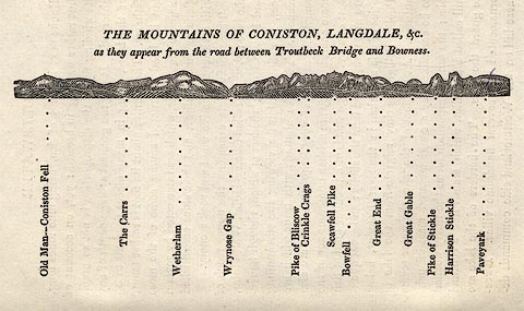 click to enlarge click to enlargeOT2E01.jpg Printed on p.7 of A Concise Description of the English Lakes, by Jonathan Otley, 5th edition, 1834. "THE MOUNTAINS OF CONISTON, LANGDALE, &c. as they appear from the road between Troutbeck Bridge and Bowness." Mountains in the view are listed:- "Old Man - Coniston Fell / The Carrs / Wetherlam / Wrynose Gap / Pike of Bliscow / Crinkle Crags / Scawfell Pike / Bowfell / Great End / Great Gable / Pike of Stickle / Harrison Stickle / Paveyark" item:- JandMN : 48.2 Image © see bottom of page |
|||||||||||||||||||||||||
|
|
||||||||||||||||||||||||||
| evidence:- | outline view:- Otley 1823 (5th edn 1834) |
|||||||||||||||||||||||||
| source data:- | Print, woodcut outline view, A Group of Mountains, seen from
Helvellyn, by Jonathan Otley, Keswick, Cumberland, 1830.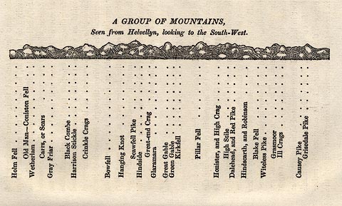 click to enlarge click to enlargeOT2E09.jpg Printed on p.63 of A Concise Description of the English Lakes, by Jonathan Otley, 5th edition, 1834. "A GROUP OF MOUNTAINS, Seen from Helvellyn, looking to the South-West." "Holm Fell / Old Man - Coniston Fell / Wetherlam / Carrs, or Scars / Gray Friar / Black Combe / Harrison Stickle / Crinkle Crags / Bowfell / Hanging Knot / Scawfell Pike / Hindside / Great-end Crag / Glaramara / Great Gable / Green Gable / Kirkfell / Pillar Fell / Honister, and High Crag / High Stile / Dalehead, and Red Pike / Hindscarth, and Robinson / Blake Fell / Witeless Pike / Grasmoor / Ill Crags / Causey Pike / Grisedale Pike" item:- JandMN : 48.10 Image © see bottom of page |
|||||||||||||||||||||||||
|
|
||||||||||||||||||||||||||
| evidence:- | descriptive text:- Otley 1823 (5th edn 1834) placename:- Bowfell |
|||||||||||||||||||||||||
| source data:- | Guide book, A Concise Description of the English Lakes, the
mountains in their vicinity, and the roads by which they may be
visited, with remarks on the mineralogy and geology of the
district, by Jonathan Otley, published by the author, Keswick,
Cumberland now Cumbria, by J Richardson, London, and by Arthur
Foster, Kirkby Lonsdale, Cumbria, 1823; published 1823-49,
latterly as the Descriptive Guide to the English Lakes. goto source Page 70:- "BOWFELL" "Rises proudly in view from Windermere and Esthwaite Lakes. It is 2911 feet in height, and sheds the rain water into Borrowdale, Langdale, and Eskdale. It is easiest of access from Langdale, but may be reached from any of the above mentioned vales, or from the vale of Duddon." |
|||||||||||||||||||||||||
|
|
||||||||||||||||||||||||||
| evidence:- | descriptive text:- Ford 1839 (3rd edn 1843) placename:- Bow Fell item:- altitude, Bow Fell |
|||||||||||||||||||||||||
| source data:- | Guide book, A Description of Scenery in the Lake District, by
Rev William Ford, published by Charles Thurnam, Carlisle, by W
Edwards, 12 Ave Maria Lane, Charles Tilt, Fleet Street, William
Smith, 113 Fleet Street, London, by Currie and Bowman,
Newcastle, by Bancks and Co, Manchester, by Oliver and Boyd,
Edinburgh, and by Sinclair, Dumfries, 1839. goto source Page 178:- "ELEVATION OF THE MOUNTAINS," "ACCORDING TO DIFFERENT AUTHORITIES."
|
|||||||||||||||||||||||||
|
|
||||||||||||||||||||||||||
| evidence:- | old map:- Ford 1839 map placename:- Bow Fell |
|||||||||||||||||||||||||
| source data:- | Map, uncoloured engraving, Map of the Lake District of
Cumberland, Westmoreland and Lancashire, scale about 3.5 miles
to 1 inch, published by Charles Thurnam, Carlisle, and by R
Groombridge, 5 Paternoster Row, London, 3rd edn 1843. FD02NY20.jpg "Bow Fell" Hill hachuring. item:- JandMN : 100.1 Image © see bottom of page |
|||||||||||||||||||||||||
|
|
||||||||||||||||||||||||||
| evidence:- | old drawing:- Aspland 1840s-60s placename:- Bowfell |
|||||||||||||||||||||||||
| source data:- | Drawing, pencil, Bow Fell, Eskdale, Cumberland, by Theophilus Lindsey Aspland, 1852.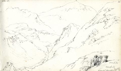 click to enlarge click to enlargeAS0339.jpg "see p34 / Bowfell / from nr Hardknot castle" page number "29" item:- Armitt Library : 1958.390.39 Image © see bottom of page |
|||||||||||||||||||||||||
|
|
||||||||||||||||||||||||||
| evidence:- | old drawing:- Aspland 1840s-60s |
|||||||||||||||||||||||||
| source data:- | Drawing, pencil, Bow Fell, Eskdale, Cumberland, by Theophilus Lindsey Aspland, 1852.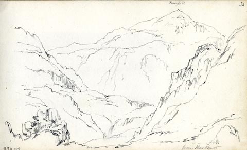 click to enlarge click to enlargeAS0347.jpg "from Hardknot" page number "34" item:- Armitt Library : 1958.390.47 Image © see bottom of page |
|||||||||||||||||||||||||
|
|
||||||||||||||||||||||||||
| evidence:- | old map:- Garnett 1850s-60s H placename:- Bowfell |
|||||||||||||||||||||||||
| source data:- | Map of the English Lakes, in Cumberland, Westmorland and
Lancashire, scale about 3.5 miles to 1 inch, published by John
Garnett, Windermere, Westmorland, 1850s-60s.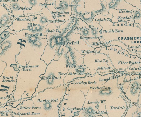 GAR2NY20.jpg "Bowfell" hill hachuring item:- JandMN : 82.1 Image © see bottom of page |
|||||||||||||||||||||||||
|
|
||||||||||||||||||||||||||
| evidence:- | outline view:- Martineau 1855 placename:- Bowfell |
|||||||||||||||||||||||||
| source data:- | Print, engraving, outline view, Mountains on the West Side of Windermere, drawn by
L Aspland, engraved by W Banks, Edinburgh, published by John Garnett, Windermere,
Westmorland, and by Whittaker and Co, London, 1855.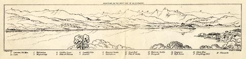 click to enlarge click to enlargeMNU102.jpg Plate folded in opposite p.7 in A Complete Guide to the English Lakes, by Harriet Martineau. "MOUNTAINS ON THE WEST SIDE OF WINDERMERE" "L Aspland Delt. / W Banks Sc Edinburgh." The view is captioned, numbers referring to mountains in the image:- "1 Coniston Old Man 1a Carrs 2 Wetherlam 3 Wrynose Gap 4 Crinkle Crags 5 Pike of Bliscow 6 Scawfell Pike 7 Bowfell 8 Hanging knotts 9 Glaramara 10 Great End 11 Pike of Stickle 12 Harrison Stickle 13 Paveyark 14 Lingmoor 15 High Raise 16 Silver How 17 Loughrigg Fell 18 Ullscarth" item:- Armitt Library : A1159.2 Image © see bottom of page |
|||||||||||||||||||||||||
|
|
||||||||||||||||||||||||||
| evidence:- | old text:- Martineau 1855 placename:- Bowfell item:- altitude, Bow Fell |
|||||||||||||||||||||||||
| source data:- | Guide book, A Complete Guide to the English Lakes, by Harriet
Martineau, published by John Garnett, Windermere, Westmorland,
and by Whittaker and Co, London, 1855; published 1855-76. goto source Page 179:- "A TABLE OF THE HEIGHTS OF MOUNTAINS IN THE COUNTIES OF CUMBERLAND, WESTMORLAND, AND LANCASHIRE." "No. : Names of Mountains. : Counties. : Height in Feet above the Sea Level." "7 : Bowfell : Westmorland : 2914" |
|||||||||||||||||||||||||
|
|
||||||||||||||||||||||||||
| evidence:- | old print:- Walton 1876 placename:- Bow Fell item:- sunset |
|||||||||||||||||||||||||
| source data:- | Print, colour lithograph, Bow Fell, from Windermere, Westmorland/Cumberland, from
a painting by Elijah Walton, published by W M Thompson, 20 Cockspur Street, Pall Mall,
and Burlington Gallery, Piccadilly, London, 1876.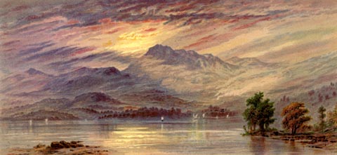 click to enlarge click to enlargeWLT321.jpg Plate 21 in English Lake Scenery, with a description by T G Bonney. item:- JandMN : 469.21 Image © see bottom of page |
|||||||||||||||||||||||||
|
|
||||||||||||||||||||||||||
| evidence:- | old photograph:- Bell 1880s-1940s |
|||||||||||||||||||||||||
| source data:- | Photograph, sepia, Crinkle Crags and Bow Fell in winter, Eskdale, Cumberland, by Herbert
Bell, Ambleside, Westmorland, 1890s.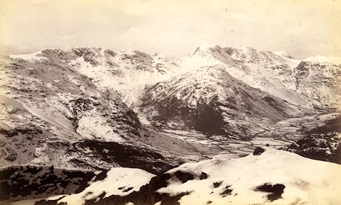 click to enlarge click to enlargeHB0399.jpg item:- Armitt Library : ALPS53 Image © see bottom of page |
|||||||||||||||||||||||||
|
|
||||||||||||||||||||||||||
| evidence:- | old text:- Gents Mag item:- sheep dog; hearing |
|||||||||||||||||||||||||
| source data:- | Magazine, The Gentleman's Magazine or Monthly Intelligencer or
Historical Chronicle, published by Edward Cave under the
pseudonym Sylvanus Urban, and by other publishers, London,
monthly from 1731 to 1922. goto source Gentleman's Magazine 1899 part 2 p.545 "[The Shepherd's Year] ..." "..." "There are many opinions as to whether sheep-dogs are ever at a loss to determine their position as well as that of the flock. My own idea is that they locate themselves perfectly by hearing - and it is acknowledged that their sense in this direction has a wider range than ours. Some of the more observant shepherds, too, use this power. They are aware of wide differences in the sound of wind and streams at different points of their beats, and of this we have a proof. We were wandering over Bowfell with an old shepherd. The mist hung in ragged edges half way down the Band; the ill-marked path ceased at the summit, and we blundered along towards Esk-hause. The old man allowed us to guide until we came to where sheer cliffs seemed to drop in every direction, and we in despair appealed to him." ""Listen," he said." "A curlew whistled far above, the wind lisped among the crags and screes around, the merry rattle of a distant rill rose from beneath. The old man, without a word, of explanation, took us round the hillock, and again we listened. The curlew was silent, the wind a trifle more boisterous, and the sound of rushing waters more clear." ""The sound heard on the far side of the hill was that of the outlet of Angle Tarn" (which, indeed, was almost sheer below), "whereas you now hear the infant Esk."" "..." |
|||||||||||||||||||||||||
|
|
||||||||||||||||||||||||||
| evidence:- | old print:- MacBride 1922 placename:- Bowfell |
|||||||||||||||||||||||||
| source data:- | Print, colour, Stake Pass and Bowfell, by Alfred Heaton Cooper, published by Adam
and Charles Black, 4-6 Soho Square, London, 2nd edn 1928.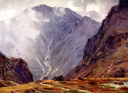 click to enlarge click to enlargeMB0109.jpg Tipped in opposite p.44 in Wild Lakeland by MacKenzie MacBride. printed at bottom:- "STAKE PASS AND BOWFELL" signed at lower right:- "A. HEATON COOPER" item:- JandMN : 195.11 Image © see bottom of page |
|||||||||||||||||||||||||
|
|
||||||||||||||||||||||||||
| evidence:- | outline view:- LMS 1920s |
|||||||||||||||||||||||||
| source data:- | Hills of Lakeland in Outline, published in the LMS Route Book No.3, The Track of the
Royal Scot, by the London, Midland and Scottish Railway, LMS, 1920s.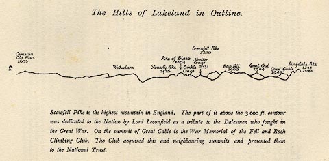 click to enlarge click to enlargeLS1E32.jpg item:- JandMN : 95.5 Image © see bottom of page |
|||||||||||||||||||||||||
|
|
||||||||||||||||||||||||||
| evidence:- | outline view:- Jenkinson 1875 placename:- Bow Fell |
|||||||||||||||||||||||||
| source data:- | Print, lithograph, outline view, Panoramic Sketches from Helvellyn, Westmorland, by
Edwin A Pettitt, London, published by Edward Stanford, 55 Charing Cross, London, 1875.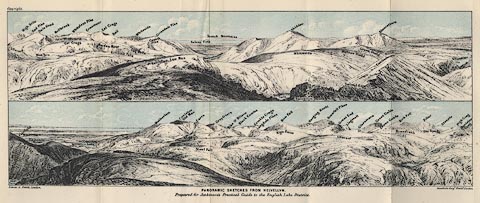 click to enlarge click to enlargeJk01E1.jpg "... Bow Fell ..." item:- JandMN : 28.5 Image © see bottom of page |
|||||||||||||||||||||||||
|
|
||||||||||||||||||||||||||
| evidence:- | outline view:- Jenkinson 1875 placename:- Bow Fell |
|||||||||||||||||||||||||
| source data:- | Print, lithograph, outline view, Panoramic Sketches from Skiddaw, Cumberland, by Edwin
A Pettitt, London, published by Edward Stanford, 55 Charing Cross, London, 1875.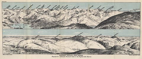 click to enlarge click to enlargeJk01E2.jpg "... Bow Fell ..." item:- JandMN : 28.8 Image © see bottom of page |
|||||||||||||||||||||||||
|
|
||||||||||||||||||||||||||
| evidence:- | outline view:- Jenkinson 1875 placename:- Bow Fell |
|||||||||||||||||||||||||
| source data:- | Print, lithograph, outline view, Panoramic Sketches from Scawfell Pike, Cumberland,
by Edwin A Pettitt, London, published by Edward Stanford, 55 Charing Cross, London,
1875.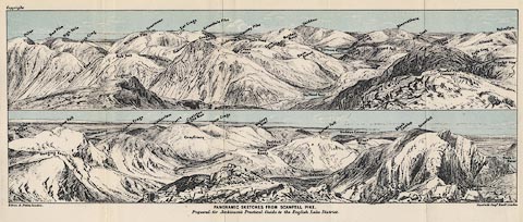 click to enlarge click to enlargeJk01E3.jpg "... Bow Fell ..." item:- JandMN : 28.9 Image © see bottom of page |
|||||||||||||||||||||||||
|
|
||||||||||||||||||||||||||
| evidence:- | old print:- Prior 1865 placename:- Bowfell |
|||||||||||||||||||||||||
| source data:- | Print, uncoloured engraving, Scafell and Bowfell from Hardknott, Cumberland, published
by John Garnett, Windermere, Westmorland, and by Simpkin, Marshall and Co, London,
1865.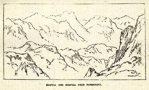 click to enlarge click to enlargePI0115.jpg Included on page 101 of the guide book, Ascents and Passes in the Lake District of England, by Herman Prior. printed at bottom:- "SCAFELL AND BOWFELL FROM HARDKNOTT." item:- JandMN : 235.17 Image © see bottom of page |
|||||||||||||||||||||||||
|
|
||||||||||||||||||||||||||
| evidence:- | outline view:- Black 1856 (23rd edn 1900) placename:- Bowfell |
|||||||||||||||||||||||||
| source data:- | Print, lithograph, Outline Views, Windermere - Mountains as seen from the North End
of Belle Isle, Windermere, and Mountains as seen from Biscay How, Bowness, by J Flintoft,
Keswick, Cumberland, engraved by R Mason, Edinburgh, Lothian, about 1900.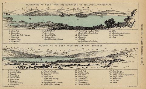 click to enlarge click to enlargeBC08E1.jpg "... 3 Bowfell ..." item:- JandMN : 37.4 Image © see bottom of page |
|||||||||||||||||||||||||
|
|
||||||||||||||||||||||||||
| evidence:- | outline view:- Garnett 1850s-60s A |
|||||||||||||||||||||||||
| source data:- | Print, uncoloured engraving, Head of Langdale, from the Blea
Tarn Road, published by John Garnett, Windermere, Westmorland,
and by Simpkin, Marshall and Co, London, 2nd edn 1860s?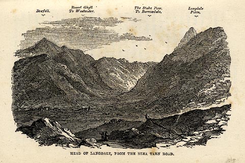 click to enlarge click to enlargeGAR6E2.jpg On p.39 of A Guide to the English Lake District, by a Cambridge Man. "Bowfell ..." item:- JandMN : 149.3 Image © see bottom of page |
|||||||||||||||||||||||||
|
|
||||||||||||||||||||||||||
| evidence:- | outline view:- Black 1841 (3rd edn 1846) placename:- Bowfell |
|||||||||||||||||||||||||
| source data:- | Print, engraving, outline view, Mountains as seen from the North End of Belle Isle,
Windermere, and Mountains as seen from Bisket How, Bowness, by J Flintoft, Keswick,
Cumberland, engraved by R Mason, Edinburgh, about 1844.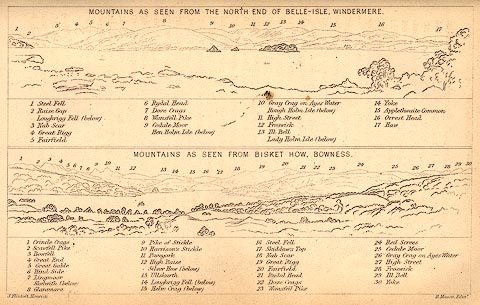 click to enlarge click to enlargeBC02E1.jpg "... 3 Bowfell ..." item:- JandMN : 32.3 Image © see bottom of page |
|||||||||||||||||||||||||
|
|
||||||||||||||||||||||||||
| evidence:- | outline view:- Tattersall 1836 (version 1869) placename:- Bowfell |
|||||||||||||||||||||||||
| source data:- | Print, hand coloured, Valley of the Stake, Mickleden etc, Westmorland, drawn by George
Tattersall, 1836, engraved by W F Topham, published by T J Allman, 463 Oxford Street,
London, 1869.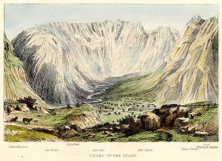 click to enlarge click to enlargeTAT204.jpg Included in The Lakes of England, by W F Topham. printed at bottom:- "VALLEY OF THE STAKE." printed at bottom:- "Pike o'Bliscoe. / The Band. / Style End. / Bowfell. / The Stake. Pike o'Stickle. / Pt. of Harrison Stickle." item:- Armitt Library : A1067.4 Image © see bottom of page |
|||||||||||||||||||||||||
|
|
||||||||||||||||||||||||||
| evidence:- | outline view:- Tattersall 1836 placename:- Bowfell |
|||||||||||||||||||||||||
| source data:- | Print, engraving, Little Langdale, Westmorland, drawn by George Tattersall, engraved
by W F Topham, published by Sherwood and Co, Paternoster Row, London, about 1836.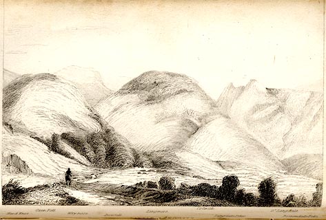 click to enlarge click to enlargeTAT107.jpg The print is captioned with mountain names and acts as an outline view. Tipped in opposite p.39 of The Lakes of England, by George Tattersall. printed at bottom:- "LITTLE LANGDALE." printed at bottom left to right:- "Hard Knot. / Oxen Fell. / Wrynose. / Bowfell. / Lingmire. / Colwith. / Langdale Pikes. / Gt. Langdale. / Borrowdale Fells." item:- Armitt Library : A1204.8 Image © see bottom of page |
|||||||||||||||||||||||||
|
|
||||||||||||||||||||||||||
 BNL40.jpg (taken 26.3.2007) 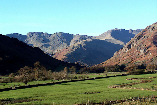 BJZ97.jpg Bow Fell and Crinkle Crags from Langdale. (taken 17.11.2005) 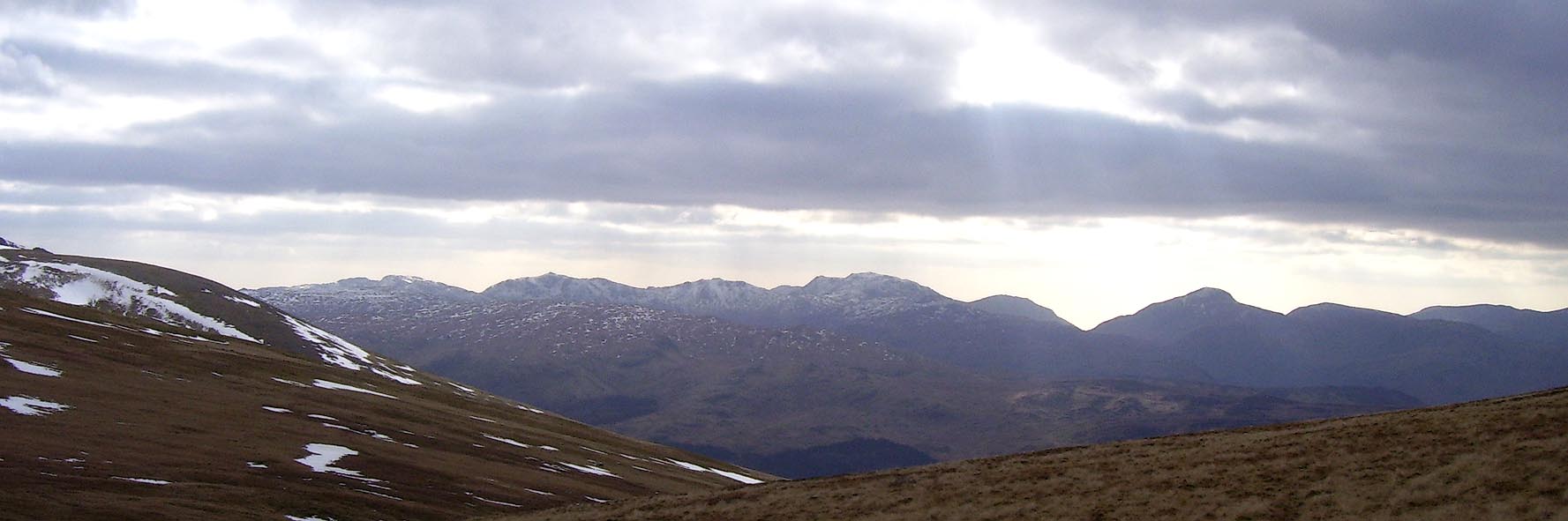 Click to enlarge BOV28.jpg Outline view from Stybarrow Dodd; Bowfell, Esk Pike, Scafell, Lingmell, Great Gable. (taken 17.3.2008) 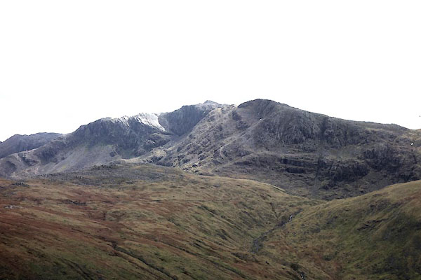 CDB10.jpg From Coombe Door. (taken 13.5.2015) |
||||||||||||||||||||||||||
|
|
||||||||||||||||||||||||||
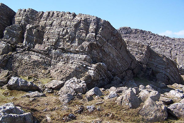 BQL47.jpg Rocks. (taken 20.4.2009) 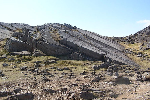 BQL48.jpg Rocks. (taken 20.4.2009) 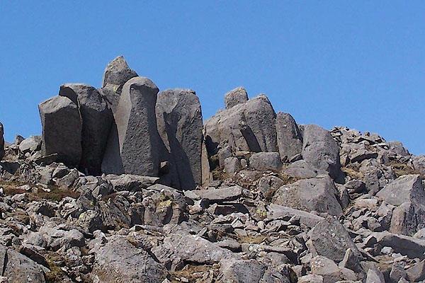 BQL50.jpg Rocks at the summit. (taken 20.4.2009) 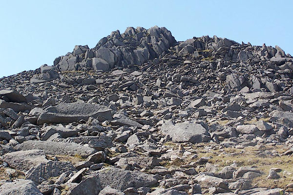 BQL51.jpg Rocks at the summit. (taken 20.4.2009) 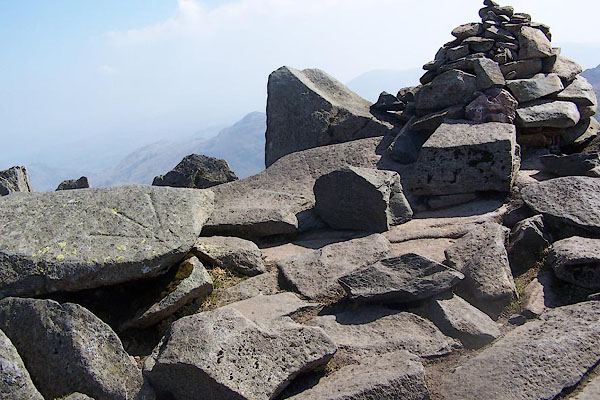 BQL52.jpg Cairn, and a bench mark (taken 20.4.2009) 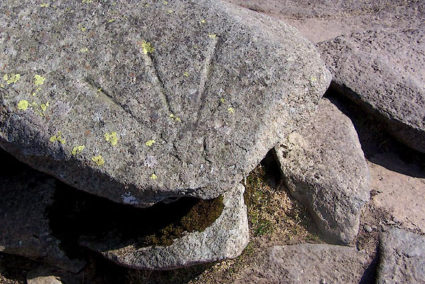 BQL53.jpg Bench mark, 2959.7 feet on the OS County Series 25inch map. (taken 20.4.2009) |
||||||||||||||||||||||||||
|
|
||||||||||||||||||||||||||
| see:- | Great Slab, Eskdale Bowfell Links, Eskdale Bowfell Buttress, Eskdale |
|||||||||||||||||||||||||
|
|
||||||||||||||||||||||||||
Lakes Guides menu.