 Old Cumbria Gazetteer
 |
 |
|
| Braithwaite Hall, Skelton | ||
| Braithwaite Hall | ||
| locality:- | High Braithwaite | |
| civil parish:- | Skelton (formerly Cumberland) | |
| county:- | Cumbria | |
| locality type:- | buildings | |
| coordinates:- | NY41134116 | |
| 1Km square:- | NY4141 | |
| 10Km square:- | NY44 | |
|
|
||
| evidence:- | probably old map:- Speed 1611 (Cmd) placename:- Brathwate |
|
| source data:- | Map, hand coloured engraving, Cumberland and the Ancient Citie
Carlile Described, scale about 4 miles to 1 inch, by John Speed,
1610, published by J Sudbury and George Humble, Popes Head
Alley, London, 1611-12.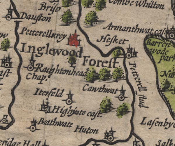 SP11NY44.jpg "Brathwate" circle, tower item:- private collection : 16 Image © see bottom of page |
|
|
|
||
| evidence:- | probably old map:- Bowen and Kitchin 1760 placename:- Brathwate |
|
| source data:- | Map, hand coloured engraving, A New Map of the Counties of
Cumberland and Westmoreland Divided into their Respective Wards,
scale about 4 miles to 1 inch, by Emanuel Bowen and Thomas
Kitchin et al, published by T Bowles, Robert Sayer, and John
Bowles, London, 1760.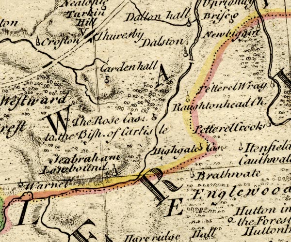 BO18NY34.jpg "Brathwate" circle, tower item:- Armitt Library : 2008.14.10 Image © see bottom of page |
|
|
|
||
| evidence:- | probably old map:- Ford 1839 map placename:- Braithwaite |
|
| source data:- | Map, uncoloured engraving, Map of the Lake District of
Cumberland, Westmoreland and Lancashire, scale about 3.5 miles
to 1 inch, published by Charles Thurnam, Carlisle, and by R
Groombridge, 5 Paternoster Row, London, 3rd edn 1843.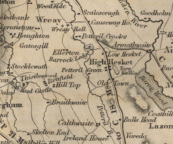 FD02NY44.jpg "Braithwaite" item:- JandMN : 100.1 Image © see bottom of page |
|
|
|
||
| evidence:- | perhaps old map:- Garnett 1850s-60s H placename:- Braithwaite |
|
| source data:- | Map of the English Lakes, in Cumberland, Westmorland and
Lancashire, scale about 3.5 miles to 1 inch, published by John
Garnett, Windermere, Westmorland, 1850s-60s.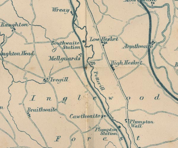 GAR2NY44.jpg "Braithwaite" item:- JandMN : 82.1 Image © see bottom of page |
|
|
|
||
 Lakes Guides menu.