 Old Cumbria Gazetteer
 |
 |
|
| Bridge End Farm, St John's Castlerigg etc | ||
| Bridge End Farm | ||
| locality:- | Bridge End | |
| locality:- | Legburthwaite | |
| civil parish:- | St John's Castlerigg and Wythburn (formerly Cumberland) | |
| county:- | Cumbria | |
| locality type:- | buildings | |
| coordinates:- | NY31431940 | |
| 1Km square:- | NY3119 | |
| 10Km square:- | NY31 | |
|
|
||
| evidence:- | old map:- OS County Series (Cmd 64 16) placename:- High Bridgend placename:- Bridgend, High |
|
| source data:- | Maps, County Series maps of Great Britain, scales 6 and 25
inches to 1 mile, published by the Ordnance Survey, Southampton,
Hampshire, from about 1863 to 1948. |
|
|
|
||
| evidence:- | old map:- Donald 1774 (Cmd) placename:- Bridge End |
|
| source data:- | Map, hand coloured engraving, 3x2 sheets, The County of Cumberland, scale about 1
inch to 1 mile, by Thomas Donald, engraved and published by Joseph Hodskinson, 29
Arundel Street, Strand, London, 1774.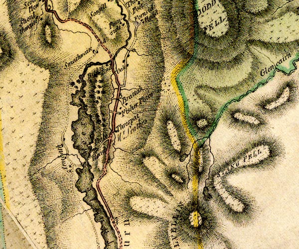 D4NY31NW.jpg "Bridge End" block or blocks, labelled in lowercase; a hamlet or just a house item:- Carlisle Library : Map 2 Image © Carlisle Library |
|
|
|
||
| hearsay:- |
To the rear? the east, there is/was a gallery across the width of the building, access
by a door on the hill slope beside. Balusters and rails gone, roof in poor condition
(1984). Still a useful place to hang the washing in wet weather. |
|
|
|
||
 Lakes Guides menu.