 Old Cumbria Gazetteer
 |
 |
|
|
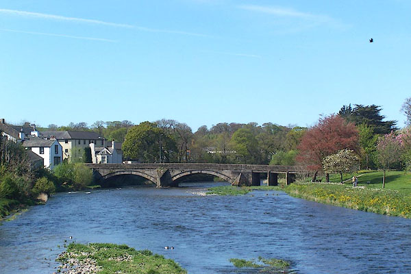
| Derwent Bridge, Cockermouth | |||
| Derwent Bridge | |||
| site name:- | Derwent, River | ||
| Street:- | Bridge Street | ||
| locality:- | Cockermouth | ||
| civil parish:- | Cockermouth (formerly Cumberland) | ||
| county:- | Cumbria | ||
| locality type:- | bridge | ||
| coordinates:- | NY11643071 | ||
| 1Km square:- | NY1130 | ||
| 10Km square:- | NY13 | ||
|
|
|||
 BNP57.jpg (taken 26.4.2007) |
|||
|
|
|||
| evidence:- | old map:- OS County Series (Cmd 54 4) placename:- Derwent Bridge |
||
| source data:- | Maps, County Series maps of Great Britain, scales 6 and 25
inches to 1 mile, published by the Ordnance Survey, Southampton,
Hampshire, from about 1863 to 1948. |
||
|
|
|||
| evidence:- | probably old map:- Saxton 1579 |
||
| source data:- | Map, hand coloured engraving, Westmorlandiae et Cumberlandiae Comitatus ie Westmorland
and Cumberland, scale about 5 miles to 1 inch, by Christopher Saxton, London, engraved
by Augustinus Ryther, 1576, published 1579-1645.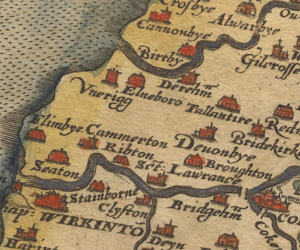 Sax9NY03.jpg W of Cockermouth. item:- private collection : 2 Image © see bottom of page |
||
|
|
|||
| evidence:- | old map:- Mercator 1595 (edn?) placename:- |
||
| source data:- | Map, hand coloured engraving, Northumbria, Cumberlandia, et
Dunelmensis Episcopatus, ie Northumberland, Cumberland and
Durham etc, scale about 6.5 miles to 1 inch, by Gerard Mercator,
Duisberg, Germany, about 1595.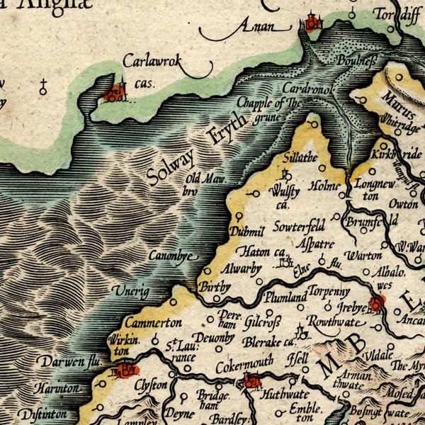 MER8CumB.jpg "" double across a stream; bridge, over the Derwent at Cockermouth item:- JandMN : 169 Image © see bottom of page |
||
|
|
|||
| evidence:- | old map:- Ogilby 1675 (plate 96) |
||
| source data:- | Road strip map, hand coloured engraving, the Road from Kendal to
Cockermouth, and the Road from Egremond to Carlisle, scale about
1 inch to 1 mile, by John Ogilby, London, 1675.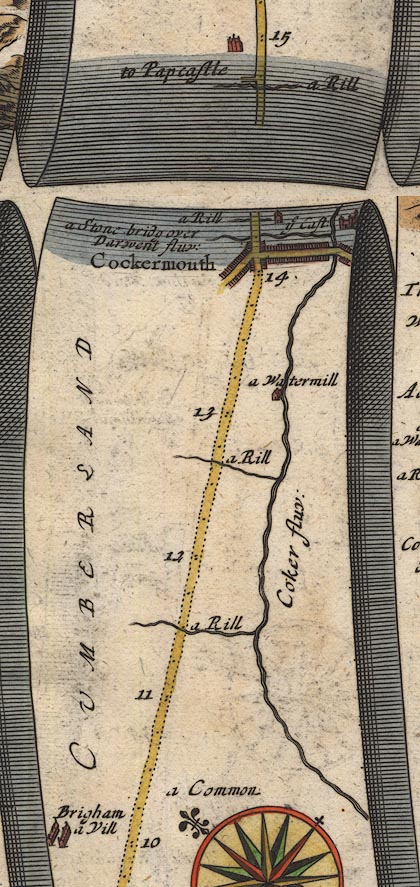 OG96Bm10.jpg In mile 14, Cumberland. Road crosses:- "a Stone bridg over Darwent fluv:" and meets the River Cocker, no bridge drawn. item:- JandMN : 22 Image © see bottom of page |
||
|
|
|||
| evidence:- | old map:- Bowen and Kitchin 1760 |
||
| source data:- | Map, hand coloured engraving, A New Map of the Counties of
Cumberland and Westmoreland Divided into their Respective Wards,
scale about 4 miles to 1 inch, by Emanuel Bowen and Thomas
Kitchin et al, published by T Bowles, Robert Sayer, and John
Bowles, London, 1760.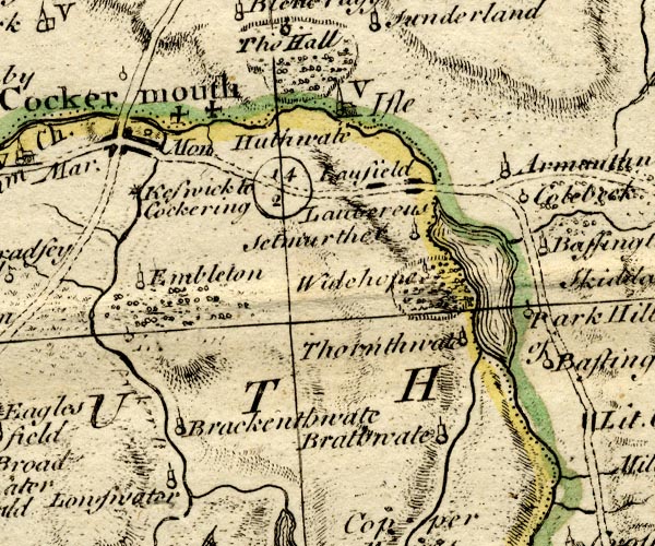 BO18NY12.jpg road across the Derwent item:- Armitt Library : 2008.14.10 Image © see bottom of page |
||
|
|
|||
| evidence:- | old map:- Donald 1774 (Cmd) placename:- Derwent Bridge |
||
| source data:- | Map, hand coloured engraving, 3x2 sheets, The County of Cumberland, scale about 1
inch to 1 mile, by Thomas Donald, engraved and published by Joseph Hodskinson, 29
Arundel Street, Strand, London, 1774.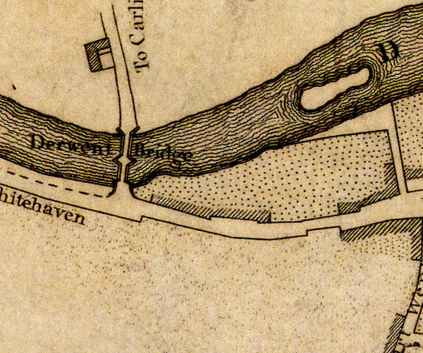 D41130T.jpg "Derwent Bridge" bridge over the Dwerent, two arches, cutwaters etc item:- Carlisle Library : Map 2 Image © Carlisle Library |
||
|
|
|||
| evidence:- | old map:- Donald 1774 (Cmd) |
||
| source data:- | Map, hand coloured engraving, 3x2 sheets, The County of Cumberland, scale about 1
inch to 1 mile, by Thomas Donald, engraved and published by Joseph Hodskinson, 29
Arundel Street, Strand, London, 1774.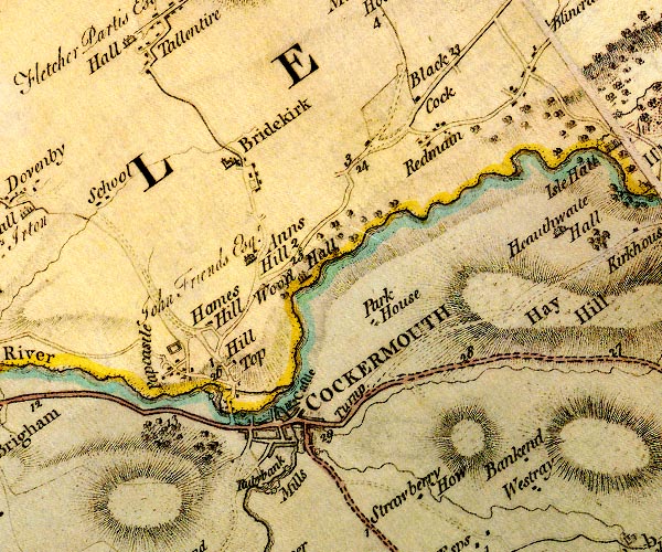 D4NY13SW.jpg double line across a river; a bridge over the Derwent item:- Carlisle Library : Map 2 Image © Carlisle Library |
||
|
|
|||
| evidence:- | old map:- Otley 1818 |
||
| source data:- | Map, uncoloured engraving, The District of the Lakes,
Cumberland, Westmorland, and Lancashire, scale about 4 miles to
1 inch, by Jonathan Otley, 1818, engraved by J and G Menzies,
Edinburgh, Scotland, published by Jonathan Otley, Keswick,
Cumberland, et al, 1833. OT02NY13.jpg Implied by a road across the stream. item:- JandMN : 48.1 Image © see bottom of page |
||
|
|
|||
| evidence:- | descriptive text:- Ford 1839 (3rd edn 1843) |
||
| source data:- | Guide book, A Description of Scenery in the Lake District, by
Rev William Ford, published by Charles Thurnam, Carlisle, by W
Edwards, 12 Ave Maria Lane, Charles Tilt, Fleet Street, William
Smith, 113 Fleet Street, London, by Currie and Bowman,
Newcastle, by Bancks and Co, Manchester, by Oliver and Boyd,
Edinburgh, and by Sinclair, Dumfries, 1839. goto source goto sourcePage 81:- "..." "... The bridge over the Derwent consists of two arches, and is two hundred and seventy feet in length; ..." |
||
|
|
|||
| evidence:- | old map:- Bell 1892 placename:- Derwent Bridge |
||
| source data:- | Map, colour lithograph, Road Map of Cumberland, by George Joseph
Bell, scale about 2.5 miles to 1 inch, printed by Charles
Thurnam and Sons, Carlisle, Cumberland, 1892.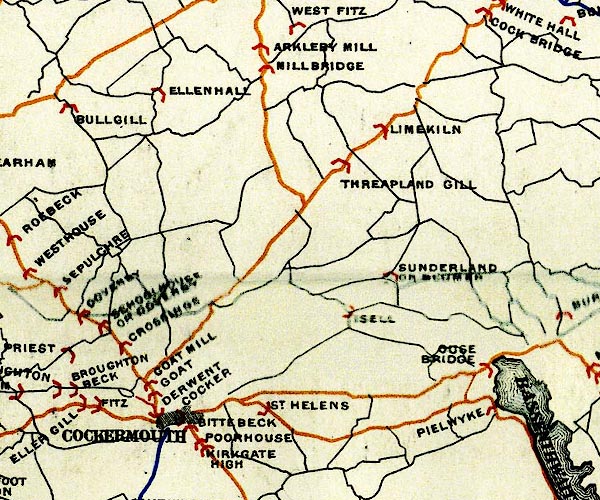 BEL9NY13.jpg "DERWENT" bridge symbol Road map of Cumberland showing County Bridges item:- Carlisle Library : Map 38 Image © Carlisle Library |
||
|
|
|||
| evidence:- | database:- Listed Buildings 2010 placename:- Derwent Bridge |
||
| source data:- | courtesy of English Heritage "DERWENT BRIDGE / / / COCKERMOUTH / ALLERDALE / CUMBRIA / II / 71648 / NY1164830712" |
||
| source data:- | courtesy of English Heritage "1822. Two segmental spans in tooled masonry, with plain string, over-sailing courses and parapets. Cutwaters are triangular on plan. Carries 2 footpaths and 2 lines of traffic over River Derwent. A simple structure of value to the landscape. Derwent Bridge forms a group with Nos 5 to 19 (odd). Nos 23 to 27 (odd) and Derwent Bridge House, Cote Road." |
||
|
|
|||
| evidence:- | old print:- Robertson 1911 |
||
| source data:- | Print, lithograph? The Derwent, seen from John Wordsworth's Terrace, Cockermouth,
from a watercolour by Arthur Tucker, published by Chatto and Windus, London, 1911.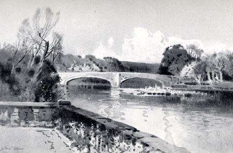 click to enlarge click to enlargeRSN109.jpg Tipped in opposite p.28 of Wordsworthshire by Eric Robertson. Derwent Bridge in the middle ground. printed at bottom:- "THE DERWENT, SEEN FROM JOHN WORDSWORTH'S TERRACE, COCKERMOUTH" signed at painting lower left:- "Arthur Tucker" item:- JandMN : 197.9 Image © see bottom of page |
||
|
|
|||
| mapping:- | Cockermouth: Crown Street Cockermouth: Crown Street Cockermouth: Gote Road Cockermouth: Gote Road |
||
|
|
|||
Lakes Guides menu.