 Old Cumbria Gazetteer
 |
 |
|
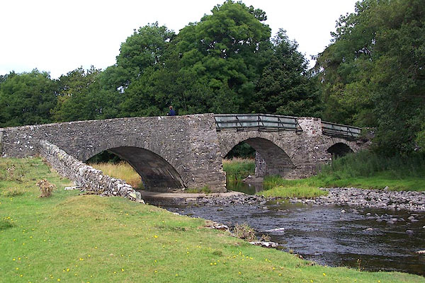
| Rosgill Bridge, Rosgill | ||
| Rosgill Bridge | ||
| site name:- | Lowther, River | |
| locality:- | Rosgill | |
| civil parish:- | Shap Rural (formerly Westmorland) | |
| county:- | Cumbria | |
| locality type:- | bridge | |
| coordinates:- | NY53421652 | |
| 1Km square:- | NY5316 | |
| 10Km square:- | NY51 | |
|
|
||
 BJT57.jpg (taken 22.8.2005) |
||
|
|
||
| evidence:- | old map:- OS County Series (Wmd 14 9) placename:- Rosgill Bridge |
|
| source data:- | Maps, County Series maps of Great Britain, scales 6 and 25
inches to 1 mile, published by the Ordnance Survey, Southampton,
Hampshire, from about 1863 to 1948. |
|
|
|
||
| evidence:- | old map:- Jefferys 1770 (Wmd) |
|
| source data:- | Map, 4 sheets, The County of Westmoreland, scale 1 inch to 1
mile, surveyed 1768, and engraved and published by Thomas
Jefferys, London, 1770.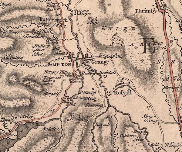 J5NY51NW.jpg double line, road, across a stream; bridge item:- National Library of Scotland : EME.s.47 Image © National Library of Scotland |
|
|
|
||
| evidence:- | old map:- Cary 1789 (edn 1805) |
|
| source data:- | Map, uncoloured engraving, Westmoreland, scale about 2.5 miles
to 1 inch, by John Cary, London, 1789; edition 1805.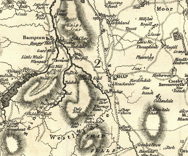 CY24NY51.jpg road across a stream; bridge over the Lowther item:- JandMN : 129 Image © see bottom of page |
|
|
|
||
| evidence:- | database:- Listed Buildings 2010 |
|
| source data:- | courtesy of English Heritage "BRIDGE OVER RIVER LOWTHER / / / SHAP RURAL / EDEN / CUMBRIA / II / 74193 / NY5341616506" |
|
| source data:- | courtesy of English Heritage "Roadbridge. Late C17 replacement of wooden bridge. Possibly widened and parapets raised following 1887 report on bridge's condition. Coursed, squared rubble; wooden fencing replaces parapet over central and eastern arches. 3 segmental arches, each spanning c.35 ft, separated by cutwaters with polygonal refuges. Roadway c.10 ft wide; splayed stone parapets, to either end and over western arch, c.3 ft high." |
|
|
|
||
 Lakes Guides menu.