 Old Cumbria Gazetteer
 |
 |
|
| bridge, Sleagill | ||
| site name:- | Sleagill Beck | |
| locality:- | Sleagill | |
| civil parish:- | Sleagill (formerly Westmorland) | |
| county:- | Cumbria | |
| locality type:- | bridge | |
| coordinates:- | NY59731920 | |
| 1Km square:- | NY5919 | |
| 10Km square:- | NY51 | |
|
|
||
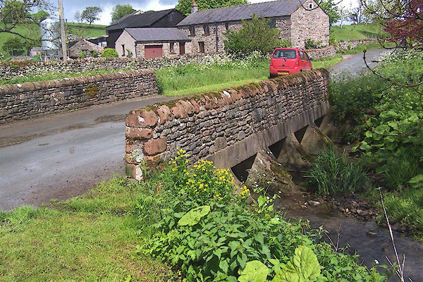 BMD15.jpg (taken 29.5.2006) |
||
|
|
||
| evidence:- | perhaps old map:- Bowen and Kitchin 1760 |
|
| source data:- | Map, hand coloured engraving, A New Map of the Counties of
Cumberland and Westmoreland Divided into their Respective Wards,
scale about 4 miles to 1 inch, by Emanuel Bowen and Thomas
Kitchin et al, published by T Bowles, Robert Sayer, and John
Bowles, London, 1760.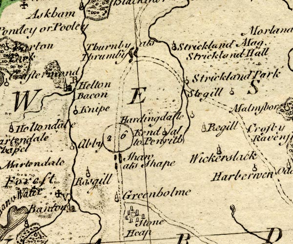 BO18NY41.jpg road across stream; the road is questionable. item:- Armitt Library : 2008.14.10 Image © see bottom of page |
|
|
|
||
 Lakes Guides menu.