 Old Cumbria Gazetteer
 |
 |
|
| Burgh Marsh, Burgh by Sands | ||
| Burgh Marsh | ||
| civil parish:- | Burgh by Sands (formerly Cumberland) | |
| county:- | Cumbria | |
| locality type:- | marsh | |
| coordinates:- | NY30635959 (etc etc) | |
| 1Km square:- | NY3059 | |
| 10Km square:- | NY36 | |
|
|
||
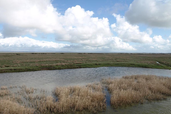 BUH58.jpg (taken 3.4.2011) |
||
|
|
||
| evidence:- | old map:- OS County Series (Cmd 15 11) placename:- Burgh Marsh |
|
| source data:- | Maps, County Series maps of Great Britain, scales 6 and 25
inches to 1 mile, published by the Ordnance Survey, Southampton,
Hampshire, from about 1863 to 1948. OS County Series (Cmd 15 12) |
|
|
|
||
| evidence:- | old text:- Gents Mag item:- base line; surveying; triangulation |
|
| source data:- | Magazine, The Gentleman's Magazine or Monthly Intelligencer or
Historical Chronicle, published by Edward Cave under the
pseudonym Sylvanus Urban, and by other publishers, London,
monthly from 1731 to 1922. goto source goto sourceGentleman's Magazine 1748 p.3 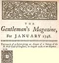 click to enlarge click to enlargeG748E03.jpg "EXTRACT of a Letter giving an Account of a Survey of the N.West Coast of England, in August 1746, at our Expence." "..." "I began, at the monument on Burgh Marsh, to measure off the Solway bay; and as the ground was very low, I took several bases of triangles, to measure the opposite shore, and fix its" |
|
|
|
||
| evidence:- | old text:- Gents Mag 1746 |
|
| source data:- | goto source Gentleman's Magazine 1748 p.4 "principal points. For general heights to keep constantly in my eye, I fixed on three remarkable mountains, as judging they might be seen thro' the greatest part of the extent of my survey; these were Skiddow in Cumberland, Criffield, and Burnswark in Scotland, which appeared, as in the draughts. The distances were determined thus:" "I measured a base line on Burgh Marsh, after correcting the magnetical meridian; this was directed to a tree on an eminence near Drumbugh, as judging it the longest course in a plain. I carefully examined every angle from each of these stations, and fix'd the several places as specified in my draught. ..." |
|
|
|
||
| evidence:- | old map:- Donald 1774 (Cmd) placename:- Burgh Marsh |
|
| source data:- | Map, hand coloured engraving, 3x2 sheets, The County of Cumberland, scale about 1
inch to 1 mile, by Thomas Donald, engraved and published by Joseph Hodskinson, 29
Arundel Street, Strand, London, 1774.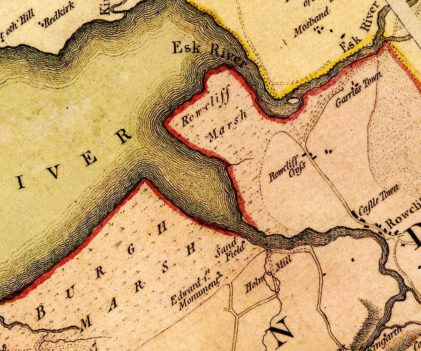 D4NY36SW.jpg "BURGH MARSH" area of marsh item:- Carlisle Library : Map 2 Image © Carlisle Library |
|
|
|
||
| evidence:- | old map:- Ford 1839 map placename:- Burgh Marsh |
|
| source data:- | Map, uncoloured engraving, Map of the Lake District of
Cumberland, Westmoreland and Lancashire, scale about 3.5 miles
to 1 inch, published by Charles Thurnam, Carlisle, and by R
Groombridge, 5 Paternoster Row, London, 3rd edn 1843.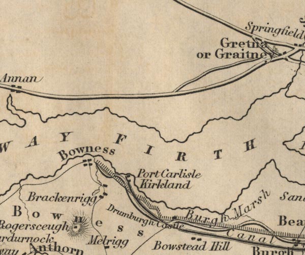 FD02NY26.jpg "Burgh Marsh" Area. item:- JandMN : 100.1 Image © see bottom of page |
|
|
|
||
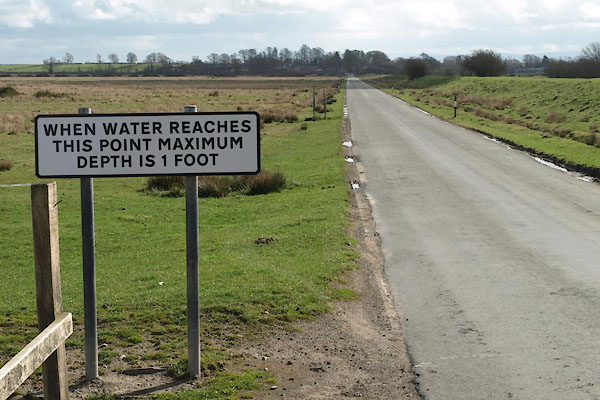 BUH59.jpg (taken 3.4.2011) |
||
| Along the road there are signs telling the driver what to expect when the tide is
on the flow. Mind where you park! |
||
|
|
||
Lakes Guides menu.