 Old Cumbria Gazetteer
 |
 |
|
| Cartmel Sands, Morecambe Bay | ||
| Cartmel Sands | ||
| locality:- | Morecambe Bay | |
| civil parish:- | Lower Allithwaite (formerly Lancashire) | |
| civil parish:- | Lower Holker (formerly Lancashire) | |
| county:- | Cumbria | |
| locality type:- | sands | |
| coordinates:- | SD33237651 (etc) | |
| 1Km square:- | SD3376 | |
| 10Km square:- | SD37 | |
|
|
||
| evidence:- | old map:- OS County Series (Lan 12 9) placename:- Cartmel Sands |
|
| source data:- | Maps, County Series maps of Great Britain, scales 6 and 25
inches to 1 mile, published by the Ordnance Survey, Southampton,
Hampshire, from about 1863 to 1948. OS County Series (Lan 12 13) OS County Series (Lan 17 5) |
|
|
|
||
| evidence:- | old map:- Saxton 1579 |
|
| source data:- | Map, hand coloured engraving, Westmorlandiae et Cumberlandiae Comitatus ie Westmorland
and Cumberland, scale about 5 miles to 1 inch, by Christopher Saxton, London, engraved
by Augustinus Ryther, 1576, published 1579-1645.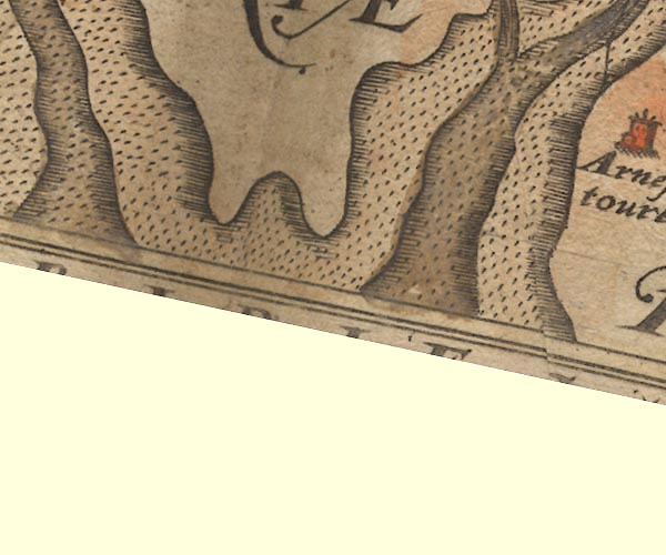 Sax9SD37.jpg item:- private collection : 2 Image © see bottom of page |
|
|
|
||
| evidence:- | old map:- Mercator 1595 (edn?) |
|
| source data:- | Map, hand coloured engraving, Westmorlandia, Lancastria, Cestria
etc, ie Westmorland, Lancashire, Cheshire etc, scale about 10.5
miles to 1 inch, by Gerard Mercator, Duisberg, Germany, 1595,
edition 1613-16.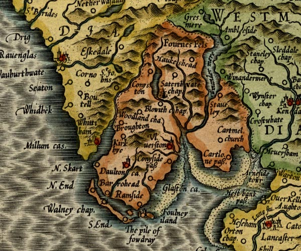 MER5LanA.jpg "" foreshore sands item:- Armitt Library : 2008.14.3 Image © see bottom of page |
|
|
|
||
| evidence:- | poem:- Drayton 1612/1622 text placename:- Ken Sands item:- placename, Kent Sands |
|
| source data:- | Poem, Poly Olbion, by Michael Drayton, published by published by
John Marriott, John Grismand and Thomas Dewe, and others?
London, part 1 1612, part 2 1622. goto source goto sourcepage 137:- "... Upon the East from these [Duddon and Leven], cleere Ken her beautie showes, ... Her name upon those Sands doth liberally bequeath, Whereas the Muse awhile may sit her downe to breath, ..." |
|
|
|
||
| evidence:- | old map:- Jansson 1646 placename:- Ken Sandes |
|
| source data:- | Map, hand coloured engraving, Cumbria and Westmoria, ie
Cumberland and Westmorland, scale about 3.5 miles to 1 inch, by
John Jansson, Amsterdam, Netherlands, 1646. JAN3SD37.jpg "Ken Sandes" Foreshore drawn with moire effect. item:- JandMN : 88 Image © see bottom of page |
|
|
|
||
| evidence:- | old map:- Sanson 1679 placename:- Ken Sandes |
|
| source data:- | Map, hand coloured engraving, Ancien Royaume de Northumberland
aujourdhuy Provinces de Nort, ie the Ancient Kingdom of
Northumberland or the Northern Provinces, scale about 9.5 miles
to 1 inch, by Nicholas Sanson, Paris, France, 1679. click to enlarge click to enlargeSAN2Cm.jpg "Ken Sandes" foreshore sands item:- Dove Cottage : 2007.38.15 Image © see bottom of page |
|
|
|
||
| evidence:- | old map:- Morden 1695 (Wmd) |
|
| source data:- | Map, hand coloured engraving, Westmorland, scale about 2.5 miles to 1 inch, by Robert
Morden, published by Abel Swale, the Unicorn, St Paul's Churchyard, Awnsham, and John
Churchill, the Black Swan, Paternoster Row, London, 1695.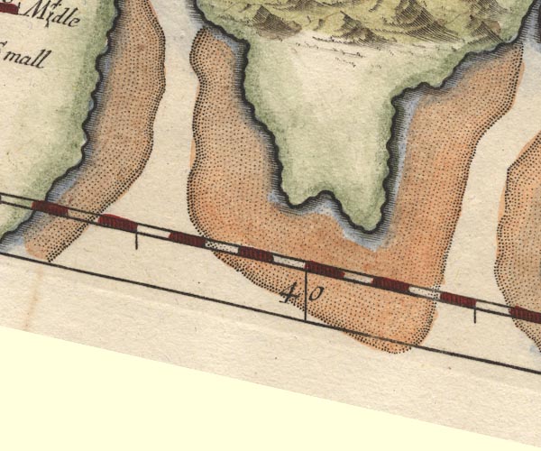 MD10SD37.jpg item:- JandMN : 24 Image © see bottom of page |
|
|
|
||
| evidence:- | old map:- Laurie and Whittle 1806 placename:- Leven Sands |
|
| source data:- | Road map, Completion of the Roads to the Lakes, scale about 10
miles to 1 inch, by Nathaniel Coltman? 1806, published by Robert
H Laurie, 53 Fleet Street, London, 1834. click to enlarge click to enlargeLw18.jpg "Leven Sands" sands in estuary item:- private collection : 18.18 Image © see bottom of page |
|
|
|
||
| evidence:- | perhaps descriptive text:- Ford 1839 (3rd edn 1843) placename:- Cartmel Bay |
|
| source data:- | Guide book, A Description of Scenery in the Lake District, by
Rev William Ford, published by Charles Thurnam, Carlisle, by W
Edwards, 12 Ave Maria Lane, Charles Tilt, Fleet Street, William
Smith, 113 Fleet Street, London, by Currie and Bowman,
Newcastle, by Bancks and Co, Manchester, by Oliver and Boyd,
Edinburgh, and by Sinclair, Dumfries, 1839. goto source Page 5:- "[Dalton] ... Is situated in a valley which stretches about four miles from it, in one large, sweeping and narrow curve, till it opens on a noble view of Cartmel bay. ..." |
|
|
|
||
Lakes Guides menu.