 Old Cumbria Gazetteer
 |
 |
|
| Catstye Cam, Patterdale | ||
| Catstye Cam | ||
| civil parish:- | Patterdale (formerly Westmorland) | |
| county:- | Cumbria | |
| locality type:- | hill | |
| coordinates:- | NY34811582 | |
| 1Km square:- | NY3415 | |
| 10Km square:- | NY31 | |
| altitude:- | 2920 feet | |
| altitude:- | 890m | |
|
|
||
 BUV10.jpg (taken 20.6.2011) 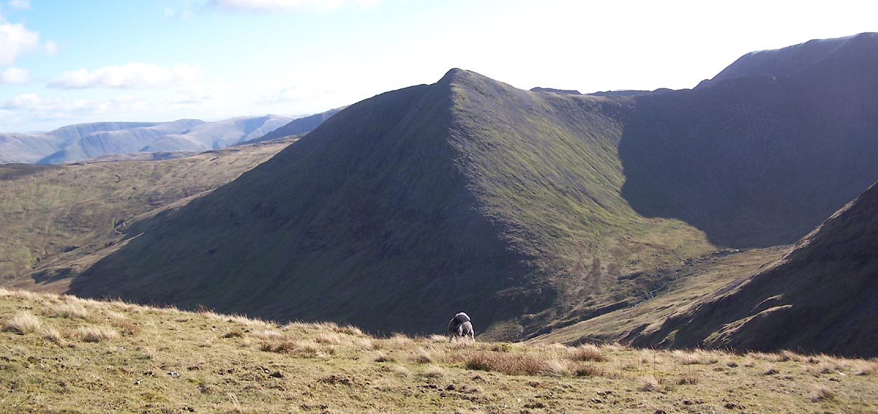 Click to enlarge BVN93.jpg (taken 19.10.2011) |
||
|
|
||
| evidence:- | old map:- OS County Series (Wmd 12 9) placename:- Catstye Cam |
|
| source data:- | Maps, County Series maps of Great Britain, scales 6 and 25
inches to 1 mile, published by the Ordnance Survey, Southampton,
Hampshire, from about 1863 to 1948. |
|
|
|
||
| evidence:- | descriptive text:- Simpson 1746 placename:- Casticand |
|
| source data:- | Atlas, three volumes of maps and descriptive text published as
'The Agreeable Historian, or the Compleat English Traveller
...', by Samuel Simpson, 1746. goto source goto source"..." "Some of the Mountains in Cumberland are very remarkable for their Height, viz. ... The third is Lauvellin, the fourth Castinand, of which, and the former, they have a proverbial Speech among them:" "Skiddaw, Lauvellin, and Castinand," "Are th' highest Hills in all England." |
|
|
|
||
| evidence:- | descriptive text:- West 1778 (11th edn 1821) placename:- Cachidecam placename:- Casticand item:- snow; weather |
|
| source data:- | Guide book, A Guide to the Lakes, by Thomas West, published by
William Pennington, Kendal, Cumbria once Westmorland, and in
London, 1778 to 1821. goto source Page 84:- "... Helvellyn and Cachidecam are ... according to Wythburn shepherds, much higher than Skiddaw. It is, however, certain that these mountains retain snow many weeks after Skiddaw; ..." goto sourceAddendum; Mr Gray's Journal, 1769 Page 208:- "... [from Castlerigg] ... the summits of Cachidecam (called by Camden Casticand) and Helvellyn, said to be as high as Skiddaw, and to rise from a much higher base." |
|
|
|
||
| evidence:- | old text:- Clarke 1787 placename:- Casticand placename:- Castycam |
|
| source data:- | Guide book, A Survey of the Lakes of Cumberland, Westmorland,
and Lancashire, written and published by James Clarke, Penrith,
Cumberland, and in London etc, 1787; published 1787-93. goto source Page 116:- "... the highest of our northern Alps, Helvellyn." "Cambden speaking of Helvellyn calls it Lauvellin, and says that the country people had a proverb concerning it." ""Skiddow, Lauvellin, and Casticand, Are the highest hills in all England."" ""But the bye-word (as he calls it,) that he was taught when a child, and which continues the same still, is," ""Kidstowpike, Castycam, Helveyllin and Skiddow-man, Are the highest hills ever clumb by Englishmen."" |
|
|
|
||
| evidence:- | old print:- Clarke 1787 placename:- Catsty |
|
| source data:- | circle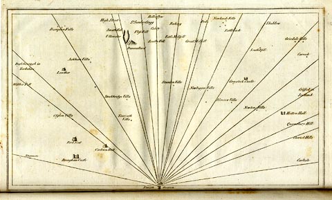 click to enlarge click to enlargeCL18.jpg "Catsty" item:- Armitt Library : A6615.12 Image © see bottom of page |
|
|
|
||
| evidence:- | old text:- Camden 1789 placename:- Casticand item:- proverb |
|
| source data:- | Book, Britannia, or A Chorographical Description of the Flourishing Kingdoms of England,
Scotland, and Ireland, by William Camden, 1586, translated from the 1607 Latin edition
by Richard Gough, published London, 1789. goto source Page 170:- "..." "And that other of the height of these [Skiddaw] and two other mountains in these parts," "Skiddaw, Lawellin, and Casticand Are the highest hills in all England." |
|
|
|
||
| evidence:- | outline view:- Otley 1823 (4th edn 1830) placename:- Catchety Cam |
|
| source data:- | Print, engraving, outline view, The Mountains of Ullswater as seen from Pooley Bridge,
published by Jonathan Otley, Keswick, Cumberland et al, 1830.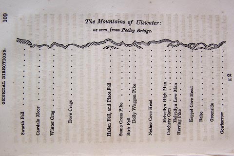 click to enlarge click to enlargeO75E05.jpg p.109 in A Concise Description of the English Lakes, by Jonathan Otley, 4th edition, 1830. "The Mountains of Ulswater: / as seen from Pooley Bridge." "Swarth Fell / Cawdale Moor / Winter Crag / Dove Crags / Hallen Fell, and Place Fell / Stone Cross Pike / Birk Fell / Dolly Waggon Pike / Nether Cove Head / Helvellyn High Man / Catchety Cam / Helvellyn Low Man / Herring Pike / Keppel Cove Head / Raise / Greenside / Gowbarrow" item:- Armitt Library : A1175.5 Image © see bottom of page |
|
|
|
||
| evidence:- | outline view:- Otley 1823 (8th edn 1849) placename:- Catchety Cam |
|
| source data:- | Engraving, outline view of mountains, Ullswater from Pooley Bridge, drawn by T Binns,
engraved by O Jewitt, opposite p.12 of A Descriptive Guide of the English Lakes, by
Jonathan Otley, 8th edition, 1849.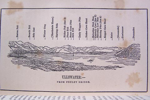 click to enlarge click to enlargeO80E07.jpg item:- Armitt Library : A1180.8 Image © see bottom of page |
|
|
|
||
| evidence:- | outline view:- Otley 1823 (5th edn 1834) placename:- Catchety Cam |
|
| source data:- | Print, woodcut outline view, Mountains of Ullswater, by
Jonathan Otley, Keswick, Cumberland, 1830.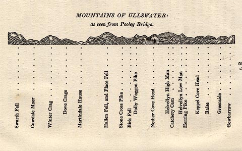 click to enlarge click to enlargeOT2E12.jpg Printed on p.113 of A Concise Description of the English Lakes, by Jonathan Otley, 5th edition, 1834. "MOUNTAINS OF ULLSWATER: as seen from Pooley Bridge." Mountains are listed:- "Swarth Fell / Cawdale Moor / Winter Crag / Dove Crags / Martindale Hause / Hallen Fell, and Place Fell / Stone Cross Pike / Birk Fell / Dolly Waggon Pike / Nether Cove Head / Helvellyn High Man / Catchety Cam / Helvellyn Low Man / Herring Pike / Keppel Cove Head / Raise / Greenside / Gowbarrow" item:- JandMN : 48.13 Image © see bottom of page |
|
|
|
||
| evidence:- | descriptive text:- Otley 1823 (5th edn 1834) placename:- Catsty Cam placename:- Catchedecam |
|
| source data:- | Guide book, A Concise Description of the English Lakes, the
mountains in their vicinity, and the roads by which they may be
visited, with remarks on the mineralogy and geology of the
district, by Jonathan Otley, published by the author, Keswick,
Cumberland now Cumbria, by J Richardson, London, and by Arthur
Foster, Kirkby Lonsdale, Cumbria, 1823; published 1823-49,
latterly as the Descriptive Guide to the English Lakes. goto source Page 35:- "... Swirrel Edge, which branches off from Helvellyn and is terminated by a peak called Catsty Cam, modernized into Catchedecam; ..." "..." |
|
|
|
||
| evidence:- | outline view:- Jenkinson 1875 placename:- Catchedecam |
|
| source data:- | Print, lithograph, outline view, Panoramic Sketches from Helvellyn, Westmorland, by
Edwin A Pettitt, London, published by Edward Stanford, 55 Charing Cross, London, 1875.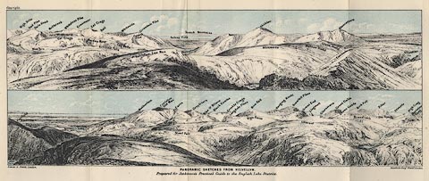 click to enlarge click to enlargeJk01E1.jpg "... Catchedecam ..." item:- JandMN : 28.5 Image © see bottom of page |
|
|
|
||
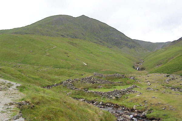
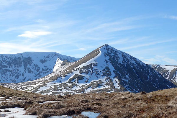 CET45.jpg (taken 14.3.2016) 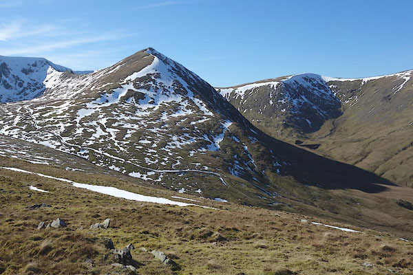 CET46.jpg (taken 14.3.2016) 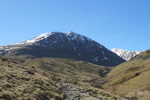 CET47.jpg (taken 14.3.2016) 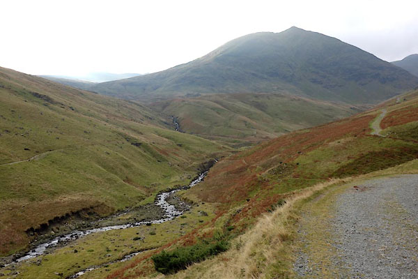 CCD01.jpg and Glenridding Beck. (taken 18.11.2014) 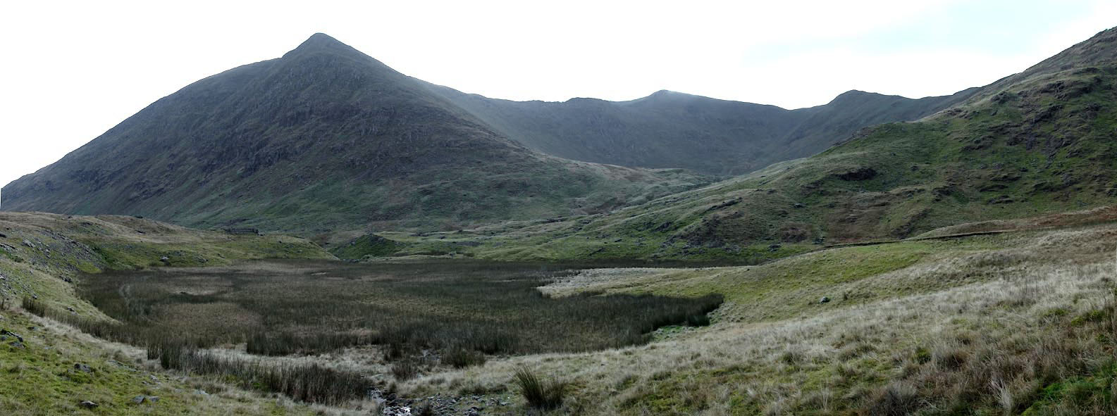 Click to enlarge CCD24.jpg and Keppel Cove Tarn and Brown Cove. (taken 18.11.2014) 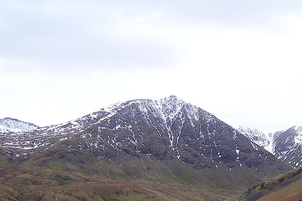 BOV34.jpg (taken 17.3.2008) 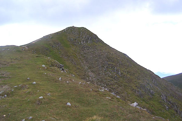 BUV11.jpg (taken 20.6.2011) 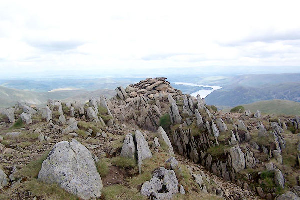 BUV12.jpg (taken 20.6.2011) 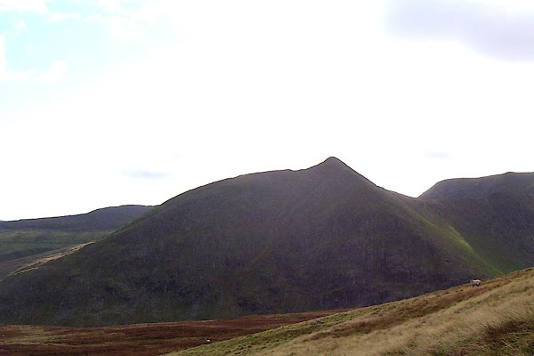 BOH54.jpg (taken 17.10.2007) 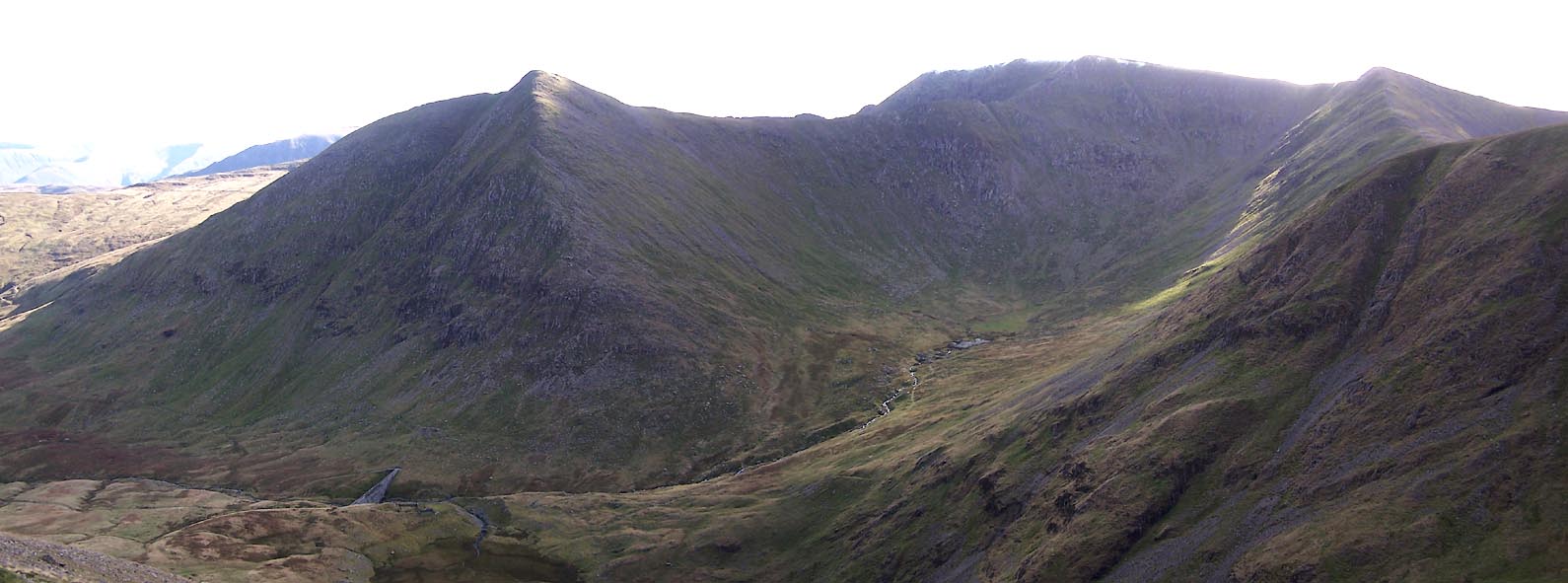 Click to enlarge BVN95.jpg (taken 19.10.2011) |
||
|
|
||
Lakes Guides menu.