 Old Cumbria Gazetteer
 |
 |
|
| Clarghyll Hall, Alston Moor | ||
| Clarghyll Hall | ||
| locality:- | Clargill | |
| civil parish:- | Alston Moor (formerly Cumberland) | |
| county:- | Cumbria | |
| locality type:- | buildings | |
| coordinates:- | NY72574932 | |
| 1Km square:- | NY7249 | |
| 10Km square:- | NY74 | |
|
|
||
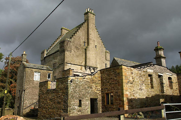 BXL17.jpg (taken 28.9.2012) 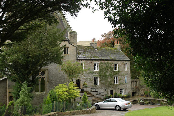 BXL16.jpg (taken 28.9.2012) |
||
|
|
||
| evidence:- | old map:- OS County Series (Cmd 34 1) placename:- Clargill Hall |
|
| source data:- | Maps, County Series maps of Great Britain, scales 6 and 25
inches to 1 mile, published by the Ordnance Survey, Southampton,
Hampshire, from about 1863 to 1948. "Clargill Hall" |
|
|
|
||
| evidence:- | old map:- Donald 1774 (Cmd) placename:- Clargill |
|
| source data:- | Map, hand coloured engraving, 3x2 sheets, The County of Cumberland, scale about 1
inch to 1 mile, by Thomas Donald, engraved and published by Joseph Hodskinson, 29
Arundel Street, Strand, London, 1774.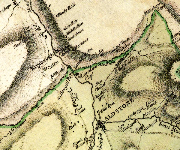 D4NY74NW.jpg "Clargill / Whitfield Esq." house item:- Carlisle Library : Map 2 Image © Carlisle Library |
|
|
|
||
| evidence:- | database:- Listed Buildings 2010 placename:- Clarghyll Hall item:- date stone (1679) |
|
| source data:- | courtesy of English Heritage "CLARGHYLL HALL / / / ALSTON MOOR / EDEN / CUMBRIA / II[star] / 73064 / NY7257249324" |
|
|
|
||
| evidence:- | database:- Listed Buildings 2010 |
|
| source data:- | courtesy of English Heritage "DRYSTONE FORECOURT WALLS &PIERS TO FRONT OF CLARGHYLL HALL / / / ALSTON MOOR / EDEN / CUMBRIA / II / 73066 / NY7270049322" |
|
|
|
||
| evidence:- | database:- Listed Buildings 2010 |
|
| source data:- | courtesy of English Heritage "BIRD HOUSE TO EAST OF CLARGHYLL HALL / / / ALSTON MOOR / EDEN / CUMBRIA / II / 73065 / NY7258949336" |
|
|
|
||
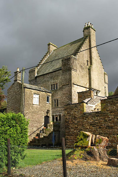 BXL18.jpg (taken 28.9.2012) |
||
|
|
||
| notes:- |
House built upon two bastles |
|
| Perriam, D R &Robinson, J: 1998: Medieval Fortified Buildings of Cumbria: CWAAS::
ISBN 1 873124 23 6; plan and illustrations |
||
|
|
||
 Lakes Guides menu.