 Old Cumbria Gazetteer
 |
 |
|
| Codale Tarn, Lakes | ||
| Codale Tarn | ||
| civil parish:- | Lakes (formerly Westmorland) | |
| county:- | Cumbria | |
| locality type:- | tarn | |
| coordinates:- | NY29670881 (etc) | |
| 1Km square:- | NY2908 | |
| 10Km square:- | NY20 | |
| altitude:- | 1530 feet | |
| altitude:- | 466m | |
|
|
||
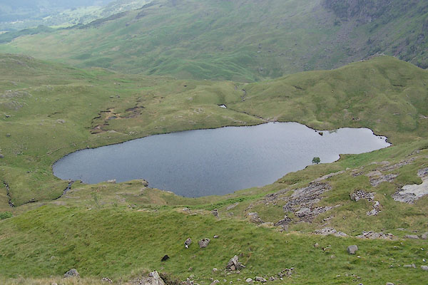 BSX46.jpg (taken 27.6.2010) 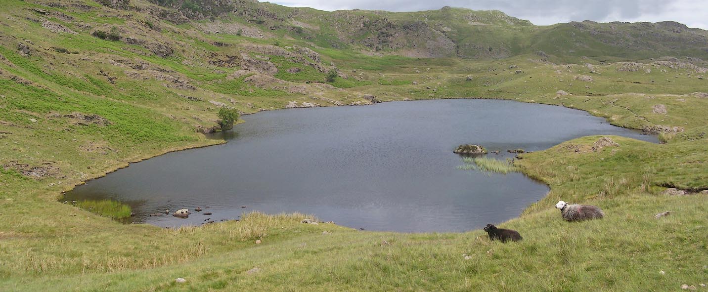 Click to enlarge BSX47.jpg (taken 27.6.2010) |
||
|
|
||
| evidence:- | old map:- OS County Series (Wmd 18 15) placename:- Codale Tarn |
|
| source data:- | Maps, County Series maps of Great Britain, scales 6 and 25
inches to 1 mile, published by the Ordnance Survey, Southampton,
Hampshire, from about 1863 to 1948. |
|
|
|
||
| evidence:- | old map:- Otley 1818 |
|
| source data:- | Map, uncoloured engraving, The District of the Lakes,
Cumberland, Westmorland, and Lancashire, scale about 4 miles to
1 inch, by Jonathan Otley, 1818, engraved by J and G Menzies,
Edinburgh, Scotland, published by Jonathan Otley, Keswick,
Cumberland, et al, 1833.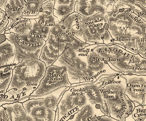 OT02NY20.jpg item:- JandMN : 48.1 Image © see bottom of page |
|
|
|
||
| evidence:- | descriptive text:- Otley 1823 (5th edn 1834) item:- fishing; trout; eel; perch |
|
| source data:- | Guide book, A Concise Description of the English Lakes, the
mountains in their vicinity, and the roads by which they may be
visited, with remarks on the mineralogy and geology of the
district, by Jonathan Otley, published by the author, Keswick,
Cumberland now Cumbria, by J Richardson, London, and by Arthur
Foster, Kirkby Lonsdale, Cumbria, 1823; published 1823-49,
latterly as the Descriptive Guide to the English Lakes. goto source goto sourcePage 34:- "[Codale] Tarn is a small piece of water containing a few trout, perch, and eels. It sends a small stream down a rocky channel into Easdale Tarn, ..." |
|
|
|
||
| evidence:- | old map:- Garnett 1850s-60s H placename:- Coldale Tarn |
|
| source data:- | Map of the English Lakes, in Cumberland, Westmorland and
Lancashire, scale about 3.5 miles to 1 inch, published by John
Garnett, Windermere, Westmorland, 1850s-60s.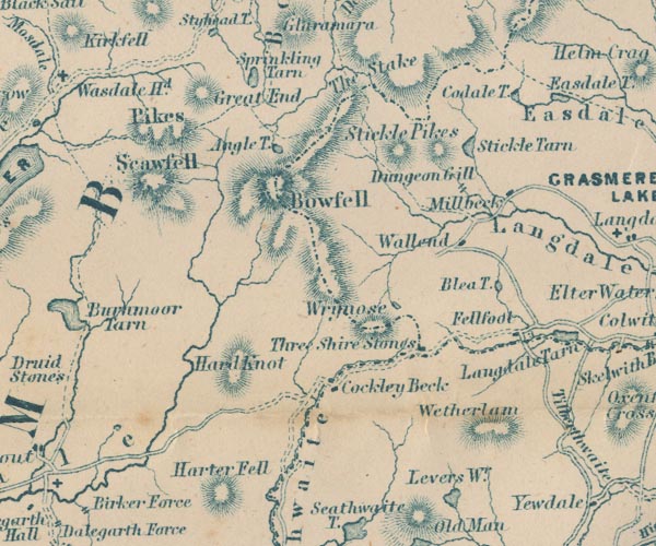 GAR2NY20.jpg "Coldale T." outline with shore form lines, lake or tarn item:- JandMN : 82.1 Image © see bottom of page |
|
|
|
||
Lakes Guides menu.