 Old Cumbria Gazetteer
 |
 |
|
||||||||||||
| Colwith Force, Lakes | ||||||||||||||
| Colwith Force | ||||||||||||||
| Culloth Force | ||||||||||||||
| site name:- | Brathay, River | |||||||||||||
| locality:- | Colwith | |||||||||||||
| civil parish:- | Lakes (formerly Westmorland) | |||||||||||||
| civil parish:- | Skelwith (formerly Lancashire) | |||||||||||||
| county:- | Cumbria | |||||||||||||
| locality type:- | waterfall | |||||||||||||
| coordinates:- | NY32790313 | |||||||||||||
| 1Km square:- | NY3203 | |||||||||||||
| 10Km square:- | NY30 | |||||||||||||
|
|
||||||||||||||
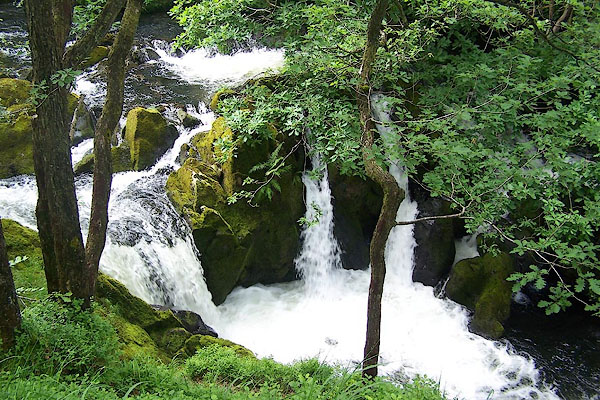
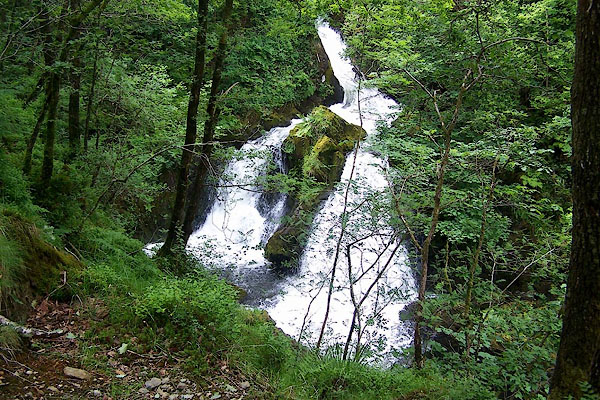 BMH21.jpg (taken 23.6.2006) 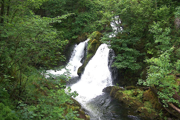 BMH22.jpg (taken 23.6.2006) |
||||||||||||||
|
|
||||||||||||||
| evidence:- | old map:- OS County Series (Wmd 25 12) placename:- Colwith Force |
|||||||||||||
| source data:- | Maps, County Series maps of Great Britain, scales 6 and 25
inches to 1 mile, published by the Ordnance Survey, Southampton,
Hampshire, from about 1863 to 1948. |
|||||||||||||
|
|
||||||||||||||
| evidence:- | descriptive text:- West 1778 (11th edn 1821) |
|||||||||||||
| source data:- | Guide book, A Guide to the Lakes, by Thomas West, published by
William Pennington, Kendal, Cumbria once Westmorland, and in
London, 1778 to 1821. goto source goto sourceRev Plumtre's Night Piece on Windermere, 1797 Page 230:- "..." "... / I heard you [the Brathay] rattling through the wood, / and pass by Colwith's [3] foaming flood; / His loose, dishevel'd, hoary head, / Affrighted, seeks a calmer bed, /" "[3] Colwith-Force is a very fine, though a small cascade, in Little, or Higher Langdale. The features of it are very wild; and the ruins of a mill, on one side of the rock, have a very good effect." |
|||||||||||||
|
|
||||||||||||||
| evidence:- | old map:- Otley 1818 |
|||||||||||||
| source data:- | Map, uncoloured engraving, The District of the Lakes,
Cumberland, Westmorland, and Lancashire, scale about 4 miles to
1 inch, by Jonathan Otley, 1818, engraved by J and G Menzies,
Edinburgh, Scotland, published by Jonathan Otley, Keswick,
Cumberland, et al, 1833.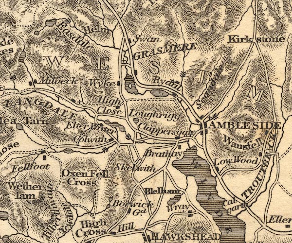 OT02NY30.jpg Marked by three chevrons across the stream. item:- JandMN : 48.1 Image © see bottom of page |
|||||||||||||
|
|
||||||||||||||
| evidence:- | descriptive text:- Otley 1823 (5th edn 1834) |
|||||||||||||
| source data:- | Guide book, A Concise Description of the English Lakes, the
mountains in their vicinity, and the roads by which they may be
visited, with remarks on the mineralogy and geology of the
district, by Jonathan Otley, published by the author, Keswick,
Cumberland now Cumbria, by J Richardson, London, and by Arthur
Foster, Kirkby Lonsdale, Cumbria, 1823; published 1823-49,
latterly as the Descriptive Guide to the English Lakes. goto source Page 45:- "COLWITH FORCE is a pretty waterfall; and is but little out of the way, for those who make the tour through Little Langdale." |
|||||||||||||
|
|
||||||||||||||
| evidence:- | descriptive text:- Ford 1839 (3rd edn 1843) placename:- Colwith Force item:- height, Colwith Force |
|||||||||||||
| source data:- | Guide book, A Description of Scenery in the Lake District, by
Rev William Ford, published by Charles Thurnam, Carlisle, by W
Edwards, 12 Ave Maria Lane, Charles Tilt, Fleet Street, William
Smith, 113 Fleet Street, London, by Currie and Bowman,
Newcastle, by Bancks and Co, Manchester, by Oliver and Boyd,
Edinburgh, and by Sinclair, Dumfries, 1839. goto source Page 36:- "..." "The next and perhaps finest of fall, is Colwith" goto sourcePage 37:- "Force with Wedderlamb, forming a grand object as beheld from the bed of the river. A stupendous crag rises out of the river; the glen sinks belnw (sic) to the depth of a hundred feet, and the water rushes down in four leaps, the last being the deepest, sending" "'From hollow clefts up to the clearer air A cloud of mist, that, smitten by the sun, Varies its rainbow hues.'" "The neighbourhood is uncommonly grand and beautiful." goto sourcePage 179:- "WATERFALLS."
|
|||||||||||||
|
|
||||||||||||||
| evidence:- | old map:- Ford 1839 map placename:- Colwith Force |
|||||||||||||
| source data:- | Map, uncoloured engraving, Map of the Lake District of
Cumberland, Westmoreland and Lancashire, scale about 3.5 miles
to 1 inch, published by Charles Thurnam, Carlisle, and by R
Groombridge, 5 Paternoster Row, London, 3rd edn 1843.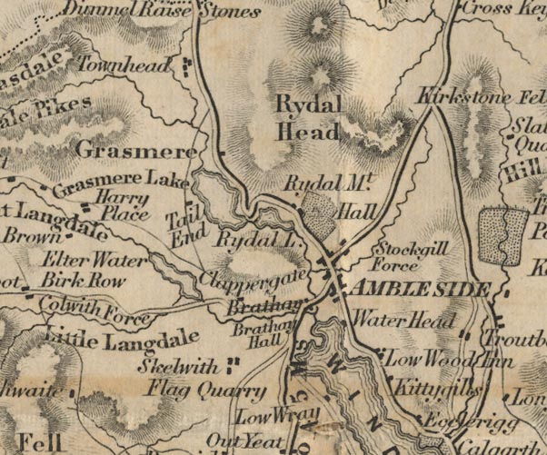 FD02NY30.jpg "Colwith Force" item:- JandMN : 100.1 Image © see bottom of page |
|||||||||||||
|
|
||||||||||||||
| evidence:- | old text:- Martineau 1855 |
|||||||||||||
| source data:- | Guide book, A Complete Guide to the English Lakes, by Harriet
Martineau, published by John Garnett, Windermere, Westmorland,
and by Whittaker and Co, London, 1855; published 1855-76. goto source Page 114:- "... down the very steep hill to Colwith Bridge. Colwith Force, a" goto sourcePage 115:- "little further on, will make itself heard and seen. It tumbles from a height of seventy feet, and the adjuncts are beautiful. ..." |
|||||||||||||
|
|
||||||||||||||
| evidence:- | old text:- Martineau 1855 |
|||||||||||||
| source data:- | Guide book, A Complete Guide to the English Lakes, by Harriet
Martineau, published by John Garnett, Windermere, Westmorland,
and by Whittaker and Co, London, 1855; published 1855-76. goto source Page 180:- "WATERFALLS." "No. : Names and Situations of Falls. : Counties : Feet in Height." "1 : Colwith Force, five miles from Ambleside : Westmorland : 90" |
|||||||||||||
|
|
||||||||||||||
| evidence:- | old print:- Walton 1876 placename:- Colwith Force |
|||||||||||||
| source data:- | Print, colour lithograph, Colwith Force, on the River Brathay, Westmorland, from a
painting by Elijah Walton, published by W M Thompson, 20 Cockspur Street, Pall Mall,
and Burlington Gallery, Piccadilly, London, 1876.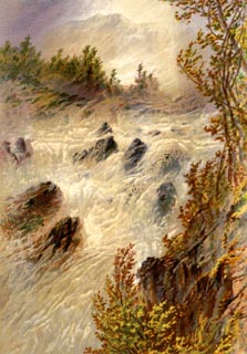 click to enlarge click to enlargeWLT303.jpg Plate 3 in English Lake Scenery, with a description by T G Bonney. item:- JandMN : 469.3 Image © see bottom of page |
|||||||||||||
|
|
||||||||||||||
| evidence:- | old photograph:- Bell 1880s-1940s |
|||||||||||||
| source data:- | Photograph, black and white, Colwith Force, Westmorland and Lancashire, by Herbert
Bell, Ambleside, Westmorland, 1890s.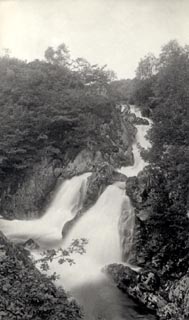 click to enlarge click to enlargeHB0441.jpg stamped at reverse:- "HERBERT BELL / Photographer / AMBLESIDE" item:- Armitt Library : ALPS96 Image © see bottom of page |
|||||||||||||
|
|
||||||||||||||
| evidence:- | old print:- Philip/Wilson 1890s |
|||||||||||||
| source data:- | Print, engraving, Colwith Force, published by George Philip and
Son, London, Philip, Son and Nephew, Liverpool, Lancashire, and
Titus Wilson, Kendal, Westmorland, about 1895.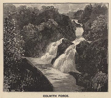 click to enlarge click to enlargePW1E19.jpg "COLWITH FORCE." item:- JandMN : 58.20 Image © see bottom of page |
|||||||||||||
|
|
||||||||||||||
| evidence:- | old print:- Garnett 1850s-60s F |
|||||||||||||
| source data:- | Print, uncoloured engraving, Colwith Force, Westmorland, engraved by William Banks
and Son, Edinburgh, published by John Garnett, Windermere, Westmorland, 1850s-60s?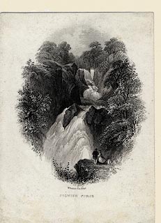 click to enlarge click to enlargeGAR723.jpg Found with Views of the English Lakes. printed at bottom:- "W. Banks &Son, Edinr. / COLWITH FORCE." item:- JandMN : 165.23 Image © see bottom of page |
|||||||||||||
|
|
||||||||||||||
| evidence:- | old print:- Sylvan 1847 placename:- Colwith Force |
|||||||||||||
| source data:- | Print, engraving, Colwith Force, Lancashire and Westmorland, engraved by Thomas Gilks,
published by John Johnstone, Paternoster Row, London, et al, 1847.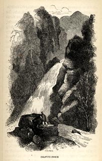 click to enlarge click to enlargeSYL125.jpg On p.75 of Sylvan's Pictorial Guide to the English Lakes. printed at bottom:- "T. GILKS. Sc / COLWITH FORCE." item:- Armitt Library : A1201.25 Image © see bottom of page |
|||||||||||||
|
|
||||||||||||||
| evidence:- | old print:- Rose 1832-35 |
|||||||||||||
| source data:- | Print, engraving, Colwith Force, Westmorland, by Thomas Allom, engraved by W Tombleson,
1832.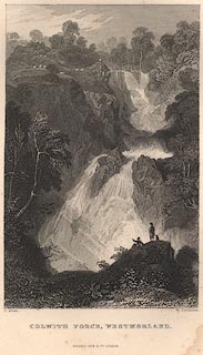 click to enlarge click to enlargeR107.jpg item:- JandMN : 66.17 Image © see bottom of page |
|||||||||||||
|
|
||||||||||||||
 BMH23.jpg (taken 23.6.2006) 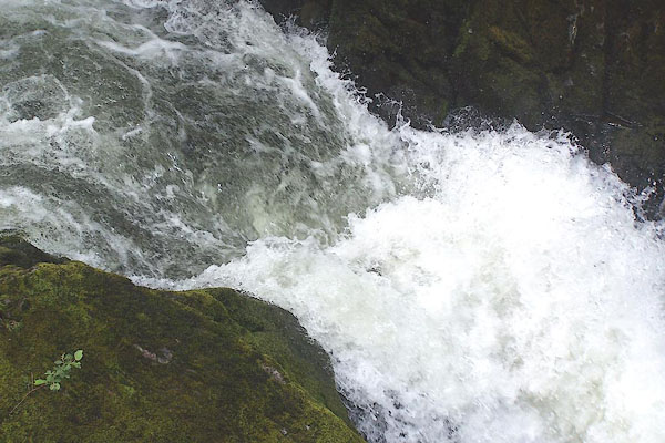 BMH24.jpg (taken 23.6.2006) 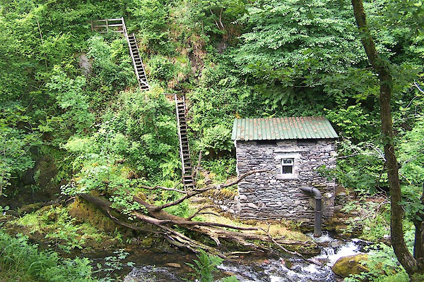 BMH25.jpg This looks like a turbine house. (taken 23.6.2006) |
||||||||||||||
|
|
||||||||||||||
Lakes Guides menu.