 Old Cumbria Gazetteer
 |
 |
|
| Derwent Bay, Above Derwent | ||
| Derwent Bay | ||
| site name:- | Derwent Bay | |
| civil parish:- | Above Derwent (formerly Cumberland) | |
| county:- | Cumbria | |
| locality type:- | buildings | |
| coordinates:- | NY25082150 | |
| 1Km square:- | NY2521 | |
| 10Km square:- | NY22 | |
|
|
||
| evidence:- | old map:- OS County Series (Cmd 64 9) placename:- Derwent Bay |
|
| source data:- | Maps, County Series maps of Great Britain, scales 6 and 25
inches to 1 mile, published by the Ordnance Survey, Southampton,
Hampshire, from about 1863 to 1948. |
|
|
|
||
| evidence:- | probably old map:- Donald 1774 (Cmd) placename:- Water End |
|
| source data:- | Map, hand coloured engraving, 3x2 sheets, The County of Cumberland, scale about 1
inch to 1 mile, by Thomas Donald, engraved and published by Joseph Hodskinson, 29
Arundel Street, Strand, London, 1774.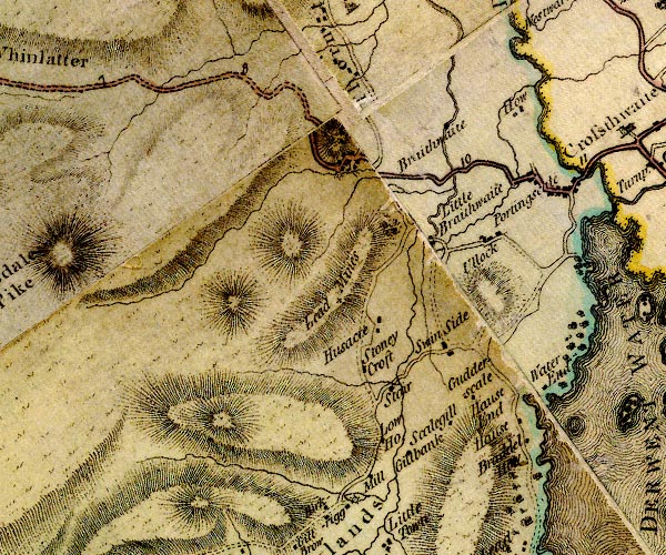 D4NY22SW.jpg "Water End" block or blocks, labelled in lowercase; a hamlet or just a house item:- Carlisle Library : Map 2 Image © Carlisle Library |
|
|
|
||
| evidence:- | probably old map:- Crosthwaite 1783-94 (Der) placename:- Water End |
|
| source data:- | Map, uncoloured engraving, An Accurate Map of the Matchless Lake
of Derwent, ie Derwent Water, scale about 3 inches to 1 mile, by
Peter Crosthwaite, Keswick, Cumberland, 1783, version published
1800.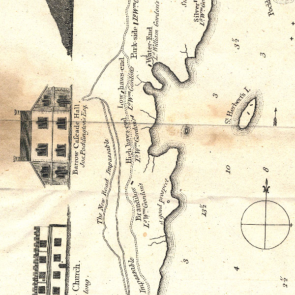 CT2NY21P.jpg "Water-End / Ld. Wm. Gordon's" item:- Armitt Library : 1959.191.3 Image © see bottom of page |
|
|
|
||
| evidence:- | old map:- Clarke 1787 map (Der) placename:- Water End |
|
| source data:- | Map, uncoloured engraving, Map of Derwentwater and its Environs,
scale about 13 ins to 1 mile, by James Clarke, engraved by S J
Neele, published by James Clarke, Penrith, Cumberland and in
London etc, 1787.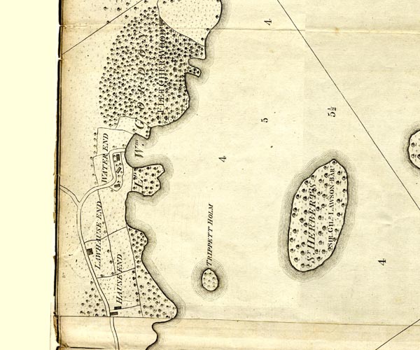 CL152521.jpg "WATER END" buildings item:- private collection : 169 Image © see bottom of page |
|
|
|
||
| evidence:- | descriptive text:- Otley 1823 (5th edn 1834) placename:- Derwentwater Bay placename:- Water End item:- viewpoint |
|
| source data:- | Guide book, A Concise Description of the English Lakes, the
mountains in their vicinity, and the roads by which they may be
visited, with remarks on the mineralogy and geology of the
district, by Jonathan Otley, published by the author, Keswick,
Cumberland now Cumbria, by J Richardson, London, and by Arthur
Foster, Kirkby Lonsdale, Cumbria, 1823; published 1823-49,
latterly as the Descriptive Guide to the English Lakes. goto source goto source"... a pleasant elevation above the woods of Lady William Gordon, the house, formerly called Water End, now Derwentwater Bay, standing sweetly sheltered on the margin of the lake. From this elevation, the lake, with its islands, bays, and promontories, is seen to great advantage." |
|
|
|
||
| evidence:- | old map:- Ford 1839 map placename:- Water End |
|
| source data:- | Map, uncoloured engraving, Map of the Lake District of
Cumberland, Westmoreland and Lancashire, scale about 3.5 miles
to 1 inch, published by Charles Thurnam, Carlisle, and by R
Groombridge, 5 Paternoster Row, London, 3rd edn 1843. FD02NY22.jpg "Water End" item:- JandMN : 100.1 Image © see bottom of page |
|
|
|
||
| notes:- |
Built by Lord Gordon, about 1790. It is a series of polygonal pavillions, the polygonal
bays make the most of the views across the lake. |
|
| Hyde, Matthew & Whittaker, Esme &Corbet, Val (photographer): 2014: Arts and Craft
Houses in the Lake District: Lincoln, Francis (London):: ISBN 978 0 7112 3408 6 |
||
|
|
||
Lakes Guides menu.