 Old Cumbria Gazetteer
 |
 |
|
| Double Mills, Cockermouth | ||
| Double Mills | ||
| Cockermouth Youth Hostel | ||
| YHA Cockermouth | ||
| site name:- | Cocker, River | |
| locality:- | Cockermouth | |
| civil parish:- | Cockermouth (formerly Cumberland) | |
| county:- | Cumbria | |
| locality type:- | water mill | |
| locality type:- | mill | |
| locality type:- | corn mill | |
| locality type:- | youth hostel (1978) | |
| coordinates:- | NY11882986 | |
| 1Km square:- | NY1129 | |
| 10Km square:- | NY12 | |
|
|
||
| evidence:- | old map:- OS County Series (Cmd 54 8) placename:- Double Mills |
|
| source data:- | Maps, County Series maps of Great Britain, scales 6 and 25
inches to 1 mile, published by the Ordnance Survey, Southampton,
Hampshire, from about 1863 to 1948. "Double Mills (Corn)" |
|
|
|
||
| evidence:- | possibly old map:- Ogilby 1675 (plate 96) |
|
| source data:- | Road strip map, hand coloured engraving, the Road from Kendal to
Cockermouth, and the Road from Egremond to Carlisle, scale about
1 inch to 1 mile, by John Ogilby, London, 1675.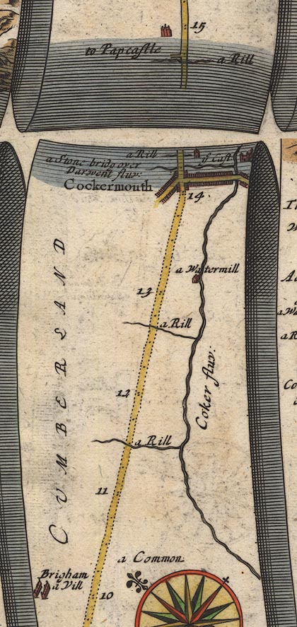 OG96Bm10.jpg In mile 13, Cumberland. "a Watermill" mill by the River Cocker on the right of the road, left of the river. item:- JandMN : 22 Image © see bottom of page |
|
|
|
||
| evidence:- | old map:- Bowen 1720 (plate 261) |
|
| source data:- | Road strip map, uncoloured engraving, pl.261, the end of the
road from Kendal to Cockermouth and the road from Egremont to
Carlisle, scale about 2 miles to 1 inch, published by Emanuel
Bowen, St Katherines, London, 1720.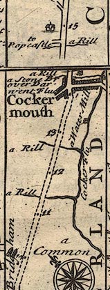 B261m10.jpg "a Water Mill" To right of road half a mile before Cockermouth. item:- Dove Cottage : Lowther.36 Image © see bottom of page |
|
|
|
||
| evidence:- | old map:- Donald 1774 (Cmd) |
|
| source data:- | Map, hand coloured engraving, 3x2 sheets, The County of Cumberland, scale about 1
inch to 1 mile, by Thomas Donald, engraved and published by Joseph Hodskinson, 29
Arundel Street, Strand, London, 1774. D4NY13SW.jpg single or double wiggly line; a river into the Cocker item:- Carlisle Library : Map 2 Image © Carlisle Library |
|
|
|
||
| evidence:- | database:- Listed Buildings 2010 placename:- Double Mills |
|
| source data:- | courtesy of English Heritage "DOUBLE MILLS / / / COCKERMOUTH / ALLERDALE / CUMBRIA / II / 71650 / NY1188129861" |
|
|
|
||
| person:- | society : Youth Hostels Association |
|
| date:- | 1978 |
|
| : 1978 (8th edn): Youth Hostels in Lakeland: Youth Hostels Association| |
||
|
|
||
 Lakes Guides menu.