 Old Cumbria Gazetteer
 |
 |
|
| High Drybarrows, Bampton | ||
| High Drybarrows | ||
| civil parish:- | Bampton (formerly Westmorland) | |
| county:- | Cumbria | |
| coordinates:- | NY49821702 | |
| 1Km square:- | NY4917 | |
| 10Km square:- | NY41 | |
|
|
||
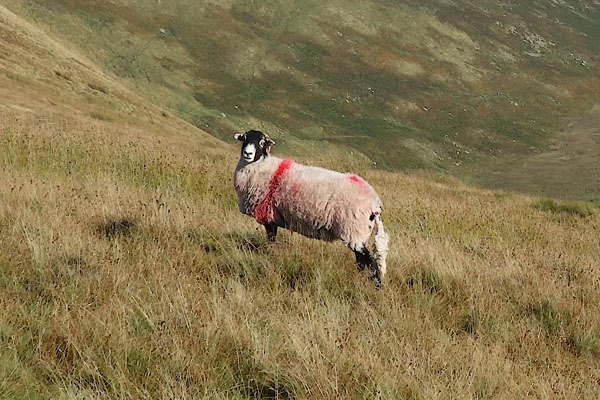 BZK56.jpg Swaledale sheep; smit mark a red stroke down near shoulder and red pop between tail head and loin. (taken 29.9.2013) |
||
|
|
||
| evidence:- | probably hearth tax returns:- Hearth Tax 1675 placename:- Drybarrows |
|
| source data:- | Records, hearth tax survey returns, Westmorland, 1674/75. "Drybarrows" in "Bampton Pattricke" |
|
|
|
||
| evidence:- | probably old map:- Jefferys 1770 (Wmd) placename:- Dry Barrow |
|
| source data:- | Map, 4 sheets, The County of Westmoreland, scale 1 inch to 1
mile, surveyed 1768, and engraved and published by Thomas
Jefferys, London, 1770.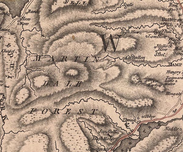 J5NY41NE.jpg "Dry Barrow" circle, labelled in italic lowercase text; settlement, farm, house, or hamlet? item:- National Library of Scotland : EME.s.47 Image © National Library of Scotland |
|
|
|
||
| evidence:- | database:- Listed Buildings 2010 |
|
| source data:- | courtesy of English Heritage "FORMER FARMHOUSE ON WEST SIDE OF HIGH DRYBARROWS / / / BAMPTON / EDEN / CUMBRIA / II / 74460 / NY4979416983" |
|
|
|
||
 Lakes Guides menu.